
The World Monuments Fund’s account of Jaisalmer begins beneath the sandstone skyline. As water use rose and modern plumbing spread through the inhabited fort, seepage entered the ground below it. Buildings began to fail. The repair problem was not confined to a carved façade: drainage, household services and the stability of the ground had become part of the same conservation story.[11]
That tension offers a way into Rajasthan’s six UNESCO-listed hill forts. They were made to shelter authority, worship, trade and domestic life, and several remain places of use. Their walls are inseparable from what happens inside them. Across the state, a hill, a river, a forest or a desert changes what a fort needs to be. At Jaisalmer, the question is how a living settlement can keep its buildings standing while daily life continues.
In 2013, UNESCO inscribed Chittorgarh, Kumbhalgarh, Ranthambore, Gagron, Amber and Jaisalmer together as the Hill Forts of Rajasthan. Their shared designation makes it possible to compare how builders answered different terrain and how later generations used the resulting spaces.[1]
01 · Amber: rooms arranged around courtyards
Amber rises above Maota Lake near Jaipur, where fortification and palace share the hillside. Rajasthan Tourism dates Raja Man Singh I’s building campaign to 1592 and describes Hindu and Mughal influences in the complex. Red sandstone and white marble, carved surfaces and mirrors belong to this courtly setting; the palace is not an ornament added to the fort but an organising centre within it.[2]
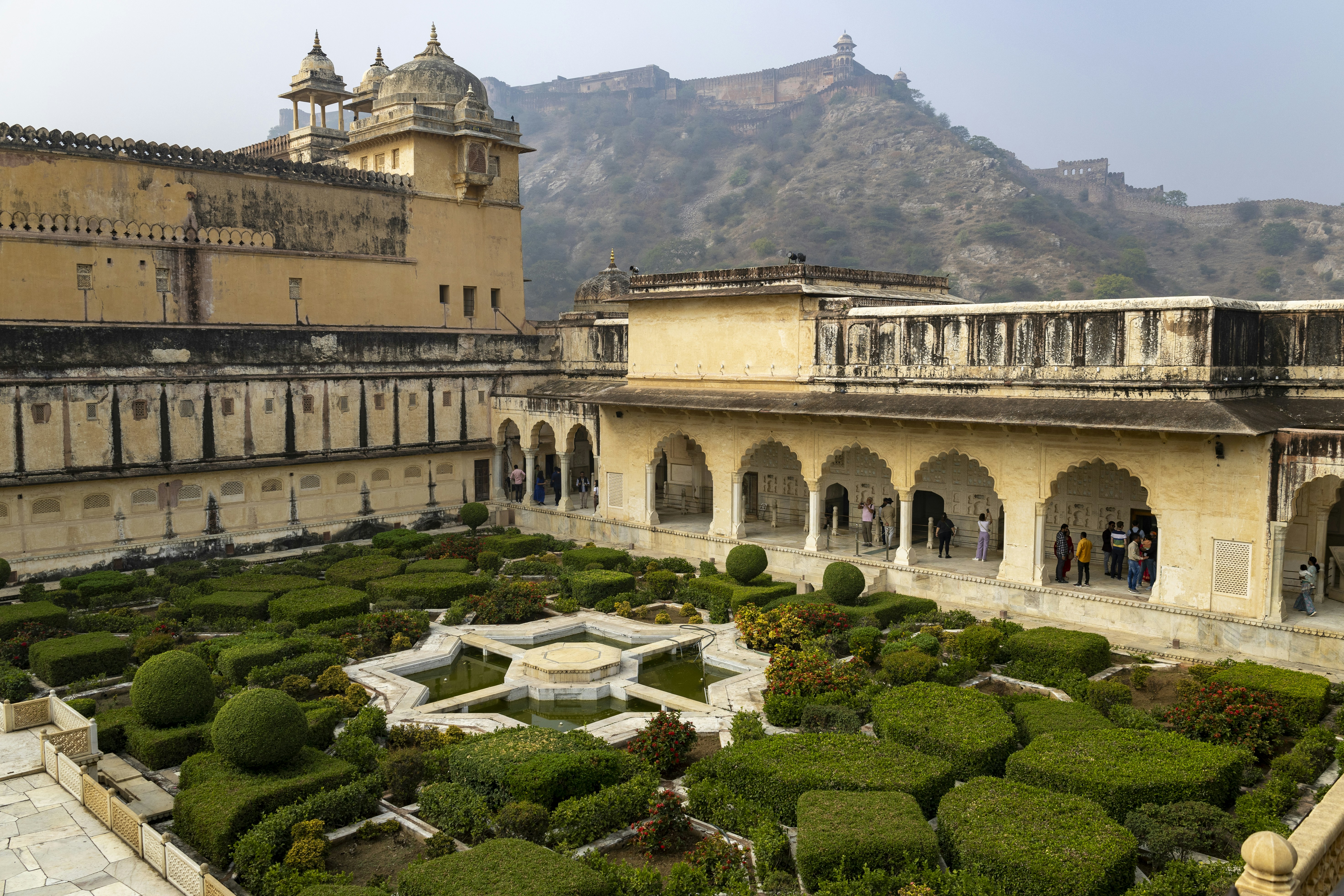
From arrival to the inner court
At Amber, the route through the palace helps explain how architecture sorted movement. The national tourism account describes four principal sections organised around courtyards. Suraj Pol opens toward Jaleb Chowk, associated with military assembly. Beyond that, the Diwan-e-Aam was a public audience hall, while the zenana served the residential life of royal women. The sequence links arrival, assembly, petition and private life without making them the same kind of space.[7] The distinction is more than a floor plan. Each threshold regulated who could enter, where an audience might happen, and how close a visitor could come to the household. The four courtyard sections make that graded movement easier to see than the single word “palace” would.
That order is visible in the contrast between the measured garden and the hill line beyond it. The view does not show every function, but it makes the relationship legible: a shaped interior sits beneath a defended ridge. Amber’s court was both a residence and a place where people encountered power through controlled access.[7]
The Sheesh Mahal draws the eye inward to reflective detail. Sukh Niwas brings comfort into the story: The same account describes a water-based cooling arrangement there and a sandalwood entrance. A fortress could be planned for defence while its inner rooms addressed heat, movement and display. Those purposes were built into the same complex.[7]

Amber’s political geography also changed. Jaipur was founded in 1727 under Jai Singh II, who moved his capital from Amber. Rajasthan Tourism connects the move with a growing population and pressure on water resources. The shift from a defended hill palace to a new capital on the plains is a reminder that a successful seat of power can outgrow the setting that first served it.[2]
02 · Chittorgarh: many centuries in one enclosure
Chittorgarh is not one ruler’s completed design. UNESCO describes architectural remains spanning the eighth to sixteenth centuries and identifies the site’s scale and variety as central to its significance. As a former Sisodia capital, the fort also occupies a powerful place in Rajput history and folklore. The stonework carries successive histories rather than a single moment of authority.[1]
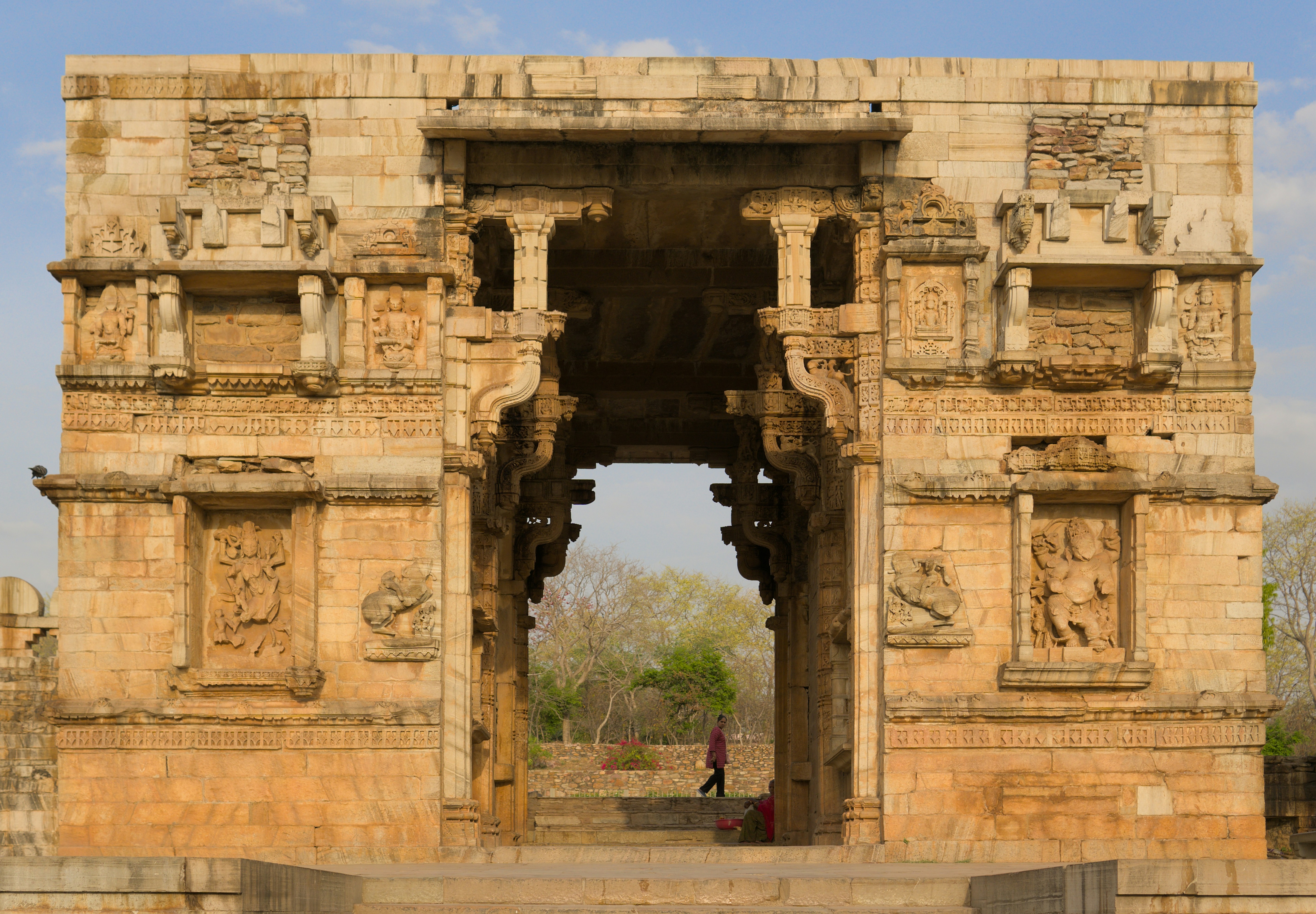
Gateways lead to different kinds of memory
The approach itself is named through a series of gates: Hanuman Pol, Ganesh Pol, Laxman Pol and Ram Pol. Within the complex, The national tourism account lists palaces, temples, memorials, water bodies and a victory tower. The place is a network of destinations. A single view of the wall cannot stand in for all the routes and sites held inside it.[8]
Several structures attach memory to named people and traditions. Rana Kumbha is associated with the Vijay Stambha, the Tower of Victory. The Kirti Stambh honours Adinath, the first Jain Tirthankara; the Meera Temple recalls the poet and devotee Meera Bai. The Kalika Mata Temple has an earlier connection to sun worship in the official account. Political commemoration and religious devotion leave different marks on the same landscape.[13] The distinction is visible in the dedications themselves: a tower records victory, another honours a Jain teacher, and a temple is linked to a poet’s devotional life. They are not interchangeable memorials. Together they show how a large fortified enclosure can hold several kinds of public memory at once. The stories do not need to be collapsed into one account for the structures to belong to the same landscape. A visitor can move from a ruler’s commemoration to a Jain dedication and then to the memory of a poet, while keeping clear who or what each place honours.
Rani Padmini’s Palace asks for another kind of care. The tourism account presents its central story as legend and myth. That distinction lets the story remain part of the place’s cultural memory without quietly turning every episode into a settled historical event. At Chittorgarh, architecture, devotion and retelling meet, but they do not all provide the same evidence.[13]
03 · Kumbhalgarh: the ridge shapes the wall
Kumbhalgarh makes terrain feel like part of the building plan. Rajasthan Tourism places its fifteenth-century construction under Rana Kumbha in the Aravalli range and records its use as a refuge for Mewar’s rulers during conflict. The site is also identified as the birthplace of Maharana Pratap. The ridge made access difficult, a quality that served the stronghold rather than merely complicating a visitor’s route.[3]
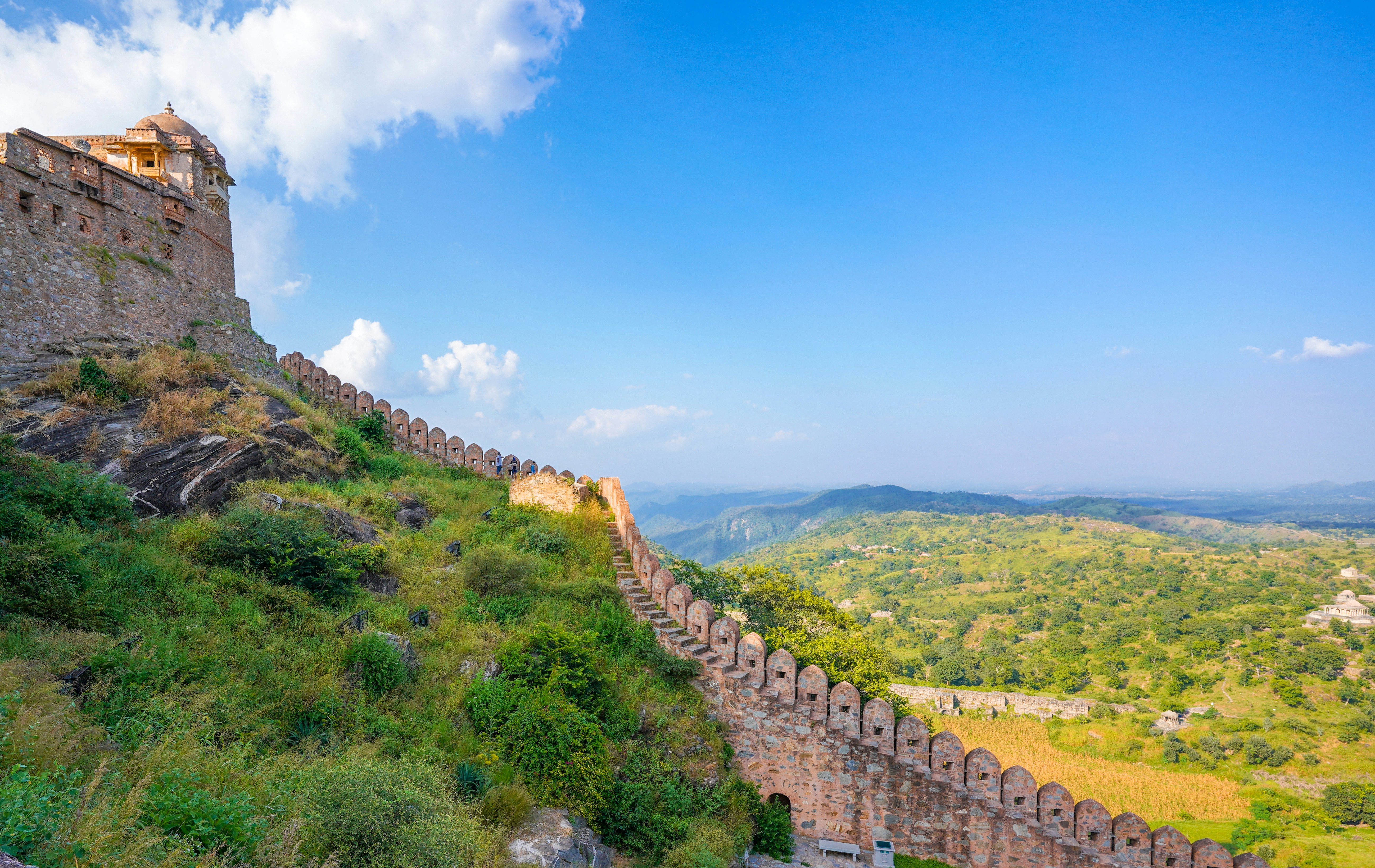
Water belongs inside a defensive story
Look along the wall as it follows the changing height of the hills. The crenellations do not draw a neat geometric outline; they make a line across a slope. The national tourism description places gateways, courtyards, reservoirs and places of worship inside the complex. Its account of the fort’s defensive arrangements includes water storage, a practical need alongside the visible perimeter.[10]
The wall is often introduced through a record-setting measurement. Published descriptions do not always use the same basis for that claim, so the more revealing point is the relation between wall and terrain. The fort’s long defensive line bends across the ridge; its reservoirs and temples show that the enclosure also had to sustain life within it. Kumbhalgarh is not just a boundary drawn against a hillside but a settlement organised around one.[1][10]
04 · Ranthambore: the hill does some of the work
At Ranthambore, the fort stands within a forested setting in Ranthambore National Park. Rajasthan Tourism attributes its construction to Chauhan rulers in the tenth century and points to temples, tanks, gateways and walls. The forest is part of the site’s present setting, while the fort’s buildings tell a history of human occupation on the hill.[4][14]
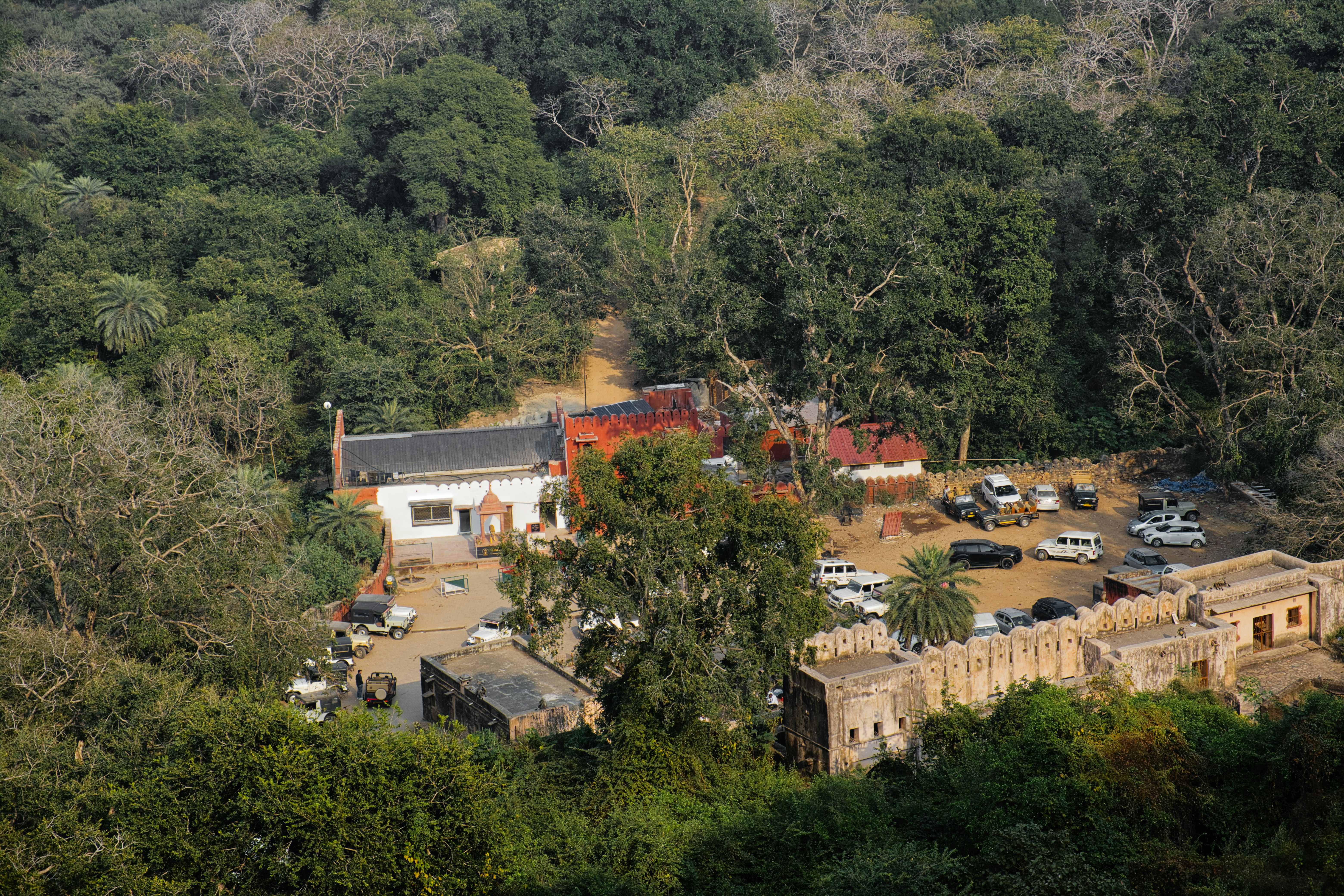
Follow the ascent
The 2013 ICOMOS evaluation describes ramparts that adapt to the hill crest, relying on steep natural features where additional walls were less necessary. The approach follows a rock-cut stair and zigzag ascent. Residential and official buildings lie toward the centre, including remains of Hammir’s palace and later pavilions. Defence here is a route as well as a ring of masonry.[9]
That detail changes how to read the boundary. A cliff edge and a constructed wall do not perform identical work, and the builders did not need to treat them as identical. The slope itself shapes the approach; the ramparts answer the ground where an added barrier is needed. The evaluation’s account is specific to the hill crest, stair and ascent, not a general formula for every fort.[9]
Tanks and temples broaden the picture beyond strategy. The enclosure needed water and places for religious life, even as the surrounding forest became part of what visitors associate with Ranthambore today.[4] The fort belongs in both frames: above the tree-covered approach, and within an interior landscape of routes and buildings.
05 · Gagron: a river edge becomes a defence
Gagron turns the journey toward water. Near Jhalawar, the Ahu and Kali Sindh rivers surround the fort on three sides. Rajasthan Tourism calls it a hill-and-water fort and notes the nearby mausoleum of the Sufi saint Mitheshah, associated with a Muharram fair. The landscape joins a defended site to a wider religious life.[5]

Between a pass and a confluence
ICOMOS places Gagron at a river confluence and beside a pass through the hills, positions connected with control of trade routes. The northern approach climbs steeply through two gates; outer and inner walls divide the defences. Within them are courts, temples, reservoirs, wells and later palace buildings. A compact silhouette above the river therefore contains a more layered plan than the photograph alone can show.[9]
The water is not decorative scenery around the stone. River, rock and masonry together make the edge of the site. The pass points to movement; the rivers shape the approaches. Gagron’s position mattered because of what it could protect and because of the routes that passed nearby. The two gates and layered walls describe a controlled entrance, while the rivers close off other sides. A fort could narrow movement as well as command a view of it. Its architecture joins barrier and connection in one place.[9]
06 · Jaisalmer: the fort is a neighbourhood
Jaisalmer brings the story back to the conservation problem beneath the opening. The fort is associated with Rawal Jaisal and the year 1156. Its yellow sandstone rises from Trikuta Hill; the national tourism account identifies four major gateways, the Raj Mahal, Jain temples and the Laxminath temple. The buildings represent different patrons and uses within one fortified settlement.[12]

Domestic, commercial and sacred life
Rajasthan Tourism calls Jaisalmer Sonar Qila, the Golden Fort, and describes homes, shops and hotels inside its walls. Its Jain temples date from the twelfth through fifteenth centuries in the official guide. These are not details around the edge of a monument. They tell us that the fort is a place of residence, trade and worship as well as a historic silhouette.[6]
That is why a lane inside the fort should not be treated as a stage set. It can be someone’s way home; a doorway can mark a private threshold; a temple remains a place of worship even when visitors come to see its architecture. The care due to residents and worshippers is inseparable from understanding the buildings as places still in use.
When drainage becomes part of conservation
World Monuments Fund documents how increasing water use and inadequate drainage let water seep into the ground beneath the inhabited fort, contributing to serious structural failures. Its conservation work with Indian partners included repairs to palace buildings and investigations into stability and infrastructure. This describes a documented conservation episode; it does not establish the condition of every building today.[11]
Here, a modern service reaches an old structure through the ground. A drain or pipe may be visually modest beside sandstone bastions, yet the management of water can affect what remains standing above it. Conservation is not only the repair of visible stone. In an inhabited fort it also involves the systems that make homes and businesses possible, and the planning needed to keep those systems from damaging the site.
A reservoir, a river and a drain
Water changes its role across the six sites. UNESCO includes water-harvesting structures among the forts’ features. Gagron’s rivers shape its position; Kumbhalgarh’s reservoirs belong inside its defensive landscape. At Jaisalmer, the conservation record describes seepage into ground supporting the settlement. Supply, storage, boundary and drainage are different problems, and each leaves a different architectural trace.[1][5][10][11]
There is no contradiction in a fort’s builders seeking water while conservators later manage excess water. The site’s needs change with settlement, services and use. A reservoir speaks to securing supply; a drain carries away what should not accumulate. The buildings persist through repeated decisions about both.
What the walls leave unfinished
UNESCO’s account brings palaces, urban settlements, sacred sites and water systems into a single group, and notes architectural exchange with neighbouring Sultanate and Mughal traditions. The six forts do not make one unchanging style. The designation instead invites comparison between courtly life, accumulated memory, defended terrain and continuing settlement.[1]
Those distinctions can lead a reader across Rajasthan in their reading, from a journey through the state to the particular routes within each fort. Amber’s courtyards organise movement; Gagron’s river edge shapes its approaches. Ranthambore makes the hill part of the defence; Chittorgarh carries stories with different evidentiary histories. At Jaisalmer, the old walls continue above homes and shops.
There, the heritage question returns to the ground beneath the lanes. The sandstone outline is striking, but its future also depends on drainage, repair and the everyday services that let a neighbourhood remain a neighbourhood. The bastion is the part most easily seen from a distance. The work that protects it may begin below the street, where water is carried away and the ground is kept stable.[11]


Share what you know
Been there, grew up there, or know something we missed? Add a comment; corrections with a source are especially welcome.