TERRITORY PORTRAIT · THE WORLD ATLAS

Antarctica

Find its place in the atlas, explore connected regions and follow the stories as they grow.

Find on the world map

Photo: Conservation Commons on Unsplash · Unsplash License

AT A GLANCE

Antarctica in facts

  • Population4,4002009
  • Area14.2 m km²slightly less than 1.5 times the size of the US
Map: Natural Earth (public domain) · Open in the world map
All geographic & statistical details (18)
Density
0 people per km²
People are called
Antarctican
Founded
1961
Government
the Antarctic Treaty and its follow-on agreements govern the use of Antarctica, ensuring it is used only for peaceful purposes and scientific research; signed in 1959 and in force since 1961, the original Treaty bans military activity, weapons testing, and nuclear waste disposal, while allowing military personnel to assist with research or other peaceful efforts; it promotes international cooperation in science, guarantees the free exchange of research, and freezes territorial claims; the Treaty covers all land and ice south of 60° south latitude, and allows Treaty nations to inspect any station or facility | | decisions are made by consensus at annual meetings, and member countries implement these decisions through their national laws (see “Legal system”); additional agreements have strengthened the Treaty system, including conventions to protect seals (1972) and other marine life (1980), as well as an environmental protocol (1991, took effect in 1998); the protocol bans mining and includes strict rules on environmental impact, waste, pollution, wildlife, and protected areas; as of December 2024, there are 58 member nations: 29 consultative members, including the 7 claimant countries (Argentina, Australia, Chile, France, New Zealand, Norway, and the UK), and 29 non-consultative members; a permanent Antarctic Treaty Secretariat, established in 2004 in Buenos Aires, supports the system
Time zones
UTC−04:00, UTC−03:00, UTC+00:00
+ 5 moreShow lessUTC+03:00, UTC+05:00, UTC+06:00, UTC+07:00, UTC+11:00
Calling code
+672
Coastline
17,968 km
Topographic elevation profile
Vinson Massif 4,892 m
▼ -3,500 mDenman Glacier more than (-11,500 ft) below sea level2,300 mMean▲ 4,892 mSummit
Climate
The coldest, windiest, and driest continent on Earth; severe low temperatures vary with latitude, elevation, and distance from the ocean; East Antarctica is colder than West Antarctica because of its higher elevation; Antarctic Peninsula has the most moderate climate; higher temperatures occur in January along the coast and average slightly below freezing; summers characterized by continuous daylight, while winters bring continuous darkness; persistent high pressure over the interior brings dry, subsiding air that results in very little cloud cover
Terrain
About 99% thick continental ice sheet and 1% barren rock, with average elevations between 2,000 and 4,000 m; mountain ranges up to nearly 5,000 m; ice-free coastal areas include parts of southern Victoria Land, Wilkes Land, the Antarctic Peninsula area, and parts of Ross Island on McMurdo Sound; glaciers form ice shelves along about half of the coastline, and floating ice shelves constitute 11% of the area of the continent
Land use
Agricultural 0%
Natural resources
iron ore, chromium, copper, gold, nickel
+ 7 moreShow lessplatinum and other minerals, and coal and hydrocarbons have been found in small noncommercial quantities, mineral exploitation except for scientific research is banned by the Environmental Protocol to the Antarctic Treaty, krill, icefish, toothfish, and crab have been taken by commercial fisheries
Railways & airports
31 airports
Internet domain
.aq
ISO & UN codes
AQ · ATA · M49 010
Name origin
Name derived from two Greek words, anti and arktikos, meaning "opposite to the Arctic" or "opposite to the north"
Names in other languages
Antártida, அன்டார்க்டிக்கா, అంటార్కిటికా, ทวีปแอนตาร์กติกา, Antarktika, Антарктида
+ 18 moreShow lessانٹارکٹکا, 南極洲, châu Nam Cực, ઍન્ટાર્કટિકા, अंटार्कटिका, ಅಂಟಾರ್ಕ್ಟಿಕ, 남극, अंटार्क्टिका, ਅੰਟਾਰਕਟਿਕਾ, Antarktyda, Antartide, Antarctique, അന്റാർട്ടിക്ക, Antarctica, 南極大陸, القارة القطبية الجنوبية, অ্যান্টার্কটিকা, جنوبگان

Facts: Wikidata Q51 and the CIA World Factbook (public domain: geography, demographics, borders, coastline and symbols), retrieved 1 November 2026. Figures can change; check the source for the latest.

FLAG & SYMBOLS

The flag and symbols of Antarctica

The flag

Two horizontal bands of navy and white, with a stylized white peak at the center; the peak casts a navy shadow in the shape of a compass arrow pointed south.

What it means

The bands represent the long days and nights at Antarctica's extreme latitude; the compass arrow is an homage to the continent's legacy of exploration; the peak and the arrow together create a diamond, symbolizing the hope that Antarctica will continue to be a center of peace, discovery, and cooperation.

Flag description and meaning, colours, symbols, anthem details, national day and independence: CIA World Factbook (public domain). Coat of arms, motto and recording: Wikidata and Wikimedia Commons (credited above). Flag artwork: flag-icons (MIT), retrieved 1 November 2026.

ON THE ATLAS · CHRONICLE IN PREPARATION

Discover Antarctica

This is a sourced directory entry. A researched regional chronicle and verified location photography are in preparation.

Geographic area

No country association assigned. Status & relationship source ↗

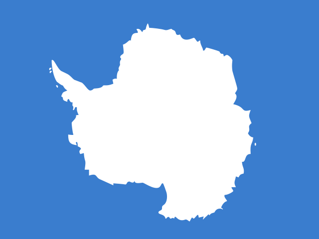
M49 lists Antarctica without a geographic macroregion. Its interface emblem is illustrative, not an official national flag.

A CLOSER LOOK

Explore the regions

0 entries

Explore the first-order regions in this GeoNames snapshot. Local names and levels vary.

No named first-order entries are available for this place in the selected export. Local administrative structures may still exist.

Names and immediate parent assignments: GeoNames, CC BY 4.0, 28 October 2026. Unspecified code 00 excluded. This is not an exhaustive list of districts, counties or municipalities. Photographs are credited individually beneath each image; one pictured place does not represent every landscape in its region.

FROM THE JOURNAL

Stories from Antarctica

Our editorial journey here is still ahead. No researched stories have been published for this place yet.

Explore published stories →
HELP US GET IT RIGHT

Suggest a correction

Spotted a factual issue, a wrong location or a missing image credit? Tell us what needs checking.

Send a correction

Saved privately for editorial review. Please do not include personal information. Reports do not change the article automatically.

CONVERSATION

Share what you know

Been there, grew up there, or know something we missed? Add a comment; corrections with a source are especially welcome.

Leave a comment

Your email address is never published. Comments are read before they appear. See our Privacy Policy.

Directory: UN M49 countries or areas, with 193 UN members, 2 observers and 53 other areas. Subdivisions: GeoNames, CC BY 4.0; filtered to this catalogue. Flags/symbols: flag-icons (MIT). Snapshot: 28 October 2026. Geographic groups are statistical. Associated-country links describe the cited relationship and do not settle sovereignty claims.

KEEP EXPLORING

Similar articles

Cultural journeys, craft traditions, and heritage chronicles from around the world.

All stories →
FOLLOW YOUR CURIOSITYA big world. A thousand ways to see it.

We’re here for the places, people and little details that make it extraordinary.
