
A Continental Faultline: The Submerged Gorge Between Two Worlds
The Bosporus—known in Turkish as the Boğaziçi or Istanbul Boğazı—is an extraordinary tectonic and fluvial incision slicing through the Thracian and Anatolian landmasses. Extending roughly thirty-one kilometers from the Black Sea entrance at Anadolu Feneri and Rumeli Feneri south to the threshold of the Sea of Marmara at Sarayburnu, the waterway forms one of the most celebrated continental boundaries on Earth, dividing Europe from Asia. Rather than an open ocean expanse or an alluvial estuary, the strait represents a drowned Pleistocene river valley, deeply carved into Paleozoic sedimentary strata and crystalline bedrock during recurring episodes of low sea level and glacial maximums.
The bathymetry of this sinuous marine channel reveals extreme topographic variability. While the average depth along the navigational axis hovers between fifty and sixty-five meters, the seabed plunges abruptly into profound subaqueous depressions exceeding one hundred and ten meters near Kandilli and the fortifications of Rumelihisarı. Across this variable sea floor, ancient river terraces, sunken meander scars, and steep submarine cliffs testify to the violent hydrodynamic forces that excavated the gorge during alternating glacial and interglacial cycles.
Unlike conventional straits that maintain uniform coastal topography, the Bosporus twists through twelve distinct directional bends. These sharp morphological angles turn every nautical transit into a navigational puzzle. At the southern terminus, the channel opens gradually into the broader marine expanse of the Sea of Marmara, where the historical promontory of the Golden Horn dissects the European peninsula, sheltering imperial harbors that have sustained human civilization for nearly three millennia.
The geomorphological evolution of the Bosporus gorge has been illuminated by seismic reflection profiles that demonstrate deep paleo-incisions during the Messinian salinity crisis, when the entire Mediterranean basin desiccated nearly six million years ago. As rivers carved deeply into the exposed continental shelves, ancestral fluvial networks cut profound gorges through the Thracian plateau. Modern high-resolution multibeam bathymetric maps reveal that these ancient channels preserve fossilized river meanders, submerged hanging valleys, and submarine talus slopes that have been continuously reshaped by the dual-current marine exchange established during the Holocene transgression.
The microclimates of the Bosporus reflect its unique position between distinct meteorological realms. The northern mouth of the strait, exposed to cool, moisture-laden winds from the Black Sea, experiences substantially higher humidity, frequent seasonal drizzle, and cooler summer temperatures than the southern entrance on the Marmara shore. This climatic differentiation produces contrasting vegetation patterns along the opposing shores: lush, dense temperate broadleaf forests and rhododendron thickets dominate the northern slopes near Sarıyer and Beykoz, whereas the southern approaches around Üsküdar and Kadıköy support Mediterranean olive groves, cypress trees, and drought-tolerant scrub.

The Hydraulic Dynamo: Opposing Currents and Subaqueous Rivers
The physical oceanography of the Bosporus operates as a colossal thermodynamic and hydraulic pump. Because the Black Sea receives relentless river runoff from the Danube, Dnieper, and Don river basins without possessing an equivalent rate of atmospheric evaporation, its water level stands thirty to fifty centimeters above that of the Sea of Marmara. This hydrostatic head drives an intense surface current flowing relentlessly south at velocities frequently exceeding three to four knots, accelerating to seven knots during winter storms and spring thaw surges.
Directly beneath this buoyant, brackish upper layer—whose salinity averages merely seventeen to eighteen practical salinity units—lies an entirely separate aquatic universe. Beginning at depths between fifteen and twenty-five meters, a sharp density interface known as a pycnocline separates the southward surface flow from a northward deep undercurrent. Powered by the high density of Mediterranean water, which carries salinities approaching thirty-eight practical salinity units, this deep stream pushes northward, climbing the underwater sills of the Bosporus to plunge over the northern shelf into the oxygen-depleted abyss of the Black Sea.
In 2010, marine scientists from the University of Leeds, employing high-resolution autonomous underwater vehicles and acoustic Doppler current profilers, unveiled a startling subaqueous phenomenon along the seabed of the strait. Running along the channel floor is a fully developed underwater river system. This deep saline current has carved pronounced riverbanks, carved subaqueous sediment channels up to thirty-five meters deep, and generated submarine rapids and waterfalls. Transporting an estimated twenty-two thousand cubic meters of dense brine per second, this hidden current represents one of the largest active fluvial systems on the planet, hidden entirely beneath the sapphire surface of the strait.
During severe winter meteorological events, the hydrodynamic regime of the Bosporus experiences a remarkable reversal known locally as an orkoz. When persistent, storm-force southwesterly winds (the lodos) blow across the Sea of Marmara, they pile up surface water against the southern entrance of the strait, temporarily elevating sea surface height by more than half a meter. This sudden reversal overwhelms the normal southward surface flow, driving the upper brackish water backward toward the Black Sea at speeds of several knots and creating chaotic standing waves that can paralyze regional ferry transit.
Cataclysms and Myths: The Geological Birth of the Straits
The origin of the Bosporus has fueled some of the most spirited debates in modern marine geology and historical archaeology. During the Last Glacial Maximum, when global sea levels sat more than one hundred meters below present thresholds, the Black Sea was an isolated, freshwater inland lake, insulated from Mediterranean waters by the emergent continental sill of the Istanbul corridor. As the great continental ice sheets retreated across Eurasia, ocean levels rose rapidly worldwide, eventually overtaking the elevation of the Bosporus ridge.
In nineteen ninety-seven, marine geologists William Ryan and Walter Pitman proposed the provocative Black Sea Deluge Hypothesis. Utilizing seismic reflection profiling, radiocarbon dating of subfossil mollusk shells, and core samples collected across the continental shelf, they argued that around fifty-six hundred BCE, rising Mediterranean waters violently breached the narrow Bosporus barrier. The resulting oceanic waterfall poured tens of cubic kilometers of saltwater into the enclosed Pontic basin each day for months, inundating more than one hundred thousand square kilometers of coastal terrain and driving rapid human dispersal across Southeastern Europe.
While subsequent geological investigations by Turkish and European oceanographers suggest a more gradual, oscillatory marine connection during the early to middle Holocene, the sheer scale of the marine incursion remains indisputable. The sudden introduction of dense Mediterranean saltwater radically altered the biochemical structure of the Black Sea, forming a permanent density stratification that killed native freshwater ecosystems and established the world’s largest stable anoxic marine basin beneath two hundred meters depth.
Deep-water marine archaeology in the Black Sea just beyond the northern sill of the Bosporus has yielded extraordinary validation of the basin’s unique biochemical environment. Because the dense Mediterranean undercurrent plunging through the strait sinks beneath two hundred meters into totally anoxic, hydrogen sulfide-rich water masses, organic materials do not decay. Expeditions led by ocean explorer Robert Ballard utilizing remotely operated vehicles have discovered wooden Byzantine, Roman, and Ottoman merchant shipwrecks lying on the seabed hundreds of meters deep with carved wooden timbers, masts, and rigging intact as if they had foundered only yesterday.
An Ecological Corridor: Cetaceans, Migrations, and Coastal Forests
Beyond its geological and hydrodynamic singularity, the Bosporus functions as an indispensable biological migration corridor linking the warm waters of the Aegean and Levantine seas with the nutrient-rich, pelagic feeding grounds of the Black Sea. Twice each year, during the spring and autumn migration cycles, countless shoals of pelagic fish—including Atlantic bonito, bluefish, mackerel, and Mediterranean horse mackerel—transit through the strait, following distinct temperature and salinity gradients.
This seasonal concentration of marine biomass provides vital sustenance for resident and migratory populations of cetaceans. Three distinct marine mammal species inhabit the waters of the Bosporus: the harbor porpoise, the common dolphin, and the common bottlenose dolphin. Pods of dolphins are frequently observed surfacing alongside commuter ferries and container ships, exploiting localized hydrodynamic eddies and shoreline breakwaters to ambush schools of migrating fish.
The terrestrial margins flanking the Bosporus harbor temperate deciduous and Mediterranean macchia forests, preserved in pockets across the northern reaches of the strait within Istanbul’s historic groves and protected parklands. Ancient stone pine, sweet chestnut, Judas tree, and laurel drape the steep granite and limestone cliffs. In spring, the shores are famous for the resilient violet-pink blossoms of the Judas tree, known locally as erguvan, which have adorned the hillsides since the Byzantine era, creating a living botanical setting that frames the steel hulls of passing transcontinental freighters.
The underwater soundscape of the Bosporus has also become an active area of bioacoustic investigation. Oceanographers from Istanbul University deploy hydrophone arrays along the underwater slopes of the strait to study how intense vessel noise impacts cetacean communication. Studies demonstrate that resident harbor porpoises and bottlenose dolphins shift the frequency and repetition rate of their echolocation clicks to cut through low-frequency propeller rumble, demonstrating remarkable behavioral adaptation while navigating one of the planet’s most congested maritime channels.
The Imperial Axis: Byzantium, the Golden Horn, and Naval Dominion
Few geographic features on Earth have exerted such an overwhelming influence on world history as the Bosporus. In the seventh century BCE, Greek colonists from Megara, guided by the legendary oracle at Delphi, founded the settlement of Byzantion on the triangular promontory at the strait’s southern threshold. The settlement’s founders recognized that whoever held this commanding headland could control all maritime commerce traveling between the Mediterranean basin and the agricultural and mineral riches of the Pontic steppes.
By three hundred and thirty CE, Roman Emperor Constantine the Great transformed this regional maritime outpost into Constantinople, the nova Roma that would serve as the capital of the Eastern Roman and Byzantine empires for over a millennium. Protected on three sides by the waters of the Marmara, the Bosporus, and the deep natural harbor of the Golden Horn, Constantinople withstood dozens of imperial sieges. To seal the harbor against hostile fleets, Byzantine engineers cast a massive iron defensive chain across the entrance of the Golden Horn, anchored between the Castles of Galata and Sarayburnu.
In fourteen fifty-two, anticipating his final siege of Constantinople, Ottoman Sultan Mehmed II constructed the fortress of Rumelihisarı on the European shore of the strait in just four months. Directly opposite the older fourteenth-century Ottoman fort of Anadoluhisarı, Rumelihisarı’s towering cannon batteries completely severed Byzantine supply lines from the Black Sea grain ports, earning the fortress the Turkish moniker Boğazkesen—meaning ‘cutter of the strait.’ The fall of the city in fourteen fifty-three established the Bosporus as the domestic waterway of the Ottoman Empire for nearly four centuries.
The maritime defenses of the Bosporus were not confined to the urban core of Constantinople; imperial authorities established a comprehensive defensive network along the entire length of the waterway. At the northern mouth of the strait facing the unpredictable Black Sea, the twin fortresses of Yoros Castle on the Asian shore and the Genoese fortifications at Rumeli Kavağı guarded the entrance against predatory Cossack raids and northern pirate fleets. Watchtowers and beacon stations lined the elevated promontories of Kandilli and Çamlıca, transmitting rapid optical fire signals across Thrace and Anatolia to alert imperial garrisons of approaching hostile fleets within minutes.
The Modern Chokepoint: Montreux Governance and Submarine Engineering
In the contemporary era, the Bosporus ranks among the most congested, hazardous, and geopolitically sensitive maritime chokepoints in international navigation. More than forty thousand vessels—including colossal oil tankers, liquefied natural gas carriers, and multi-thousand-TEU container ships—navigate the narrow waterway each year. Tankers transporting millions of barrels of crude oil from Russian, Kazakh, and Azerbaijani terminals must maneuver through thirteen distinct course alterations, some requiring rudder turns of eighty degrees, amidst treacherous localized cross-currents and dense seasonal fog banks.
The legal framework governing this international maritime highway was codified in the nineteen thirty-six Montreux Convention Regarding the Regime of the Straits. Brokered in Switzerland, the treaty recognized Turkish sovereignty over the waterway while enshrining absolute freedom of navigation for commercial merchant ships during peacetime. However, the convention established strict restrictions on naval warships belonging to non-Black Sea powers, regulating transit tonnages, weapons capabilities, and duration of deployment within the enclosed basin—limitations that remain central to contemporary naval balance in Southeastern Europe.
To alleviate surface traffic while binding Istanbul’s bifurcated metropolitan population, modern engineering has transformed the Bosporus into a multi-tiered transportation corridor. Three magnificent suspension bridges—the 15 July Martyrs Bridge opened in nineteen seventy-three, the Fatih Sultan Mehmet Bridge completed in nineteen eighty-eight, and the Yavuz Sultan Selim Bridge inaugurated in twenty sixteen—span the sky hundreds of meters above passing ships. Deep beneath the channel floor, the Marmaray undersea railway tunnel and the Eurasia highway tunnel convey millions of commuters daily through the submerged bedrock, marrying ancient geography with cutting-edge engineering.
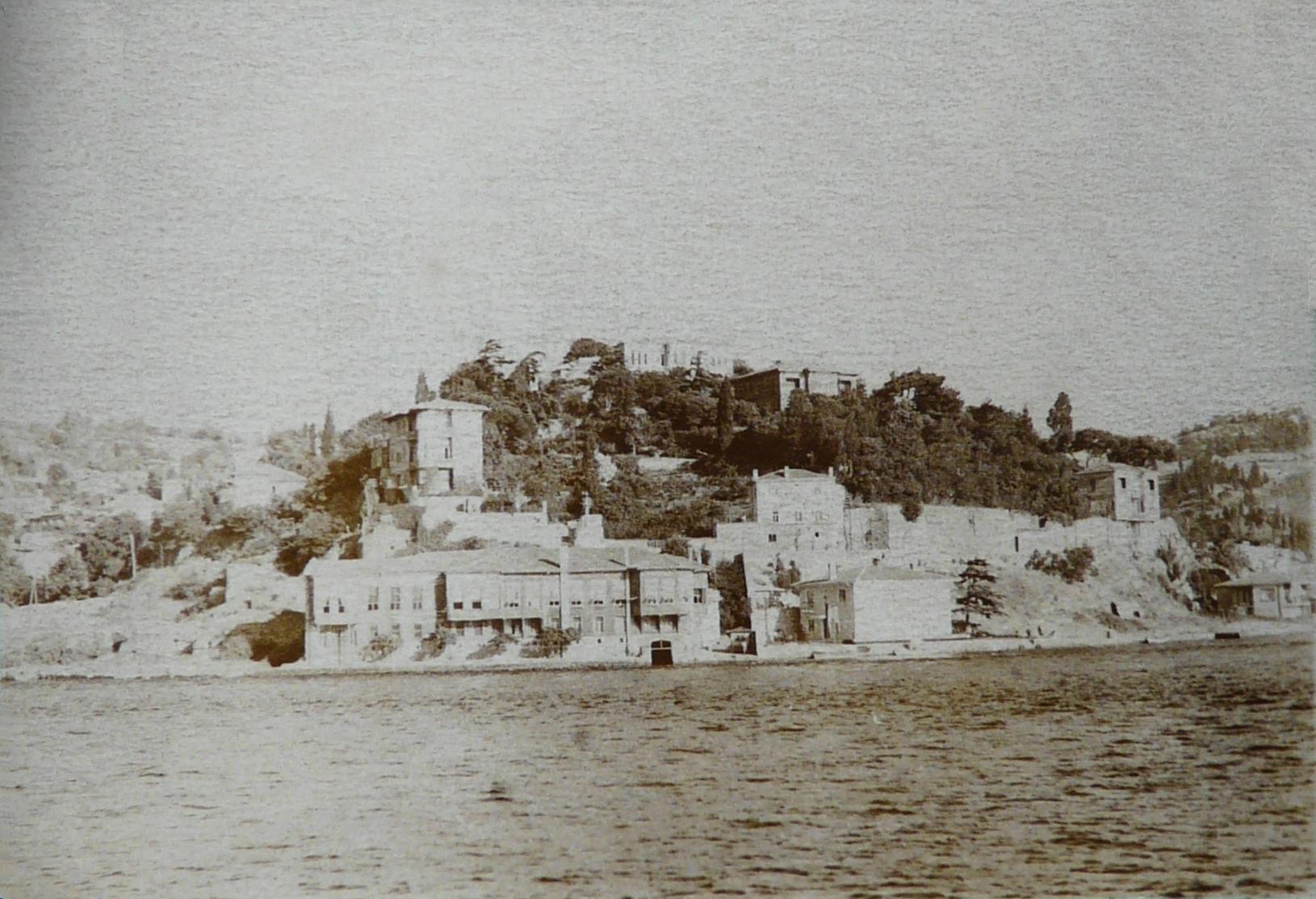
The cultural life of the Bosporus during the Ottoman classical and tulip eras was centered on the distinctive architectural tradition of the yalı—ornate wooden waterfront mansions constructed directly over the water upon stone stilts and foundations. Built by Ottoman grand viziers, pashas, and foreign ambassadors, these graceful timber residences were deliberately oriented toward the sea, featuring expansive sash windows and interior divans positioned to capture cool marine breezes. The water served as the primary highway of daily life, with gilded caiques and private rowboats conveying nobility across the strait between Europe and Asia.
In the late twentieth century, the immense volume of hazardous crude oil transit prompted international maritime authorities to implement revolutionary safety protocols. Following catastrophic maritime disasters—most notably the nineteen seventy-nine collision of the Romanian supertanker Independenta, which exploded off Haydarpaşa, burned for twenty-seven days, and spilled ninety-five thousand tons of crude oil—Turkey established one of the world’s most advanced Vessel Traffic Services (VTS) networks. Utilizing high-frequency thermal imaging, Doppler radar towers, and mandatory escort tugboats for ultra-large crude carriers, the system coordinates precise convoy transits to protect the seventeen million inhabitants living along its historic shores.
Frequently Asked Questions
Why does the Bosporus have two opposite currents flowing simultaneously?
The dual currents result from dramatic differences in density and surface elevation between the Black Sea and the Mediterranean basin. Massive freshwater inflow from major European rivers like the Danube, Dnieper, and Don causes the Black Sea surface to sit roughly thirty to fifty centimeters higher than the Sea of Marmara, driving a brisk southward surface current of brackish water (around seventeen to eighteen parts per thousand salinity). Beneath this surface layer, starting at depths of twenty to thirty meters, dense, warm Mediterranean water (roughly thirty-eight parts per thousand salinity) flows relentlessly northward, driven by the strong hydrostatic pressure gradient toward the Black Sea deep basin.
How narrow is the Bosporus at its most restrictive navigation point?
At its narrowest constriction, situated between the historic medieval fortifications of Anadoluhisarı on the Asian shore and Rumelihisarı on the European shore, the strait contracts to approximately seven hundred meters in width. Within this tight choke point, ships must negotiate severe twelve-degree to forty-five-degree rudder maneuvers while counteracting complex whirlpools, localized eddy currents known as orkoz, and cross-channel wind shear.
What legal framework governs maritime traffic through the strait?
The navigation of the strait is regulated by the 1936 Montreux Convention Regarding the Regime of the Straits. This landmark international treaty guarantees unrestricted freedom of passage for civilian merchant vessels of all flags during peacetime without mandatory pilotage or transit taxes. Simultaneously, it grants Turkey sovereign maritime oversight, establishing stringent tonnage restrictions, advance notification protocols, and limitations on the transit of non-Black Sea belligerent naval vessels.
Did a catastrophic flood create the modern Bosporus waterway?
According to the Black Sea deluge hypothesis first proposed by marine geologists William Ryan and Walter Pitman in 1997, the melting of northern ice sheets during the early Holocene pushed global sea levels higher until Mediterranean waters overtopped the earthen bedrock ridge spanning the Bosporus valley around 7,600 years ago. Geoscientists calculate that this catastrophic breach unleashed a torrent equal to hundreds of Niagara Falls, rapidly drowning thousands of square kilometers of coastal farmland and transforming the freshwater Pontic lake into an anoxic marine basin.




Share what you know
Been there, grew up there, or know something we missed? Add a comment; corrections with a source are especially welcome.