

At Jaipur’s Jantar Mantar, a shadow crosses a stone scale and gives the Sun a local time. The Samrat Yantra is an instrument large enough to walk beside: a triangular gnomon rises between curved, graduated surfaces, turning an astronomical relationship into a reading.[13] Its scale is striking, but the task is practical. The instrument belongs to a city laid out by Sawai Jai Singh II, where observation, commerce and public space were all part of a larger act of planning.[4][5]
That conjunction opens a way into Rajasthan. The state is often introduced through the Thar Desert, yet its geography also includes the Aravalli hills, river country, plateaus and managed wetlands. Its cities hold different histories of trade, worship, water and political authority. Rather than make one landscape stand for the whole region, follow the work people did in particular places: measuring the sky in Jaipur, sustaining a fort on a ridge, or directing water through a stepwell and a wetland.
The Aravallis divide more than a map
Rajasthan occupies India’s northwest and is the country’s largest state by area, covering 10.4 per cent of India’s land.[1] Its international border meets Pakistan; within India it borders Punjab, Haryana, Uttar Pradesh, Madhya Pradesh and Gujarat.[1] The state’s two defining forms, the Thar Desert and the Aravalli Range, run across it on a diagonal. The hills mark a broad transition in climate and terrain: dunes dominate the west, the Aravalli country occupies the middle, and more fertile plains and river landscapes lie farther east and southeast.[1][2]
The difference is not simply a shift in colour on a map. Rainfall is unequal, and the state’s physiographic account distinguishes sandy northwest from hill country and plateau farther south and east.[2] Mewar’s hills, the plateaus around Kota and Bundi, and the Chambal landscape each offer different ground for travel and settlement. The Aravallis themselves are not a wall that separates two uniform halves; they are a long, varied range, with ridges, valleys and passages that people have used in different ways.
That variation changes what a place asks people to build. A settlement on the dry western plain faces different questions of water and movement from one among the southern hills or beside the Chambal. The state’s physical account describes sandy tracts, rocky uplands, plateaus and river valleys within the same administrative boundary.[1][2] Read from west to east, Rajasthan is not a single desert crossed by occasional exceptions. It is a sequence of environments whose soils, slopes and watercourses offer different possibilities for farming, travel and settlement.
Six hill forts, six relationships with the land
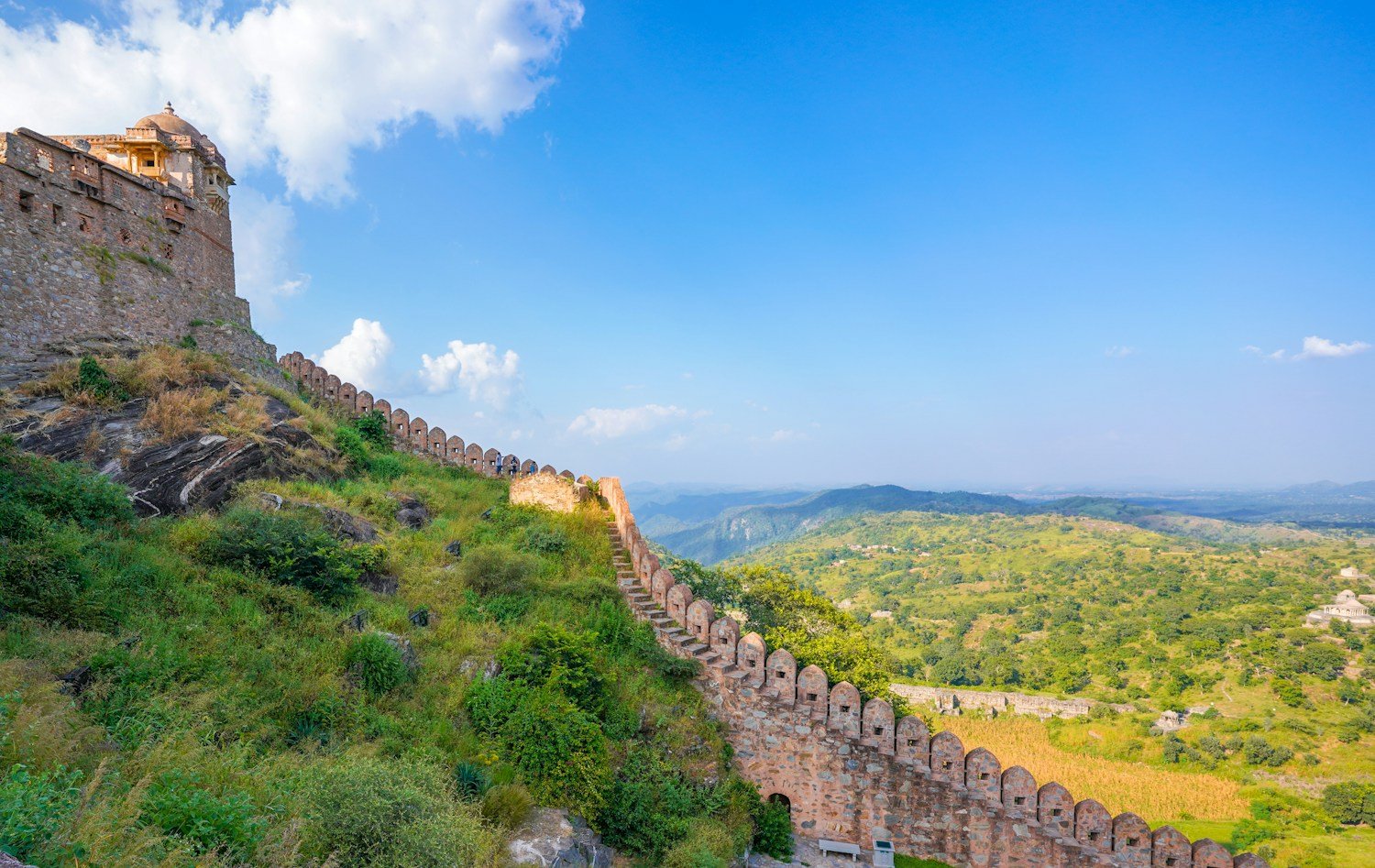
UNESCO’s Hill Forts of Rajasthan property brings six places into one listing: Chittorgarh, Kumbhalgarh, Ranthambore, Gagron, Amber and Jaisalmer.[3] Their shared name should not blur their differences. One rises above a forest, another occupies a ridge or river setting, and Jaisalmer stands within a desert city. The natural feature is not scenery added to the fort. It is part of how a fortified place worked.
UNESCO’s description includes settlements, palaces, temples and water systems as well as defensive structures.[3] With fortifications that can extend up to 20 kilometres in circumference, these were inhabited places, where people worked, worshipped and stored water as well as defended a ruler’s territory. UNESCO also records elaborate water-harvesting systems inside the forts, many still in use.[3] That detail shifts the reading from ramparts to daily survival: a fortress had to protect a settlement, but its people also needed dependable water, room to worship, and routes to move goods through the walls. Terrain shaped the fort’s defenses and the practical life it enclosed. Reading them at both scales keeps attention on design and use, not only on a fort’s outline against the landscape.[3] The setting remains part of the history.
UNESCO’s examples make the geographical contrasts concrete. Gagron is protected by a river and occupies a strategic hill pass; Ranthambore is a forest fort; Jaisalmer stands on a desert hill, its walled township still inhabited and home to Jain temples.[3] The sites share a political history, but their settings shaped different relationships with routes, settlement and defense. A river crossing, forested height and desert town cannot be read through one fort plan. The serial listing is useful because it lets the differences remain visible while showing how architecture adapted to the varied physiographic zones of Rajasthan.[3]
Jaisalmer also shows that the relationship between fort and city did not end with military use. The World Heritage Centre identifies water seepage linked to inadequate infrastructure as a threat to the hill’s stability and notes the need for improved conservation of individual buildings.[3] This is a living settlement within a protected fort, where repair has to respect daily use as well as fragile material. Its walls have endured for centuries; their future also depends on how the modern city manages water and maintenance.
From a hilltop, the state’s other urban idea comes into view. Jaipur was not built as a fort adapting to an existing ridge. It was planned on open ground as a commercial capital, with streets and markets arranged to organise movement. The shift from fort to city changes the story from defence toward design and exchange.
Jaipur was planned for trade as well as rule
Sawai Jai Singh II founded Jaipur in 1727. UNESCO describes the walled city as a planned commercial capital, laid out on a plain with an ordered street grid and broad market streets. Shops, workshops and residences formed part of the plan, alongside civic and religious buildings.[4] This is an urban idea that joins royal authority to everyday exchange: the market is not an afterthought beyond the palace, but one of the things the city was built to hold.
The grid is only one part of the plan. UNESCO also records nine city gates, broad bazaars, public squares known as chaupars, and the sector structure called chowkris.[4] The main streets organised movement through the walled city, while shops, havelis, temples and craft streets gave those routes a daily purpose. That combination helps explain why Jaipur’s historic centre is read as an urban ensemble rather than a collection of isolated monuments. A gate directed traffic; a bazaar gave it somewhere to stop; a square created a shared space between the two. The plan joined civic, commercial and religious life within a legible street structure.
The city’s plan also gives a setting for scientific work. Jai Singh II sponsored Jantar Mantar, a group of about 20 fixed masonry instruments designed for naked-eye observations of celestial positions.[5] The instruments stand in open courtyards, where the sky is not an abstract subject but the field of observation. Their size makes relationships among the Sun, stars, horizon and time visible in built form.
Jantar Mantar is not a collection of oversized sundials doing one job. UNESCO describes instruments for observing celestial positions and measuring time, built at a scale that makes their geometry part of the method.[5] The Samrat Yantra is the clearest example, but the observatory’s other structures offer different ways to take a reading. It belongs to a wider history of astronomy, while its location in Jaipur also reflects Jai Singh II’s own programme of observation and patronage. The city’s grid and the observatory’s geometry are separate projects, but both make planning visible: one orders streets for movement and exchange, the other arranges stone around the motions overhead.
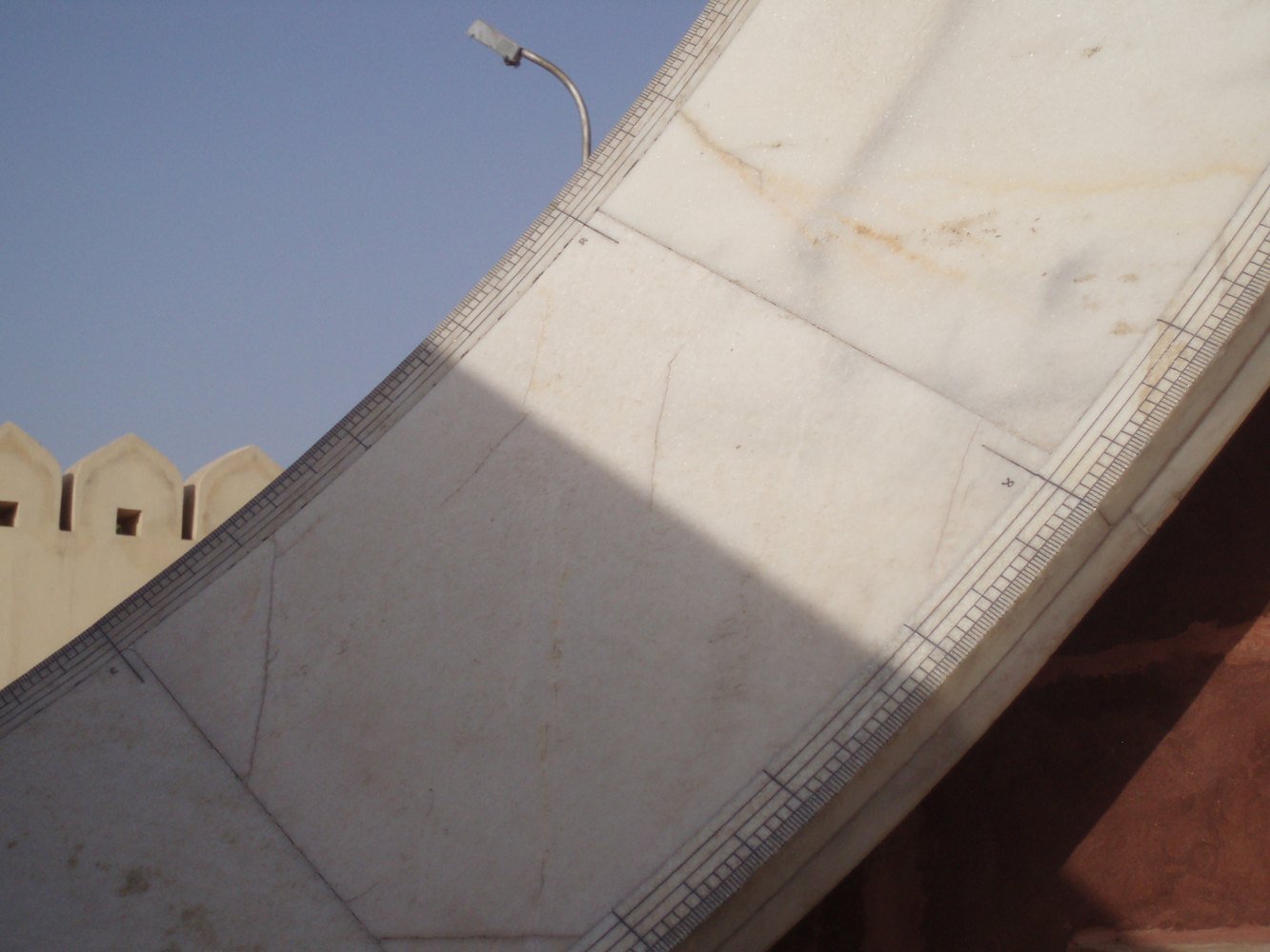
The Samrat Yantra is the most readily grasped example. Its triangular gnomon casts a moving shadow over curved, marked surfaces. The reading is local solar time, which differs from standard clock time and requires adjustments for longitude and the changing relation between solar and clock time through the year.[13] The edge of a shadow is not infinitely precise, so measurement also involves reading a mark against a soft boundary. The large scale provides room for fine graduations, while the observer still has to interpret what the instrument shows.[13]
A block printer leaves a pattern one impression at a time
Rajasthan’s craft traditions range across hand block printing, tie-dye, blue pottery, stonework, embroidery and miniature painting.[6] That list is a beginning, not a description of how any one object was made. In the photograph from Bagru, a woman presses a carved block against cloth. We can see the hand, tool and fabric meet; the image does not establish a complete recipe for the dye or every stage that came before and after this impression.
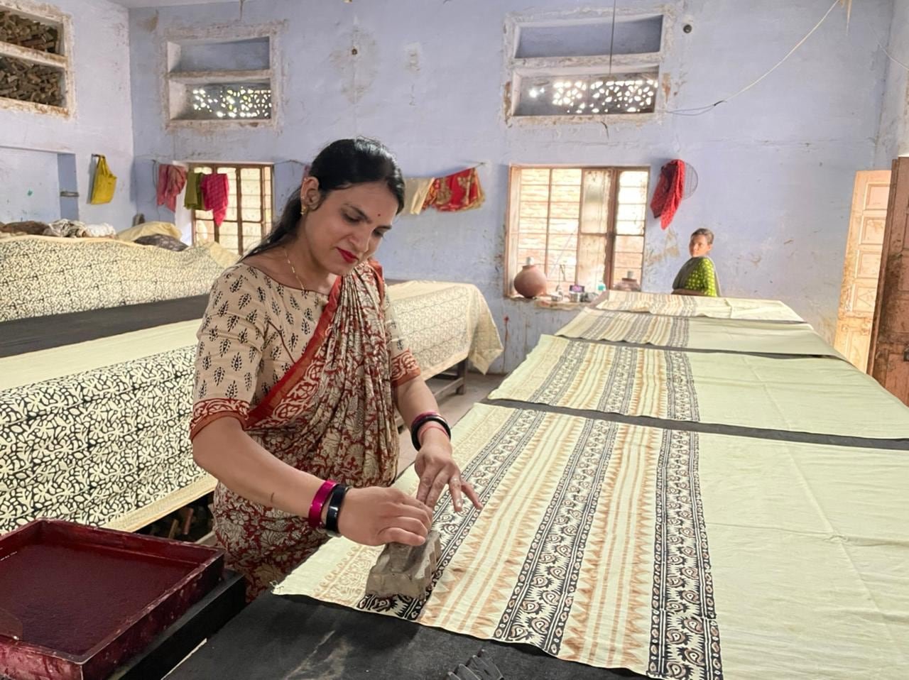
The practice remains contemporary: makers continue to decide what to print, adapt and sell. The block is a working tool, not a fixed image of the past.
From cloth, the story returns to water. The same attention to repeated forms that helps a printer align a pattern appears at Chand Baori, where flights of steps descend in a precise geometry toward a well. There, repetition has a different purpose: it organises access to a resource.
Stepwells and lakes hold water in different ways

At Abhaneri, Chand Baori turns water storage into a striking architectural space. Rajasthan Tourism describes a stepwell with flights of steps on three sides and a pavilion on the fourth.[7] The stairs descend toward the well in a dense pattern that is easy to read from above, but the structure also belongs to the scale of a person moving down toward water. Its geometry has a practical direction.
A stepwell brings people down to a single water point; a lake spreads a city’s relationship with water across a wider shore. They solve different problems, and each depends on maintenance and management beyond the structure or waterline itself.[7][15]
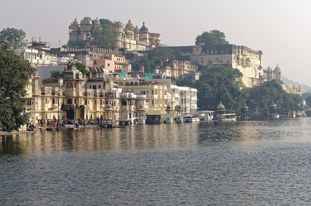
A stepwell and a city lake ask different questions. Chand Baori gathers movement into a descent; Udaipur’s lakes extend the comparison across an urban shoreline. What flows into them and how they are maintained belong to the city’s present, as well as to its famous view.[7][15]
The question of management becomes even clearer at Bharatpur, where a wetland’s bird habitat depends on water directed through a wider system. Keoladeo is not an exception that cancels Rajasthan’s dry landscapes. It is a different landscape within the same state, shaped by water and by human decisions.
Udaipur’s lakes are part of a working city
In Udaipur, Pichola, Fateh Sagar and Udai Sagar belong to a district network that also includes wells and groundwater. The environment plan discusses the lakes in relation to water quality and domestic sewage.[15] That changes the familiar panorama. A lake can be an open edge to the city and a water body needing care beyond its shore. The plan does not establish that each lake supplies drinking water; it does show that their condition is a present environmental concern, connected to what enters the water and how the wider system is maintained. In a city known for palace façades reflected on the surface, the infrastructure behind the image deserves attention too.
Keoladeo’s birds depend on water beyond the park
Keoladeo National Park near Bharatpur has a history that joins human management to wildlife habitat. UNESCO describes it as a wetland developed from a former royal duck-hunting reserve and recognised for its aquatic birds.[8] Water moves through dykes and sluices into shallow areas of different depths, creating conditions that support different bird life.[8] Its wetlands are not untouched wilderness; they are a managed landscape whose ecological significance depends on how water is distributed.
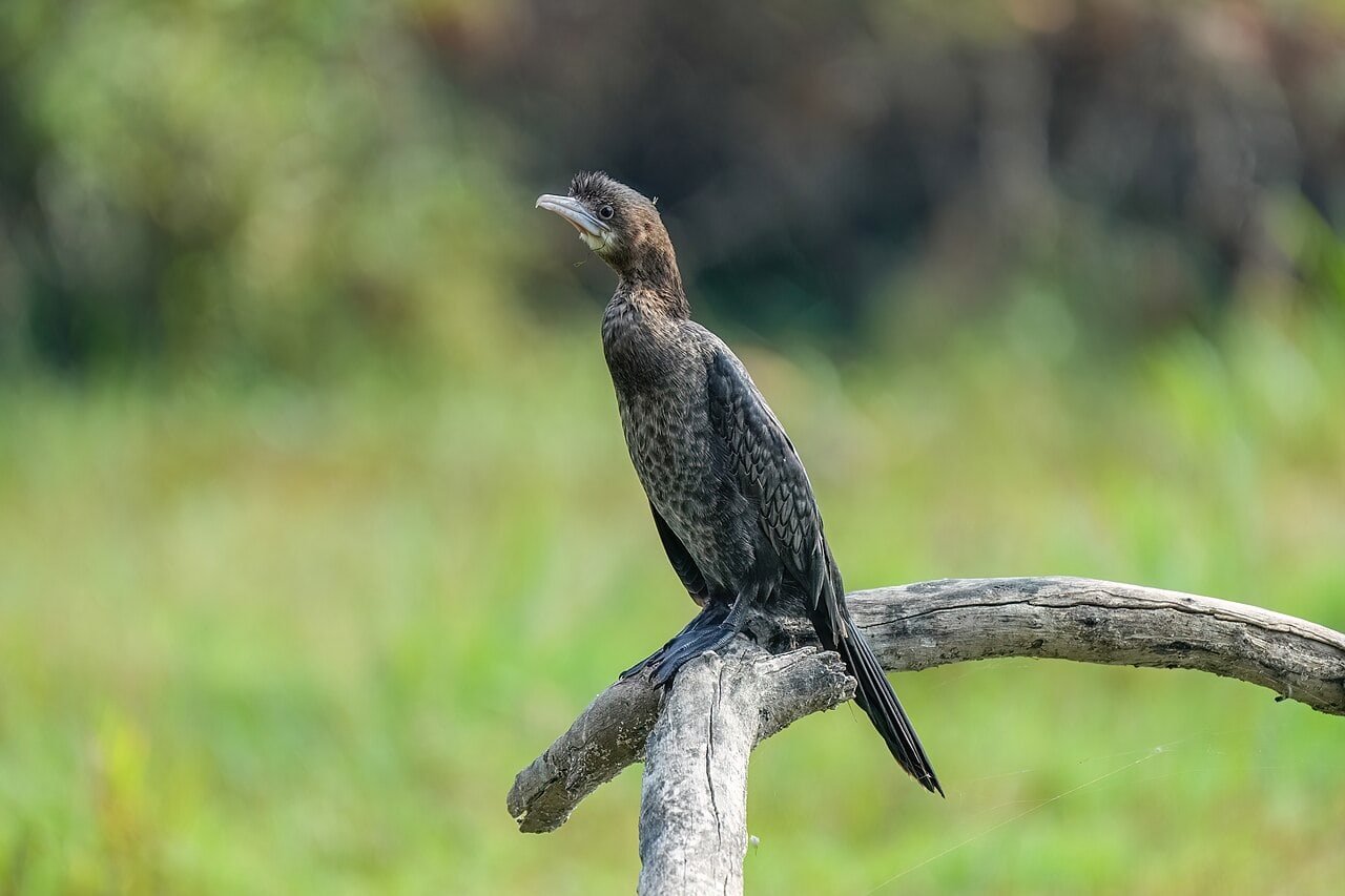
The boundary of a protected area does not always contain the whole system it depends on. A World Heritage Committee decision in 2025 recorded that the minimum water supply required for Keoladeo had been met in 2024, while calling for a longer-term solution.[14] That is a dated management finding, not a prediction about every later season. It points to a practical question: how can a wetland receive enough water over time while also meeting demands beyond its boundaries?
A 2025 State Party report records that 570 million cubic feet reached Keoladeo in 2024 from the Gambhir River and Azan Bandh, above the park’s stated 550-million-cubic-foot capacity.[18] That one year did not settle the wider problem: the World Heritage Committee notes that supply in most years remains below the minimum required for the wetland’s ecological functioning and calls for a durable arrangement.[14] The park’s water story therefore extends beyond its boundary, into the infrastructure and decisions that determine what arrives and when.
This is why Keoladeo complicates the familiar picture of Rajasthan as a single desert landscape. The state holds dunes, hills, plateaus, river country, lakes and wetlands. Each setting has its own water story. The wetland does not make the desert less real, and the desert does not make the wetland less Rajasthani. Together they show how much a regional label can contain.
A meal can carry more than one landscape
Dal baati churma is one of the Rajasthani meals most likely to be recognised by name. Rajasthan Tourism describes its three parts: lentils, baked wheat balls and a sweet preparation made from crushed grain.[9] The components differ in texture and taste, and together they make a dish that is more revealing than a general label such as “desert food”.
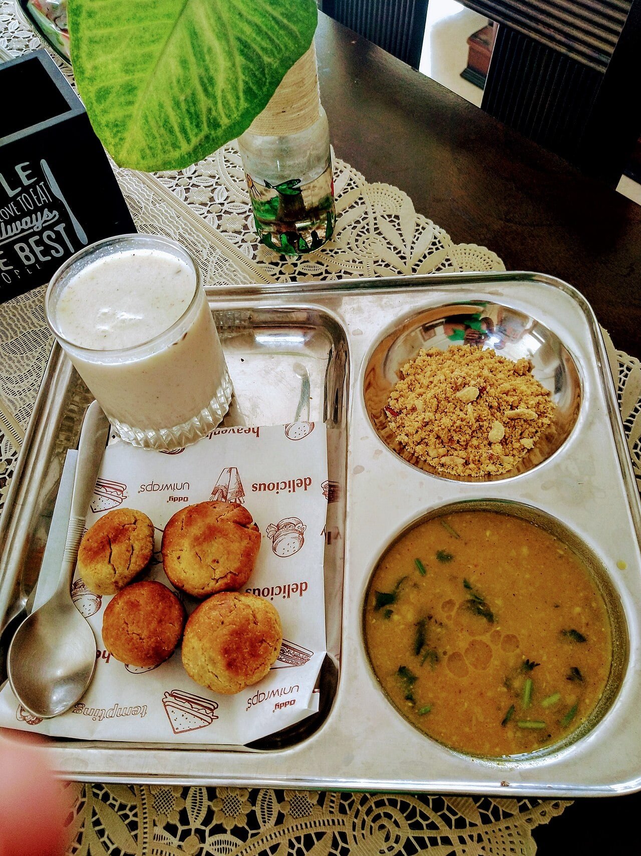
Other foods make different claims on memory and occasion. Rajasthan Tourism also describes ker sangri, made with desert beans and berries, and ghevar, a sweet associated with particular festive occasions.[9] Rajasthan Foundation’s cuisine overview names gram flour, millet and dairy among ingredients used in the region.[10] These examples open up a broader food geography: some foods are tied to ingredients, some to preparation, and others to the moment when they are shared.
Even these familiar names need room for variation. A meal served at home, a sweet made for a celebration and a dish ordered from a city restaurant do not tell the same story about the people who prepare them. The tourism and foundation overviews name ingredients and dishes, but they do not define a single menu for the whole state.[9][10] Keeping that limit in view makes food useful as a way into regional life: it gives the reader something concrete to recognise while leaving space for household preference, local practice and change.
Kalbelia performance belongs to a living community
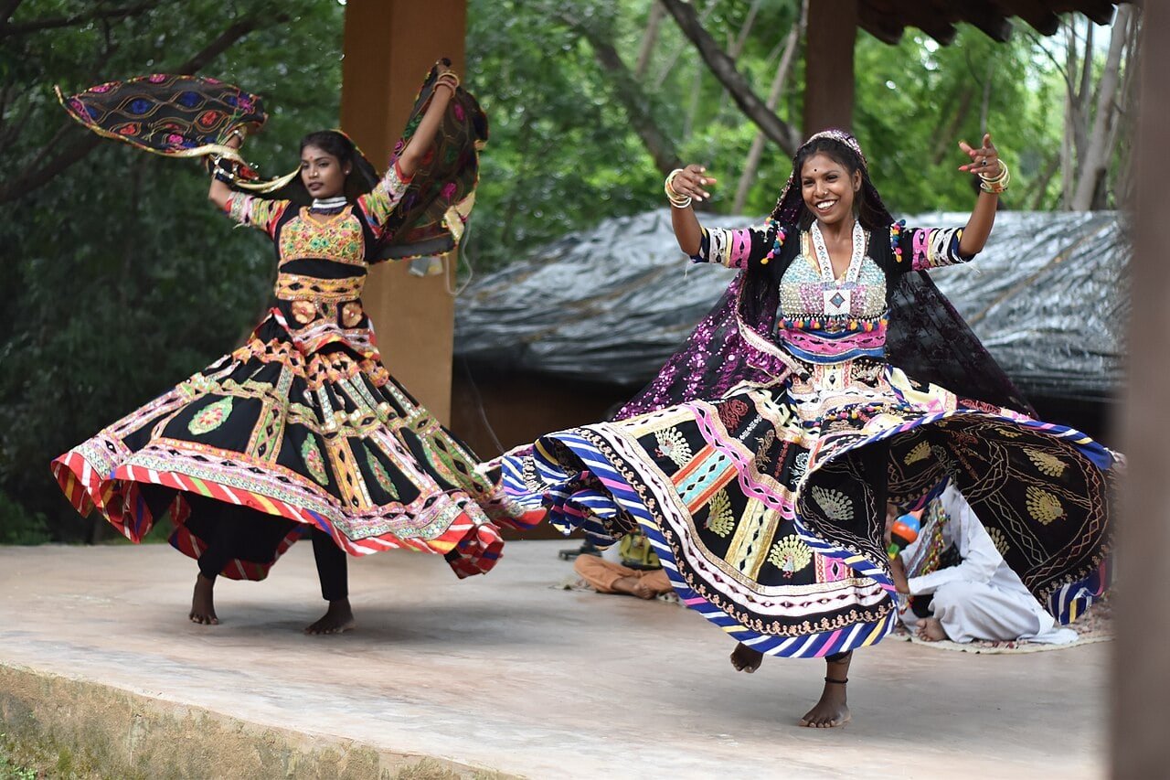
Kalbelia songs and dances are associated with a specific community in Rajasthan. UNESCO describes an oral tradition shaped by performance, improvisation and transmission between generations.[11] The songs include mythological stories and improvised lyrics; the dance and music draw on instruments including the poongi and khanjari.[11] The form is connected to the community’s former snake-handling livelihood, but it has also adapted as performers meet new settings and audiences.
Language is another part of everyday cultural life. Hindi is widely used, while regional speech varies across the state: Marwari in the west, Jaipuri or Dhundhari around the east and southeast, Mewati near Alwar, and Mewari around Udaipur.[16] The Rajasthan Foundation also names Marwari, Mewari, Dundari and Vagadi among Rajasthani’s dialects, and records a state academy devoted to Rajasthani literature and language.[19] These names are not interchangeable labels for one uniform voice; they follow distinct regions and communities. A map of Rajasthan can show where a language is associated, but it cannot imply that every resident speaks it or that one speech variety represents the whole state.
The present-day city is also a place of work. Jaipur, Jodhpur, Udaipur and Kota have growing information-technology workforces, while Bhilwara is a major centre for suiting fabric and yarn production.[17] The forts and observatories belong to long histories, but the cities around them are also workplaces shaped by textiles, services, tourism and industry.
That present is visible in the way Rajasthan’s cities combine older street patterns with newer work and transport. A visitor may move between a fort, a market and a business district in one day, but those places answer different needs. The state’s historic buildings are not museum pieces separated from ordinary life; they sit within towns whose residents work, study, trade and travel through them.
Farming also has a varied crop calendar. The Rajasthan Foundation names coarse grains, pulses, oilseeds, cumin, garlic, coriander and mustard among crops grown in the state, while its overview places food processing alongside agriculture.[17] In one district the economic story may follow a textile mill or a mineral deposit; in another it may follow fields, livestock or a food-processing unit. Those activities are affected by the same differences in rainfall and terrain that shape settlement. This is not a claim that climate alone determines work. It is a reminder that regional livelihoods are spread across different ground and depend on more than the best-known tourist city.
The economy is not concentrated in one kind of work. The Rajasthan Foundation describes agriculture and food processing alongside mining, cement, textiles, auto components, tourism and information technology.[17] Its examples put different parts of the state on the same map: cotton and textile production around Bhilwara, agro-industrial activity in several districts, and IT parks in Jaipur, Jodhpur, Udaipur and Kota. These are not details that replace the region’s historic sites. They show that the present landscape is also made by supply chains, workshops, farms and service work, each with its own relationship to transport and settlement.
What can be said securely is that the present state is younger than many of the places inside it. Rajasthan Foundation’s post-independence history describes the integration of former princely states through a sequence of unions. Greater Rajasthan was formalised on 30 March 1949, and reorganisation was completed on 1 November 1956.[12] The chronology matters because it separates the modern state from older kingdoms and city histories without denying the ties among them.
The sequence took seven stages. Matsya Union joined Alwar, Bharatpur, Dholpur and Karauli in March 1948; another group of princely states formed Rajasthan Union days later. Udaipur then joined that union, and the addition of Bikaner, Jaisalmer, Jaipur and Jodhpur created Greater Rajasthan on 30 March 1949. Matsya merged into it in May; further integration followed in 1950, before the 1956 reorganisation added Ajmer and other territories.[12] The present map is therefore the outcome of several political decisions, not a boundary that had always enclosed the same places.
That sequence is a useful correction to the temptation to treat the state’s current border as permanent. The forts, markets and cities in this account were made under different rulers and for different purposes; they did not all belong to one Rajasthan in the modern administrative sense.[3][4][12] The regional name now lets a reader hold those places together, but the history still needs its dates and local identities. A map can connect them for us without making them identical.
The Samrat Yantra does not hold the Sun still; it gives its movement a scale. Jaipur gives that measurement a public address: stone arranged around the sky, streets planned for exchange, and a living city moving below.[4][13]








Share what you know
Been there, grew up there, or know something we missed? Add a comment; corrections with a source are especially welcome.