

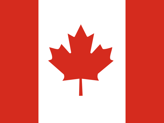

Canada’s first transcontinental railway was completed in 1885. That same year, the federal government imposed a punitive head tax on Chinese newcomers, after thousands of Chinese labourers had performed the most perilous rock-blasting and grading through the canyons of British Columbia. The steel track physically tied distant colonies together, yet it also exposed the structural exclusions and expropriations built into the emerging federation. Across ancestral Indigenous homelands, provincial borders and three ocean-facing coastlines, Canada’s story turns on who can move, whose legal titles are recognized, and what mutual belonging asks of a geographically sprawling state.[11][12]
The sovereign territory reaches from the Atlantic Ocean westward to the Pacific Ocean and northward into the frozen archipelago of the Arctic Ocean. Political maps divide this expanse into ten provinces and three northern territories. Administrative lines, however, represent only a recent layer upon much older human geographies. The maritime provinces face the Atlantic swells; Québec and Ontario cluster along the freshwater spine of the St. Lawrence River and the Great Lakes; the Prairie provinces unroll across dryland grass and fertile river valleys; British Columbia folds temperate rainforest, deep fjords, and alpine cordillera together. Farther north, Yukon, the Northwest Territories, and Nunavut encompass subarctic taiga and polar tundra. These regions cohere under one federal parliamentary system. Even so, their physical environments, resource economies, linguistic landscapes, and political priorities often pull in divergent directions.[3][4]
Physical size can be deceiving. Although Canada encompasses roughly ten million square kilometres—making it the second-largest country on Earth by total area—the overwhelming majority of its population resides within a narrow ribbon extending barely two hundred kilometres from the border with the United States. In this southern corridor, milder climatic conditions, alluvial soils, and contiguous rail and highway links have fostered dense urban clusters. The Windsor–Québec City corridor alone concentrates more than half of the national population, linking Montréal, Ottawa, and Toronto in an interdependent industrial and financial axis. Farther west, the urban corridor between Calgary and Edmonton acts as an administrative hub for agricultural, livestock, and petroleum hinterlands. Vancouver looks out toward trans-Pacific trade routes, while coastal outports in Atlantic Canada face fishing grounds and shipping lanes. In the northern territories, settlements are separated by vast expanses of muskeg, permafrost, and open water, where year-round air transit, winter ice roads, and seasonal maritime sealifts provide the fragile lifelines of daily existence.[4][7]
The Granite Anchor of the Canadian Shield
Underlying more than half of the national landmass lies the Canadian Shield, an immense horseshoe-shaped expanse of exposed Precambrian granite, gneiss, and metamorphic rock that wraps around Hudson Bay. These ancient continental cratons date back between two and four billion years. They represent the eroded geological core of North America. During the Pleistocene glaciations, continental ice sheets several kilometres thick ground across the terrain like titanic scouring pads, stripping away topsoil and scraping deep grooves into the crystalline bedrock. When the ice retreated ten thousand years ago, it left behind a rugged, rolling topography gouged with millions of depressions. As these filled with glacial meltwater, they gave Canada more natural lakes than the rest of the world combined.[1][5]
The thin, acidic soils and waterlogged muskeg of the Shield prevent large-scale commercial farming, yet this rugged expanse has historically dictated the routes of trade and resource accumulation. A dense mantle of boreal forest stretches across the southern perimeter of the Shield, dominated by black spruce, jack pine, tamarack, and balsam fir. This forest provides the raw material for paper, lumber, and wood products. Beneath the granite shield lie world-class geological anomalies containing heavy concentrations of nickel, gold, copper, zinc, iron ore, and uranium, which fueled boom-and-bust mining settlements from Sudbury and Rouyn-Noranda to Flin Flon and Yellowknife.[5][24]
The Shield also serves as a continental water tower. Thousands of rushing rivers tumble down bedrock escarpments toward Hudson Bay, James Bay, and the St. Lawrence River, offering monumental hydraulic gradients. Beginning in the mid-twentieth century, provincial crown corporations dammed these wild watercourses—most notably in northern Québec with the colossal James Bay Project—transforming indigenous river systems into vast reservoirs of hydroelectric power that supply distant cities and industrial smelters. These engineering interventions altered natural migration pathways and flooded ancestral hunting grounds, sparking prolonged legal battles and modern treaty agreements between provincial authorities and Cree and Inuit nations.[5][10][25]
Three Ocean Horizons and Riparian Corridors
Canada possesses the longest maritime coastline in the world, spanning more than two hundred thousand kilometres across three ocean basins. On the Pacific flank, moist maritime air masses from the North Pacific collide with the towering Coast Mountains. The resulting heavy precipitation sustains temperate rainforests of western redcedar, Sitka spruce, and Douglas-fir. The coastline is deeply indented with fjords, islands, and narrow channels. These sheltered waters sustain migratory salmon runs and diverse marine life. Here, coastal ports serve as the nation’s principal oceanic gateway to Asian economies, with modern deepwater terminals handling container freight, metallurgical coal, potash, and grain.[4][5]

On the Atlantic coast, a completely different maritime ecology predominates. The cold Labrador Current flows southward along Newfoundland and Labrador, colliding with the warm Gulf Stream over shallow continental banks. This mixing zone sustained the Grand Banks, one of the most productive cod fisheries in global history. For centuries, it drew Basque, Portuguese, French, and British fishing fleets across the Atlantic. The eventual collapse of the northern cod stock in the early 1990s triggered a traumatic federal moratorium that dismantled centuries of village-scale inshore fishing and spurred severe outmigration from rural Newfoundland outports. Further south, the Bay of Fundy between Nova Scotia and New Brunswick channels tidal currents into the world’s most extreme tidal oscillations, where sixteen-metre water fluctuations generate fierce tidal bores that temporarily reverse coastal rivers.[1][4]
Between these oceanic coasts, the Great Lakes and the St. Lawrence River form an essential continental waterway. The St. Lawrence Seaway opened in 1959. It allows ocean-going freighters to travel over three thousand kilometres inland from the Atlantic Ocean into the industrial heartland of Ontario and the American Midwest. The river was also the historic avenue of New France, where early French colonists established farming settlements laid out in narrow seigneurial strips fronting the water. Along this waterway arose the political institutions of the state, centered on Parliament Hill in Ottawa, overlooking the Ottawa River at the boundary between Ontario and Québec.[3][11]

In the high north, the Arctic Ocean weaves between the high-latitude islands of the Canadian Arctic Archipelago through icy straits known collectively as the Northwest Passage. Historically choked by multi-year sea ice, these channels are experiencing rapid seasonal retreat due to accelerated polar warming. Reduced pack ice may open commercial shipping routes that shorten journeys between Europe and East Asia. Yet it also creates jurisdictional disputes and threatens polar wildlife that depends on stable sea ice.[6][31]
The Prairie Furrows and Western Cordillera
West of the Canadian Shield, the flat to gently undulating plains of the Interior Basin extend across southern Manitoba, Saskatchewan, and eastern Alberta. Underlain by thick layers of Cretaceous sedimentary rock and fertile glacial till, these grasslands receive relatively low precipitation due to the rain shadow cast by western mountain ranges. In the late nineteenth and early twentieth centuries, federal settlement campaigns promoted the Prairies as the “Granary of the British Empire.” Homestead grants of quarter-sections drew millions of Ukrainian, German, Scandinavian, British, and American settlers.[4][19]
This demographic influx transformed the native shortgrass and mixed-grass prairies into an expansive agrarian grid dominated by monocultures of hard red spring wheat, barley, canola, and lentils. Communities grew along rail lines at regular eight-to-ten-mile intervals—the distance a farmer could travel by horse and wagon within a single day. At each siding, towering wooden grain elevators were constructed to collect and store harvest grain for shipment to eastern ports and western terminals. While concrete terminal elevators and consolidated transport hubs have replaced many traditional wooden structures, these rustic towers remain poignant architectural icons across prairie skies.[4][23]
As one travels farther west across Alberta, prairie grasslands yield to the foothills and dramatic limestone crags of the Canadian Rocky Mountains. The Western Cordillera comprises multiple parallel mountain systems—including the Rockies, the Columbia Mountains, and the Coast Ranges—formed through intense tectonic collisions and uplift over millions of years. Glaciers and high-altitude snowpacks within these mountains feed critical river arteries, such as the Bow, Saskatchewan, Athabasca, and Columbia rivers, which provide potable water and irrigation for downstream plains. The abrupt transition from semiarid prairie to snow-capped alpine passes created formidable transport barriers, demanding extraordinary engineering feats to bore rail tunnels through Kicking Horse and Rogers passes.[5][11]
Treaty Geographies, Indigenous Nunangat, and the Federation
The sovereign territory of Canada occupies the ancestral lands and waterways of hundreds of distinct Indigenous nations, classified under federal law into First Nations, Inuit, and Métis peoples. Long before European explorers mapped northern waterways, sovereign Indigenous societies maintained complex trading alliances, legal traditions, and sustainable resource management frameworks. In the Atlantic provinces, British authorities concluded Peace and Friendship Treaties between 1725 and 1779 with the Mi’kmaq, Wolastoqiyik (Maliseet), and Passamaquoddy nations, establishing diplomatic relationships without ceding Indigenous title to the land.[2][8][27]
Following Confederation in 1867, the Dominion government embarked upon the negotiation of eleven Numbered Treaties between 1871 and 1921, spanning northwestern Ontario across the Prairies to the Rocky Mountains and north to the Mackenzie River. While the Crown viewed these treaties as legal instruments for the surrender of land title to clear the path for rail construction and European settlement, Indigenous signatories understood them as sacred, perpetual covenants of mutual sharing, peace, and coexistence. The subsequent implementation of the Indian Act of 1876 established paternalistic reserve systems, restricted mobility through pass regulations, and banned traditional ceremonial practices such as the potlatch and sundance.[8][9]
During the same era, the Red River Resistance of 1869–1870, led by Métis leader Louis Riel, challenged unilateral federal annexation of Rupert’s Land and forced the creation of the province of Manitoba with legal protections for French-language rights and Métis land claims. However, federal failure to honor land scrip commitments sparked the 1885 North-West Resistance, resulting in Riel’s trial and execution. Over the ensuing century, federal policies established the residential school system. More than 150,000 Indigenous children were forcibly separated from their families in an effort to suppress native languages and cultures. In 2015, the Truth and Reconciliation Commission of Canada documented the widespread physical, emotional, and cultural trauma of this system, designating it cultural genocide and issuing 94 Calls to Action to reset the legal, educational, and civic relationship between Indigenous nations and the Canadian state.[13][14][26]

In the Arctic, Inuit communities preserved their territorial relationship through modern land claim agreements rather than historical treaties. Inuit Nunangat comprises four distinct regions: Nunatsiavut in northern Labrador, Nunavik in northern Québec, the territory of Nunavut, and the Inuvialuit Settlement Region in the Northwest Territories. On April 1, 1999, the federal government formally established Nunavut through the Nunavut Land Claims Agreement, creating an autonomous public government spanning two million square kilometres where Inuit constitute roughly eighty-five percent of the populace. In Iqaluit, the territorial legislative assembly governs through consensus without partisan political parties, conducting proceedings in Inuktut alongside English and French, and embedding traditional ecological knowledge—Inuit Qaujimajatuqangit—into polar wildlife management and community justice.[6][18][28][29]
Vernacular Winters, Lingua Franca, and the Seasonal Table
Cultural identity in Canada is inextricably tied to the rhythms of extreme seasonal shifts and linguistic duality. As an officially bilingual country under the Official Languages Act of 1969, Canada protects the institutional equality of English and French in federal courts, parliament, and public administration. In Québec, where French is the official provincial language and the mother tongue of the majority, society is anchored in a distinctive legal heritage based on the civil law tradition and an active literary, cinematic, and artistic sphere. Outside Québec, established Francophone communities—such as the Acadians of New Brunswick and Nova Scotia, the Franco-Ontarians, and the Franco-Manitobans—have defended their schools and institutions over generations, while more than seventy distinct Indigenous languages are actively preserved through community immersion programs.[15][16][17]
Winter imposes severe logistical and psychological conditions across the country, prompting innovative architectural and social adaptations. In major southern metropolises, extensive climate-controlled pedestrian systems—such as Montréal’s thirty-three-kilometre underground city (RÉSO) and Toronto’s PATH network—allow hundreds of thousands of commuters to navigate downtown retail and transit hubs without braving blizzards. In prairie cities, where winter temperatures routinely plunge below minus thirty degrees Celsius, dry continental cold is occasionally broken in southern Alberta by the chinook—a warm, dry westerly wind that descends the eastern slopes of the Rockies, capable of raising local temperatures by twenty degrees Celsius within a few hours and melting city snowpacks overnight.[1][4]
Culinary practices across Canada mirror the country’s ecological diversity, seasonal harvesting cycles, and successive waves of global migration. In the maple-dense deciduous forests of southern Québec, eastern Ontario, and New Brunswick, the arrival of spring thaw heralds the temps des sucres (sugaring season). Communities gather at rustic cabanes à sucre (sugar shacks) to celebrate the maple harvest with hearty feasts of pea soup, baked beans, ham, and hot maple taffy poured directly onto clean snow. This tradition builds upon techniques developed by Haudenosaunee and Anishinaabe peoples, who harvested maple sap long before European arrival. Across the Atlantic provinces, food heritage revolves around salt cod, lobster, and root vegetables, while on the Pacific coast, indigenous nations maintain millennia-old reef net and weir fisheries for wild sockeye salmon.[21][22][30][32]
In metropolitan centres such as Toronto, Vancouver, and Montréal, where over forty percent of residents were born outside Canada, international food cultures have redefined everyday life. From packed dim sum halls in Richmond and authentic South Asian spice markets in Brampton to Caribbean bakeries in Little Jamaica and Middle Eastern eateries in Montréal, immigrant communities have shaped contemporary urban neighborhoods. Far from conforming to a uniform national cuisine or monolithic identity, the table in Canada reflects an ongoing negotiation between regional ecologies, indigenous traditions, and immigrant inheritances, embodying a federation that is perpetually listening, adjusting, and discovering itself.[19][20][21]








Share what you know
Been there, grew up there, or know something we missed? Add a comment; corrections with a source are especially welcome.