
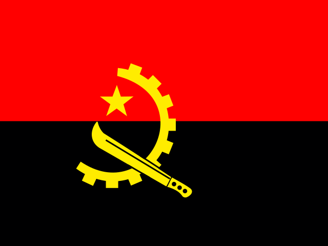


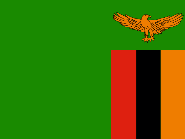


Flanked by the icy Benguela Current of the South Atlantic Ocean to the west and the semi-arid thornveld of the Kalahari Basin to the east, the Republic of Namibia occupies an immense territory of 825,615 square kilometers in southwestern Africa. Sharing terrestrial borders with Angola and Zambia to the north along the Kunene, Okavango, and Zambezi river systems, Botswana to the east, and South Africa to the south along the Orange River, Namibia is the second-least densely populated sovereign country on Earth, home to approximately three million people dispersed across vast, sun-drenched expanses [3]. Its landscapes encompass the hyper-arid Namib Desert—geologically the oldest desert on the planet—towering rust-red coastal sand seas, ancient metamorphic river gorges, and salt pans visible from space. Pioneering a globally recognized constitutional framework for community-based environmental conservation, Namibia balances desert ecology with rich mineral deposits, diamond dredging, and resilient multiethnic pastoral traditions [6].
The Namib Sand Sea and the Dead Playa of Deadvlei
Stretching for nearly two thousand kilometers along the entire Atlantic coastline of Namibia, the Namib Desert has endured hyper-arid conditions for at least fifty-five million years, making it the oldest continuous desert on Earth. The desert’s extreme aridity is driven by the cold, north-flowing Benguela Current, which chills surface ocean waters and creates a permanent atmospheric temperature inversion that suppresses convective rainfall while producing dense coastal fog banks. These coastal fogs—known locally as the *braai* or Benguela fog—roll up to fifty kilometers inland on more than one hundred and eighty mornings each year, providing the critical moisture lifeline that sustains specialized desert flora and fauna, including fog-basking tenebrionid beetles and the living fossil plant *Welwitschia mirabilis*, individual specimens of which survive for more than a thousand years.
In the southern and central Namib lies the Namib Sand Sea, inscribed on the UNESCO World Heritage list in 2013 as the only coastal desert in the world that encompasses extensive dune fields influenced by fog [1]. Powered by high-energy southerly wind regimes, the sand sea covers more than three million hectares, characterized by colossal linear and star dunes that glow deep orange and ochre due to iron oxide coatings on the quartz grains. At Sossusvlei, where the ephemeral Tsauchab River terminates amidst a wall of shifting sand, star dunes such as “Big Daddy” and “Dune 45” rise more than three hundred meters above the desert floor, ranking among the tallest sand dunes in the world.

Adjacent to Sossusvlei lies Deadvlei (“dead marsh”), a hauntingly beautiful white clay playa enclosed by towering rust-colored dunes. Approximately nine hundred years ago, rare seasonal river floods burst through the dunes, creating temporary shallow wetlands that allowed camel thorn trees (*Vachellia erioloba*) to germinate and flourish. As the regional climate shifted and advancing sand dunes completely choked off the river course, the water vanished. Scorched black by intense solar radiation and desiccated by the extreme absence of moisture, the dead camel thorn skeletons have remained standing upright for over nine centuries without decomposing, creating an indelible visual tableau of black tree silhouettes set against bleached white clay and glowing orange dunes [1].
The Fish River Canyon and Karoo Geology
In the arid southern interior of Namibia, cutting through the rocky Huns and Huib-Hochland plateaus of the ǁKaras Region, lies the Fish River Canyon. Plunging up to five hundred and fifty meters deep and stretching for one hundred and sixty kilometers, the Fish River Canyon is the largest canyon on the African continent and the second-largest in the world, carved over hundreds of millions of years by tectonic rifting and the erosive power of the ephemeral Fish River.

The geological story of the canyon began approximately 650 million years ago with the formation of a structural graben (a down-dropped crustal valley) along ancient fault lines. As the supercontinent Gondwana fragmented during the Jurassic period, the continental base level dropped, causing the ancestral Fish River to cut deeply through flat-lying sedimentary strata of the Nama Group into ancient Precambrian metamorphic basement rocks of gneisses and amphibolites. The canyon exhibits two distinct structural tiers: an upper canyon carved through soft shales and sandstones, and a deep, narrow lower gorge sliced through hard, dark metamorphic bedrock. During the arid winter months, river flow ceases, leaving isolated emerald pools along the rocky floor where mountain zebras, klipspringers, and leopard tortoises gather, while hot thermal sulphur springs bubble to the surface at Ai-Ais near the canyon’s southern mouth.
Farther north, near Keetmanshoop, the prehistoric landscape is punctuated by the Giant’s Playground and the Kokerboom (Quiver Tree) Forest. Here, hundreds of monumental quiver trees (*Aloidendron dichotomum*)—giant succulent aloes whose hollowed fibrous branches were historically used by San hunters to fashion quivers for poisoned arrows—grow amidst chaotic piles of black dolerite boulders intruded during the volcanic breakup of Gondwana 180 million years ago, creating a striking prehistoric botanical sanctuary.
Spitzkoppe, Brandberg, and Twyfelfontein Rock Art
In the arid transitional plains of Damaraland, the landscape is punctuated by ancient granitic inselbergs that rise sheer above the desert floor like stone islands. The most iconic of these is Spitzkoppe, often hailed as the “Matterhorn of Namibia.” Formed more than one hundred and thirty million years ago during the Early Cretaceous opening of the South Atlantic Ocean, Spitzkoppe is an eroded ring complex composed of smooth, bald granite domes that soar to 1,728 meters above sea level. Sculpted by millions of years of wind erosion and temperature-induced thermal exfoliation, Spitzkoppe features monumental natural rock bridges, hollow caves, and delicate perched boulders that glow brilliant amber at sunrise and sunset.

North of Spitzkoppe rises the Brandberg massif (“Fire Mountain”), Namibia’s highest mountain, which culminates at Königstein Peak (2,573 meters). Famous worldwide for its prehistoric rock art, the Brandberg shelters more than forty thousand individual rock paintings in sheltered overhangs, most famously the “White Lady” of the Tsisab Ravine. Recorded by German surveyor Reinhard Maack in 1918 and later interpreted by French prehistorian Henri Breuil, the painting depicts a graceful hunter or medicine person holding a bow and water goblet, painted in white and red ochre alongside gazelles and gemsbok, dating back between two thousand and four thousand years to ancient hunter-gatherer trance rituals.
In the Huab River valley of Damaraland lies Twyfelfontein (known officially by its indigenous Damara name, ǀUi-ǁaes, meaning “jumping waterhole”). Inscribed as Namibia’s first UNESCO World Heritage site in 2007, Twyfelfontein contains one of the densest and finest concentrations of rock petroglyphs in Africa, encompassing more than two thousand five hundred stone engravings pecked into red sandstone boulders over a period of six thousand years [2]. Created by Late Stone Age hunter-gatherer shamans, the engravings illustrate rhinos, elephants, ostriches, giraffes, and human footprints, alongside enigmatic geometric motifs. singularly, the artists frequently depicted animals transforming into spirit forms—such as the celebrated “Lion Man,” a lion with a long tail ending in a human hand—illustrating how San ritual practitioners entered altered states of consciousness to access supernatural rain-making and hunting powers [2].
Etosha National Park and Desert-Adapted Wildlife
In northern Namibia, the landscape is centered upon the Etosha Pan, an immense salt playa covering 4,800 square kilometers within Etosha National Park. Once an ancient inland lake fed by the Kunene River during wetter pluvial epochs, tectonic shifts diverted the river westward to the Atlantic thousands of years ago, leaving behind a colossal depression of shimmering white salt and clay that stretches one hundred and thirty kilometers across the horizon. During rare summer flood rains, the pan fills with a shallow sheet of water, attracting tens of thousands of greater and lesser flamingos that gather to breed in a spectacular pink concourse.
During the prolonged winter dry season, the salt pan dries completely, transforming into a stark expanse where dust devils spin across white alkali flats. Life in Etosha revolves around dozens of perennial natural springs and artesian waterholes distributed along the southern rim of the pan, including Okaukuejo, Halali, and Namutoni. These waterholes become theaters of intense ecological interaction, where herds of blue wildebeest, Burchell’s zebras, springbok, and gemsbok (oryx) drink beneath the watchful eyes of lion prides, spotted hyenas, and leopards. Etosha is recognized worldwide as one of the ultimate sanctuaries for the critically endangered southwestern black rhinoceros (*Diceros bicornis occidentalis*), which emerge under floodlights at waterholes each night to drink and socialize in undisturbed safety.
In the arid wilderness of Damaraland and the Kaokoveld to the west, wildlife exhibits astonishing physiological and behavioral adaptations to survival in hyper-arid terrain. Here roam desert-adapted African elephants, possessing broader footpads that distribute weight across loose sand, longer legs, and smaller body sizes than their savanna relatives. These remarkable animals can travel up to seventy kilometers between ephemeral riverbed waterholes without drinking for three to four days, digging into sandy dry riverbeds (wadis) with their tusks to uncover hidden subterranean water pools that subsequently hydrate other desert fauna. In the same arid canyons live desert-adapted lions, which hunt gemsbok and coastal seals along the Skeleton Coast, navigating gravel plains where daytime temperatures regularly exceed forty-five degrees Celsius.
Community Conservancies and the Human Fabric
Namibia is celebrated worldwide as a pioneer in community-based natural resource management (CBNRM) [6]. In 1996, the Namibian parliament passed progressive environmental legislation empowering rural indigenous communities to form legal entities known as communal conservancies. By granting local communities rights over wildlife and tourism revenues on their communal lands, the policy transformed wildlife from a competitive burden for farmers into a valuable economic asset. Today, eighty-six communal conservancies encompass over sixteen million hectares—nearly twenty percent of the nation’s total land area—involving more than two hundred thousand rural citizens [6]. Under community stewardship, poaching has plummeted, black rhino and elephant populations have rebounded across non-protected communal lands, and safari lodge joint ventures fund village clinics, water wells, and high school bursaries.
Namibia’s human population is a rich cultural mosaic encompassing diverse ethno-linguistic groups. The majority Ovambo people (comprising roughly half the national population) inhabit the fertile northern agricultural plains between the Etosha Pan and the Angolan border, cultivating pearl millet (mahangu) and raising cattle. In central Namibia, the Herero people are celebrated for their distinctive historical dress: Herero women wear voluminous Victorian-style floor-length cotton gowns with crinolines, accompanied by distinctive horn-shaped headdresses (otjikaiva) crafted from folded fabric, honoring the importance of cattle in Herero cosmology. In the rugged northwestern mountains of the Kunene Region, the semi-nomadic Himba people preserve traditional pastoral ways of life; Himba women are renowned for coating their skin and intricately braided hair with *otjize*—a fragrant cosmetic paste of crushed red ochre, butterfat, and aromatic tree resins—which protects the skin from intense solar radiation and desert wind while symbolizing ancestral beauty and connection to the earth.
Culinary life in Namibia reflects this pastoral heritage, celebrating high-quality meat prepared over open wood fires. The national culinary passion is the *braai* (barbecue), where succulent cuts of beef, lamb, and game meats—such as springbok, kudu, and oryx steaks—are grilled alongside *boerewors* (spiced beef-and-pork sausage scented with coriander and cloves). To preserve meat in the dry climate, Namibians make *biltong*—strips of cured, air-dried spiced meat—and *droëwors* (dried sausage). In Ovamboland, traditional meals center on *oshifima*, a stiff porridge made from pounded mahangu flour, served with savory chicken or wild spinach (*ombidi*) stews, accompanied by *ontaku*, a refreshing sweet-and-sour fermented cereal beverage brewed from sorghum and millet.
Mining Foundations and the Green Hydrogen Future
Namibia’s modern economy is anchored by rich mineral endowments, particularly diamonds, uranium, zinc, and lithium. Along the southern coast around Lüderitz and Oranjemund, the forbidden diamond area (Sperrgebiet) has yielded billions of carats of gem-quality alluvial diamonds washed down from South African kimberlite pipes by the Orange River over millions of years and concentrated by ocean surf along coastal beaches and seabed gravels. Marine diamond mining vessels operated by Debmarine Namibia use advanced seabed crawling crawlers to vacuum diamondiferous gravels from ocean depths up to one hundred and forty meters [5]. In the central desert, the Rössing and Husab mines exploit colossal low-grade uranium deposits, positioning Namibia as one of the world’s leading suppliers of uranium for international nuclear power generation [4].
Looking toward the future, Namibia is leveraging its extraordinary geographic gifts to pioneer large-scale green industrialization. With some of the highest solar irradiance levels on Earth and powerful, relentless Atlantic coastal winds, Namibia has launched sub-Saharan Africa’s most ambitious green hydrogen and green ammonia development projects [5]. Centered around the port of Lüderitz and the Tsau ǁKhaeb National Park, these multi-billion-dollar initiatives will harness seawater desalination, massive solar photovoltaic arrays, and offshore wind turbines to generate clean hydrogen fuels for export to Europe and global markets. Balancing ancient geological wonder with progressive environmental governance and renewable energy leadership, Namibia stands as an inspiring model of sustainable stewardship in the twenty-first century.








Share what you know
Been there, grew up there, or know something we missed? Add a comment; corrections with a source are especially welcome.