
Tropical Archipelago and the Bali Basin Bathymetry

Cradled in the volcanic heart of the Indonesian archipelago between the sun-drenched northern coasts of Bali and Lombok and the palm-fringed coral atolls of the Kangean archipelago, the Bali Sea covers roughly forty-five thousand square kilometers of deep blue tropical water. Spanning approximately one hundred and seventy-five kilometers from north to south and nearly three hundred kilometers from east to west, this dynamic marginal sea serves as the critical oceanic intersection where the shallow epicontinental waters of the Sunda Shelf terminate against the deep tectonic trenches of Wallacea. Across this transition, tropical water temperatures remain warm year-round, averaging twenty-seven to twenty-nine degrees Celsius outside of localized seasonal upwelling pulses. Geologically, the Bali Sea is a young, seismically active back-arc basin formed along the active subduction zone where the oceanic Indo-Australian plate plunges northward beneath the Eurasian continental lithosphere at a rate of roughly seven centimeters per year.
The bathymetry of the basin exhibits a dramatic structural asymmetry. To the west and northwest, the seabed shallows over the Madura Platform, where depths rarely exceed sixty meters, forming a tranquil shelf environment dominated by biogenic sands and terrigenous muds discharged by eastern Javanese rivers. However, as one moves eastward, the seafloor plunges abruptly down the continental slope into the central Bali Basin—an expansive submarine depression descending to maximum soundings of one thousand five hundred and ninety meters. This tectonic deep is bounded on the south by the submerged roots of the Sunda volcanic arc, where towering stratovolcanoes rise precipitously from the coastal waters, creating steep underwater talus slopes that plunge hundreds of meters just a stone’s throw from black volcanic sand beaches. On the northern perimeter of the basin, the seabed rises toward the limestone platforms of the Kangean Islands, where extensive petroleum-bearing geologic formations in the Terang-Sirasun gas fields are tapped by subsea production infrastructure. Marine geologists exploring the floor of the Bali Basin have documented active hydrothermal fluid venting along deep fracture zones, where mineral-rich thermal fluids support localized communities of chemosynthetic sulfur-oxidizing bacteria.
The southern shoreline of the sea is dominated by the awe-inspiring volcanic mass of Mount Agung—an active stratovolcano rising three thousand and thirty-one meters directly above the coastal waters of northeastern Bali. Periodic volcanic eruptions of Mount Agung, most recently in 2017 and 2018, shower the coastal waters with millions of tons of mineral-rich basaltic tephra and volcanic ash, fertilizing nearshore phytoplankton communities while depositing dark, nutrient-laden sediments along coastal coral slopes. Deep submarine canyons—such as the Tulamben Canyon—carve through these volcanic margins, funneling cold upwelled water directly into coastal bays where luxuriant coral reefs grow directly over submerged volcanic lava flows.
Lombok Strait Hydrodynamics and the Wallace Line Gateway
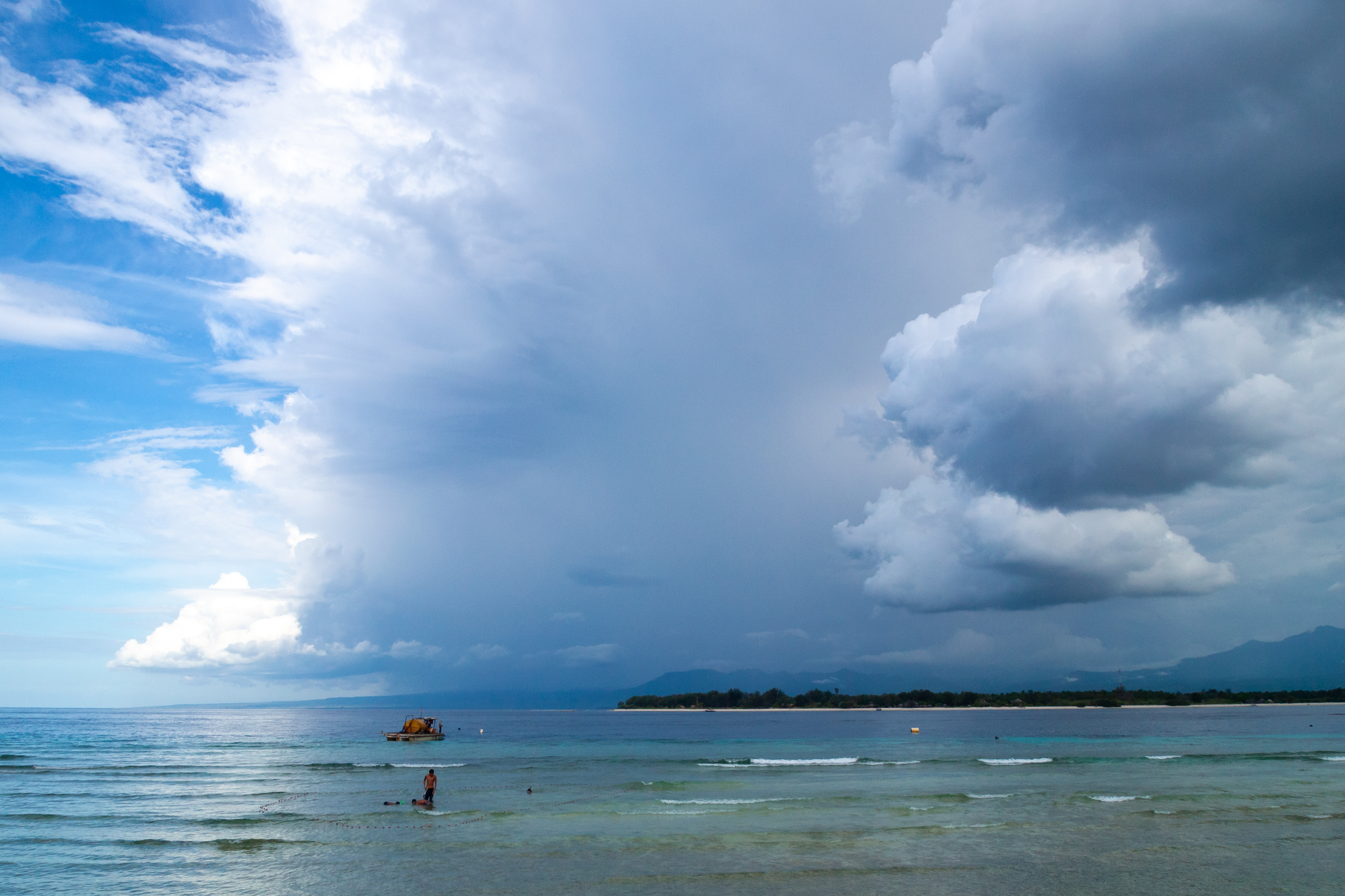
The physical oceanography of the Bali Sea is commanded by its connection to the Lombok Strait—the legendary deep-water passage separating the eastern tip of Bali from the western coast of Lombok. Measuring thirty-five kilometers across at its narrowest point with an undulating submarine sill depth of approximately two hundred and fifty meters, the Lombok Strait functions as the premier western corridor for the Indonesian Throughflow (ITF). Driven by the global sea-level gradient between the Pacific and Indian oceans, a titanic river of warm, relatively low-salinity tropical water surges southward through the strait at an average transport volume of between two and four Sverdrups (million cubic meters per second), discharging directly into the open Indian Ocean.
Because this colossal oceanic transport is forced through a narrow bathymetric bottleneck constrained by high volcanic topography on either side, the hydrodynamic forces within the strait are among the most violent and unpredictable on the globe. Powerful semidiurnal tidal currents generate hydraulic head differences of over a meter between the Bali Sea and the Indian Ocean, accelerating surface current velocities to blistering speeds of six to eight knots. These ferocious tidal races generate towering standing waves, turbulent rip tides, and hazardous surface whirlpools that have tested the nerve of traditional Bugis prahu mariners and modern cargo captains alike.
Beneath the turbulent surface, the passage of these powerful tidal currents over the shallow submarine sills of the strait triggers colossal internal solitary waves. Reaching amplitudes of more than one hundred meters, these hidden underwater wave trains propagate southward into the Indian Ocean and northward into the deep Bali Basin. As they break against steep submarine bathymetry, they generate intense vertical mixing that uplifts cold, nutrient-rich sub-thermocline water from the depths, lowering coastal sea surface temperatures by several degrees and fueling spectacular localized primary productivity.
The strategic depth and swift currents of the Lombok Strait have also shaped naval warfare. During World War II, in February 1942, the strait became the battleground for the Battle of Badung Strait, where an American and Dutch naval squadron clashed with a Japanese invasion convoy escorting troops to southern Bali. Later in the war, American submarines utilized the deep bathymetric trench of the strait to slip into the Java and Flores seas unnoticed beneath thermal layer boundaries that disrupted Japanese sonar detection. Modern nuclear-powered attack submarines continue to utilize the deep waters of the Lombok Strait as an essential submerged passage between the Pacific and Indian oceans.
Oceanic Sunfish Nurseries and Coral Triangle Biodiversity
Situated at the southwestern apex of the Coral Triangle—the global epicenter of marine biodiversity—the Bali Sea supports an extraordinarily rich and ecologically unique biological community. The combination of intense tropical sunlight, mineral enrichment from surrounding volcanic ash, and localized upwelling driven by the Indonesian Throughflow creates conditions where coral reefs, pelagic predators, and deep-sea organisms flourish in close proximity. The shallow fringe reefs of the Kangean Islands, northern Bali, and the Gili Islands support more than five hundred species of scleractinian reef-building corals, interspersed with luxuriant gardens of sea fans, gorgonians, and giant barrel sponges.
The most celebrated biological spectacle in the Bali Sea is the seasonal aggregation of the oceanic sunfish (Mola mola and Mola alexandrini). Beginning in July and extending through October, the onset of the southeast monsoon drives intense upwelling along the southern and eastern margins of the sea, causing surface water temperatures to drop from twenty-eight degrees Celsius to less than twenty degrees. In response to this cold-water pulse, giant adult sunfish—the heaviest bony fish on Earth, reaching lengths of over three meters and weighing up to two metric tons—ascend from their normal deep-water feeding depths between two hundred and six hundred meters up into the sunlit shallows around the rocky promontories of Nusa Penida and Candidasa. Here, the gentle giants hover motionlessly in the current, attended by schools of bannerfish (Heniochus diphreutes) and emperor angelfish that pick parasitic copepods from their rough, leathery skin.
Sharing these nutrient-rich coastal currents are resident populations of reef manta rays (Mobula alfredi) and oceanic manta rays (Mobula birostris), which congregate at coastal cleaning stations along rocky pinnacles to filter feed on dense swarms of sergestid shrimp and larval fish. In the deeper waters of the Bali Basin, deep-diving sperm whales and pods of short-finned pilot whales hunt large oceanic squid along the shelf break, while five of the world’s seven species of marine turtles—including green, hawksbill, and olive ridley sea turtles—nest on remote sandy beaches along the northern coastline. In shallow coastal bays like Pemuteran and Menjangan Island, coral reef restoration projects employing Biorock electrolytic mineral accretion technology have restored damaged reef tracts, stimulating rapid calcification among branching acropora corals and providing critical habitat for miniature masters of camouflage like Bargibant’s pygmy seahorse (Hippocampus bargibanti) and flamboyant cuttlefish.
Alfred Russel Wallace and the Biogeographical Divide
The waters of the Bali Sea hold an immortal place in the history of evolutionary biology as the geographic cradle where the concept of island biogeography was born. In June 1856, British naturalist Alfred Russel Wallace sailed across the narrow Lombok Strait from Bali to Lombok aboard a native prahu. Wallace was astonished by what he discovered on the opposite shore. Although the islands of Bali and Lombok are separated by barely thirty-five kilometers of water and share identical tropical climates and volcanic soil regimes, their animal populations were completely, radically different.
On Bali, Wallace observed animals that were distinctly Asian: woodpeckers, barbets, weavers, wild cattle (banteng), and monkeys. Yet on Lombok, just across the strait, these Asian species vanished entirely. In their place, Wallace encountered birds and mammals belonging to the Australasian faunal realm: noisy cockatoos, mound-building megapodes, honeyeaters, and Australian friarbirds, alongside marsupials like the cuscuses. In an 1859 paper presented to the Linnean Society of London, Wallace outlined the foundational concept of what would later be formally designated by Thomas Henry Huxley as the ‘Wallace Line’—the invisible biogeographical boundary running through the Lombok Strait and north across the Makassar Strait. Working alongside his loyal Malay field assistant Ali, Wallace collected thousands of insect and bird specimens across the region, culminating in his 1869 masterpiece The Malay Archipelago, which provided independent confirmation of Charles Darwin’s theory of evolution by natural selection.
The explanation for this dramatic ecological divide lies in the deep bathymetric architecture of the Bali Sea. During the Pleistocene ice ages, when lowered global sea levels drained the shallow Sunda Shelf, Bali, Java, Sumatra, and Borneo were united to the Asian mainland as a continuous terrestrial continent, allowing Asian mammals to walk across dry land to Bali. However, the deep oceanic abyss of the Lombok Strait and the Bali Basin never dried up, remaining a permanent deep-water marine barrier that prevented Asian terrestrial animals from colonizing Lombok, and isolating the ancient evolutionary trajectories of two great continental realms for millions of years.
Segara Cosmology and Contemporary Marine Stewardship
For the coastal communities of Bali, Lombok, and the surrounding islands, the Bali Sea is far more than a physical body of water; it is a sacred spiritual realm and the foundation of everyday cultural life. In Balinese Hindu cosmology, the universe is divided into the sacred mountain peaks (Kaja) where the gods reside, and the mysterious, untamed ocean (Kelod), known as Segara. The ocean is revered as the domain of Bhatara Baruna, the god of the sea, serving both as the source of life and the ultimate purifier of the material world. Coastal villages maintain solemn sea temples (Pura Segara) perched on rocky cliffs overlooking the waves, where priests make offerings of flowers, rice, and incense to appease the sea spirits before fishermen launch their outrigger jukung boats into the dawn surf.
The ultimate spiritual connection between the Balinese people and the Bali Sea occurs during the sacred mortuary rite of Ngaben. Following the ceremonial cremation of the deceased on land, the purified ashes and bone fragments are escorted to the seashore in solemn processions accompanied by gamelan music. The ashes are reverently cast into the waves of the Bali Sea, returning the earthly elements back into the cosmic ocean so the soul may be liberated from the cycle of reincarnation. Prior to the annual Day of Silence (Nyepi), coastal villages enact the sacred Melasti purification rite, carrying sacred temple effigies and heirlooms to the ocean shoreline to be cleansed in the purifying seawater of Segara. Along black sand beaches from Kusamba to Amed, artisanal salt-makers harvest seawater from the Bali Sea, splashing it over raked volcanic sands to evaporate under the tropical sun, harvesting mineral-rich sea salt prized by international culinary traditions for its delicate floral crystals.
In the twenty-first century, the Bali Sea faces escalating pressures from rapid coastal resort development, plastic pollution, and intensive scuba diving tourism. The world-famous shipwreck of the USAT Liberty in Tulamben—a United States Army transport ship torpedoed by a Japanese submarine in 1942 that was pushed into the shallows by Mount Agung’s 1963 lava flows—attracts hundreds of thousands of international divers each year. To safeguard these fragile marine treasures, local communities have revived traditional customary marine tenure systems known as Awig-Awig, which establish local marine protected areas, outlaw destructive blast fishing, and regulate dive boat traffic. Traditional Balinese fishing cooperatives (sekehe jukung) work in coordination with the marine police to patrol coastal reefs against illegal cyanide fishing. In partnership with the Coral Triangle Center and international marine scientists, coastal communities continue to plant coral restoration nurseries, deploy acoustic listening stations for cetacean monitoring, and track sunfish populations, ensuring that the sacred living waters of the Bali Sea remain protected for generations to come.
Frequently Asked Questions
Where is the Bali Sea located and what are its boundaries?
The Bali Sea is a compact tropical marginal sea located in the southern Indonesian archipelago. It is bounded to the south by the volcanic north coasts of the islands of Bali and Lombok; to the west by the eastern tip of Java and the shallow Madura Strait; to the north by the Kangean Islands; and to the east by the open, deep waters of the Flores Sea. Its surface area covers roughly forty-five thousand square kilometers.
What is the Wallace Line and how does it relate to the Bali Sea?
The Wallace Line is a biological boundary line proposed by British naturalist Alfred Russel Wallace in 1859 that runs through the Lombok Strait between Bali and Lombok on the southern threshold of the Bali Sea. Even though Bali and Lombok are separated by only thirty-five kilometers of water, the deep oceanic trench between them prevented land bridges from forming during Ice Age sea-level drops. Consequently, animal species to the west (Bali, Java, Borneo) are strictly Asian (elephants, tigers, monkeys), while species to the east (Lombok, Flores, Australasia) belong to the Australasian faunal realm (marsupials, cockatoos, komodo dragons).
How deep is the Bali Sea?
The bathymetry of the Bali Sea transitions rapidly from the shallow continental Sunda Shelf in the west, where water depths rarely exceed fifty meters, into the deep tectonic depression of the Bali Basin in the central and eastern sectors, reaching maximum depths of one thousand five hundred and ninety meters (five thousand two hundred and seventeen feet).
Why are the tidal currents in the Lombok Strait so violent?
The Lombok Strait acts as one of the primary deep-water conduits for the Indonesian Throughflow (ITF), conveying millions of cubic meters of water per second from the Pacific Ocean to the Indian Ocean. Because the narrow strait constricts between high volcanic islands and plunges to depths over a thousand meters, semidiurnal tides create immense hydraulic heads, generating violent surface currents exceeding six to eight knots, turbulent standing waves, and colossal underwater internal waves.




Share what you know
Been there, grew up there, or know something we missed? Add a comment; corrections with a source are especially welcome.