
The Vast Submarine Shelf: Boundaries and Morphology
Enclosed between the New Siberian Islands in the west and Wrangel Island in the east, the East Siberian Sea represents the most isolated, climatically severe, and least disturbed marine realm on planet Earth. Spanning nine hundred eighty-seven thousand square kilometers of sub-polar water, this marginal sea of the Arctic Ocean rests entirely upon the colossal Eurasian continental shelf. Unlike deep oceanic basins with dramatic undersea trenches, the East Siberian Sea is a gigantic, drowned continental plain where water depths rarely exceed a few dozen meters. Across an area larger than France and Germany combined, the average water depth is a modest fifty-four meters, making it one of the flattest submarine landscapes on the globe.
The southern shoreline of the basin traces the rugged, wild coasts of the Republic of Sakha (Yakutia) and the Chukotka Autonomous Okrug. Here, low permafrost tundra gives way to gravel spits, broad river deltas, and rocky headlands that drop into shallow, ice-strewn bays such as Chaun Bay and Kolyma Gulf. For hundreds of kilometers out from the mainland, the sea floor slopes with barely perceptible gradations, maintaining depths of ten to twenty-five meters over vast aquatic pastures of soft clay and muddy sand. In many places, a ship can sail beyond the sight of land while remaining in water so shallow that its keel comes within meters of the seabed.
At its northern boundary, approximately five hundred kilometers from the Siberian coast, this shallow platform finally approaches the continental margin. Here, along the border with the Arctic Ocean basin, the seabed drops beyond the shelf break into abyssal depths. Yet even at its deepest northern extreme, the maximum recorded sounding in the East Siberian Sea reaches only one hundred fifty-five meters before transitioning into the High Arctic. This structural shallowness leaves the water column vulnerable to freezing from surface to seafloor, creating an aquatic environment dominated by the grinding mechanics of bottom-gouging sea ice. The seafloor is also incised by ancient drowned river channels that formed during periods of lower sea levels, including the submerged paleochannels of the Kolyma and Indigirka rivers. These underwater trenches, though only ten to twenty meters deeper than the surrounding shelf, act as natural sediment funnels and conduits for dense, cold bottom water masses that slowly circulate beneath the winter pack ice. In the open waters of the central shelf, persistent polar fog blankets the sea throughout the summer, created when warm continental air masses from the Siberian interior cool over the melting ice pack. This dense fog severely limits visibility, requiring modern vessels to rely entirely on satellite radar systems.
Fluvial Systems: The Kolyma and Indigirka Inflows
Despite its frozen reputation, the East Siberian Sea receives substantial freshwater pulses from the continental interior of northeast Asia. Two great Siberian rivers dominate its hydrological input: the Indigirka River in the west and the Kolyma River in the east. Together with smaller watercourses like the Alazeya and Rauchua, these rivers drain an immense expanse of mountain taiga, gold-bearing highlands, and permafrost wetlands, delivering approximately two hundred fifty cubic kilometers of freshwater into the sea each year.
The Kolyma is the undisputed colossus of this eastern drainage. Flowing for more than twenty-one hundred kilometers from the Chersky and Kolyma mountain ranges, it empties into Kolyma Gulf through an expansive delta spanning three thousand square kilometers across three main distributary channels. During the spring freshet in June, when ice dams break along the river’s upper reaches, the Kolyma discharges a roaring torrent of dark, tea-colored water rich in dissolved humic substances, permafrost carbon, and mineral sediments. This freshwater plume spreads tens of kilometers into the sea, forming a buoyant, low-salinity surface layer that floats atop the freezing marine waters beneath.
The Indigirka River, cutting through some of the coldest permanently inhabited valleys on Earth near Oymyakon, terminates in a low, marshy delta in the western sector of the sea. Its waters carry high concentrations of terrestrial nutrients and silica, feeding seasonal diatom blooms along the delta margins. However, because the ice-free season in the East Siberian Sea lasts for barely two months, these river nutrients have little time to circulate before winter freeze-up descends, causing massive quantities of organic carbon to settle undisturbed onto the cold seafloor muds. The Alazeya River, winding through the vast Kolyma Lowland between the Indigirka and Kolyma basins, drains thousands of shallow thermokarst lakes and peat bogs. Its waters are exceptionally rich in dissolved organic matter and iron, imparting a distinct amber tint to coastal waters and providing essential micronutrients that nourish benthic microalgae during the brief periods when solar radiation penetrates the retreating sea ice. The benthic invertebrate communities of the East Siberian Sea are characterized by extraordinary biomass densities of cold-water bivalves, brittle stars (Ophiura sarsii), and giant isopod crustaceans (Saduria entomon) that process organic carbon exported by the river plumes.
Subsea Permafrost and the Methane Cryosphere
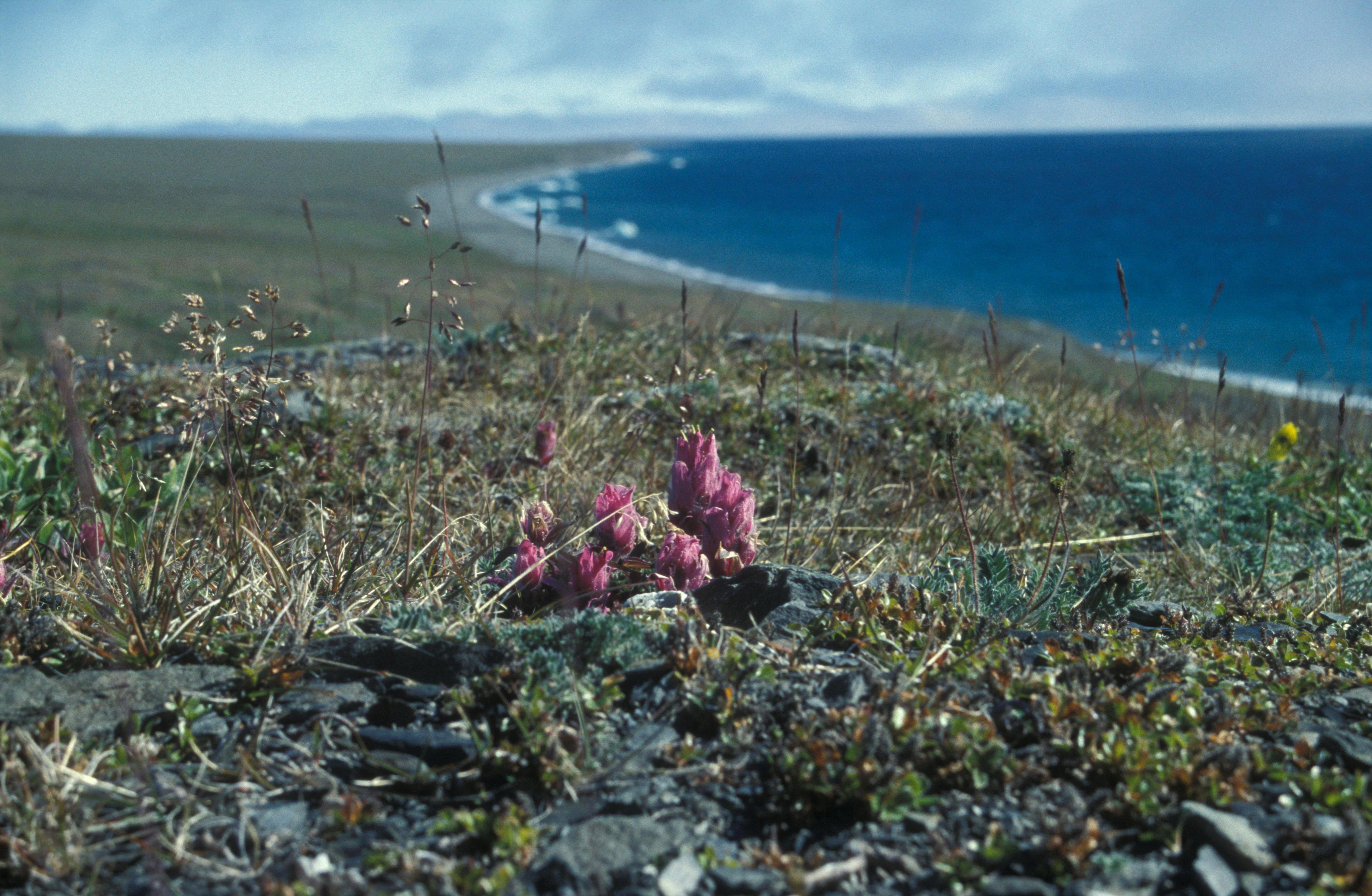
Beneath the shallow waters of the East Siberian Sea lies an extraordinary geological phenomenon that has attracted intense global scientific scrutiny: the East Siberian Arctic Shelf subsea permafrost. During the Pleistocene glaciations, when vast quantities of Earth’s water were locked in continental ice sheets and sea levels dropped by more than one hundred meters, this vast continental shelf was entirely exposed as dry land. For tens of thousands of years, this unglaciated terrestrial plain—the mammoth steppe of Beringia—was subjected to extreme polar winters, freezing the soil down to depths of several hundred meters into solid, ice-cemented permafrost.
When the global climate warmed at the onset of the Holocene roughly eleven thousand years ago, rising post-glacial seas inundated the plain, submerging the frozen landscape beneath ocean water. However, because bottom water temperatures in the Arctic remain close to the freezing point, much of this ancient permafrost has survived beneath the seafloor, acting as an impermeable frozen cap that seals immense reservoirs of ancient organic matter and methane gas hydrates trapped in deep sedimentary strata.
In recent years, marine biogeochemists have discovered that this subsea permafrost barrier is beginning to degrade and perforate. Centuries of contact with relatively warm seawater, combined with modern ocean warming, have caused subsea permafrost to thaw from above. As the frozen cap thins and fractures, massive plumes of methane gas—a potent greenhouse gas—are venting from the seabed, rising through the shallow water column in bubbling seeps to escape into the Arctic atmosphere. Scientific research expeditions have documented thousands of flare-like methane seeps across the shelf, making the East Siberian Sea a critical frontline in global climate change research. In addition to methane venting, the thawing of subsea permafrost alters the mechanical stability of the continental shelf, creating localized seafloor collapse features and pockmarks measuring hundreds of meters across. These submarine craters, documented by multi-beam sonar surveys, indicate that subsea permafrost degradation is a dynamic and accelerating geological process that influences benthic sediment transport and marine carbon budgets across the entire Arctic. Coastal erosion along the East Siberian Sea is accelerating rapidly due to the loss of protective sea ice and the warming of nearshore waters, causing permafrost bluffs to retreat by up to ten meters annually, carving dramatic thermal collapse features into the barren tundra landscape. In the western sector near the New Siberian Islands, Sannikov Strait provides an essential navigation corridor linking the Laptev and East Siberian seas. Dredged to maintain safe transit depths, this rocky passage requires constant hydrographic monitoring to prevent ice-class freighters from running aground on submerged shoals.
Wrangel Island Sanctuary and Polar Wildlife
At the eastern threshold of the East Siberian Sea, rising like a mountainous fortress from the freezing waters, sits Wrangel Island. Designated as a UNESCO World Heritage site and a state nature reserve, Wrangel Island and its neighbor Herald Island preserve one of the most astonishing biological refuges in the polar world. Because Wrangel Island was not glaciated during the last ice age, it served as a prehistoric ecological sanctuary, famously harboring the last surviving population of woolly mammoths on Earth, which persisted as a dwarfed relict population until roughly four thousand years ago—long after the Egyptian pyramids were constructed.
Today, Wrangel Island is celebrated as the undisputed polar bear maternity ward of the planet. Each autumn, hundreds of pregnant female polar bears (Ursus maritimus) travel across the drifting pack ice of the East Siberian and Chukchi seas to reach the island’s mountainous valleys, excavating maternity dens in deep snowdrifts along the slopes. In some years, scientists have documented more than four hundred active maternity dens on the island, representing the highest concentration of breeding polar bears on Earth.
The surrounding waters of the East Siberian Sea support a specialized community of polar marine mammals. Dense herds of Pacific walruses (Odobenus rosmarus divergens) haul out on isolated gravel spits and offshore ice floes, diving into the shallow muds to forage for bivalves. Ringed seals and bearded seals maintain breathing holes through the multi-year pack ice, while pods of grey whales and bowhead whales cruise the coastal channels during the brief summer thaw, filtering benthic invertebrates and plankton from the nutrient-rich sediments.
Avian life transforms the rocky cliffs of Wrangel Island and coastal Chukotka into deafening seabird metropolises each summer. Millions of thick-billed murres, black-legged kittiwakes, pelagic cormorants, and horned puffins nest in packed rows along sheer limestone ledges, their collective hunting flights clouding the sky as they dive into the frigid surf to harvest schools of polar cod. The island of Wrangel also sustains the world’s largest breeding population of Pacific walruses, with more than one hundred thousand individuals hauling out on its isolated gravel spits in late summer when pack ice retreats beyond their continental shelf feeding grounds. These colossal haul-outs create scenes of incredible natural spectacle, with thousands of tusked pinnipeds crowded shoulder-to-shoulder on the shores, while polar bears patrol the margins to scavenge. Traditional hunting and dog sled travel along the coast of the East Siberian Sea have been practiced by Chukchi and Yupik communities for thousands of years, following the seasonal movements of ringed seals and walruses across the coastal fast ice.
Polar Pioneers, Pevek, and Northern Sea Route Realities
The maritime history of the East Siberian Sea is a saga of extreme isolation and perilous navigation. For early European and Russian explorers, this basin represented the most impenetrable bottleneck along the Northeast Passage. The persistent presence of the Ayon ice massif—a massive agglomeration of multi-year pack ice driven against the Siberian coast by prevailing Arctic currents—frequently blocked navigation even in high summer. Intrepid Cossacks led by Semyon Dezhnyov first navigated these waters in sixteen forty-eight aboard fragile wooden koches, surviving terrifying shipwrecks to round the northeastern tip of Asia.
In nineteen thirty-three, the Soviet cargo steamship Chelyuskin attempted to traverse the Northern Sea Route in a single navigation season. As it entered the eastern margins of the East Siberian Sea, it was besieged by heavy pack ice, drifting trapped for months before being crushed and sunk in February nineteen thirty-four, triggering a legendary aerial rescue of its crew from drifting ice floes that captured international attention.
To conquer this formidable barrier, the Soviet Union constructed the port of Pevek on the sheltered waters of Chaun Bay in nineteen thirty-three. Serving as the administrative and logistics capital of the Chaunsky District, Pevek grew into the northernmost city in Russia. For decades, it handled shipments of tin, gold, and uranium extracted from remote mining settlements in the interior mountains. In twenty-twenty, Pevek achieved modern technological fame as the operating base for the Akademik Lomonosov, the world’s first floating nuclear power plant, which docked in its harbor to supply heat and electricity to this isolated Arctic outpost.
Today, commercial shipping through the East Siberian Sea remains strictly seasonal and dependent on powerful icebreakers. Between late July and October, convoys of ice-class container ships, oil tankers, and bulk freighters navigate the dredged fairway of the Dmitry Laptev and Sannikov straits, participating in the modern expansion of Eurasian Arctic trade. Navigating past gleaming tabular icebergs and desolate permafrost headlands, modern seafarers honor the enduring severity of this ancient, frozen sea. Along the coast of Chaun Bay, the abandoned mining settlements of the Soviet era—such as Valkumey and Komsomolsky—stand as frozen ghost towns along the tundra margins, preserved by the sub-zero Arctic cold. In contrast, modern Pevek is experiencing a technological resurgence, with high-speed fiber-optic connectivity and automated meteorological radar systems transforming it into an advanced polar operational node along the eastern corridor of the Northern Sea Route. The unique biogeochemistry of the East Siberian shelf is heavily influenced by the high dissolved organic carbon export from thawing permafrost, which alters the optical properties of the surface waters and affects light penetration for under-ice microalgal communities. Marine microbiological surveys in the East Siberian Sea have revealed active communities of psychrophilic bacteria and methanotrophic archaea capable of consuming dissolved methane within the water column, mitigating atmospheric release before the gas breaches the ocean surface. Remote sensing satellites continuously track the thickness of the landfast ice edge, providing essential navigational ice charts for nuclear icebreakers escorting cargo convoys between the Pacific and Atlantic oceans. These advanced navigational charts ensure that modern mariners can transit the forbidding Arctic shelf with unprecedented safety and efficiency.
Frequently Asked Questions
Where is the East Siberian Sea located?
The East Siberian Sea is an extensive marginal sea of the Arctic Ocean located off the coast of northeastern Siberia. It is bounded to the west by the New Siberian Islands (which separate it from the Laptev Sea), to the east by Wrangel Island and Cape Billings (which separate it from the Chukchi Sea), to the south by the Siberian mainland (Yakutia and Chukotka), and to the north by the Arctic Ocean basin.
How deep is the East Siberian Sea?
The East Siberian Sea is exceptionally shallow throughout almost its entire extent. Its average depth is approximately fifty-four meters, and across vast southern and central areas, water depths rarely exceed twenty to thirty meters. Its deepest point reaches only one hundred fifty-five meters in the far northern sector along the edge of the continental slope.
What rivers flow into the East Siberian Sea?
The primary rivers discharging into the East Siberian Sea are the Kolyma River and the Indigirka River, alongside smaller waterways such as the Alazeya and Chaun. The Kolyma terminates in a sprawling, multi-channel delta in the eastern sector, while the Indigirka flows into the western shallows, contributing more than two hundred fifty cubic kilometers of freshwater and sediments annually.
Why is the East Siberian Sea so difficult to navigate?
Navigation in the East Siberian Sea is among the most treacherous on Earth because heavy multi-year pack ice frequently fails to melt even during the height of summer. Relentless polar winds drive dense ice floes and grounded pressure ridges against the shallow coastline, trapping vessels in narrow channels. Commercial navigation is restricted to a brief window from July to September and requires escort by heavy icebreakers.




Share what you know
Been there, grew up there, or know something we missed? Add a comment; corrections with a source are especially welcome.