TERRITORY PORTRAIT · THE WORLD ATLAS

Saint Helena

Find its place in the atlas, explore connected regions and follow the stories as they grow.

Find on the world map

Photo: ---=XEON=--- / Wikimedia Commons (resized) Image licenceCC BY 3.0Photograph by ---=XEON=--- / Wikimedia Commons (resized). Display crop may differ from the original.

AT A GLANCE

Saint Helena in facts

  • CapitalJamestown
  • Population5,6332016
  • Area394 km²slightly more than twice the size of Washington, D.C
  • CurrencyPound sterlingalso Saint Helena pound
Map: Natural Earth (public domain) · Open in the world map
All geographic & statistical details (28)
Density
14 people per km²
Official name
Saint Helena, Ascension, and Tristan da Cunha
Government
parliamentary democracy
World region
Africa · Sub-Saharan Africa · Western Africa
Official language
English
Founded
1833
Time zone
UTC+00:00
Calling code
+290, +247
+ 1 moreShow less+27
Drives on the
left
Land borders
None
Coastline
60 km
Natural resources
fish, lobster
Topographic elevation profile
Queen Mary's Peak 2,062 m
0 mAtlantic Ocean▲ 2,062 mSummit
Median age
45.5 years (2025 est.)
Climate
Saint Helena: tropical marine; mild, tempered by trade winds | | Ascension Island: tropical marine; mild, semi-arid | | Tristan da Cunha: temperate marine; mild, tempered by trade winds (tends to be cooler than Saint Helena)
Terrain
The islands of this group are of volcanic origin associated with the Atlantic Mid-Ocean Ridge | | Saint Helena: rugged, volcanic; small scattered plateaus and plains | | Ascension: surface covered by lava flows and cinder cones of 44 dormant volcanoes; terrain rises to the east | | Tristan da Cunha: sheer cliffs line the coastline of the nearly circular island; the flanks of the central volcanic peak are deeply dissected; narrow coastal plain lies between The Peak and the coastal cliffs
Land use
Agri 30.8%Forest 5.1%Other 64.1%
Administrative subdivisions
3 first-order regions
Urban population
Urban 40.7%Rural 59.3%(2023)
Major urban areas
Jamestown (capital) (000)
Ethnic groups
St. Helena 82.1%, UK 7.6%, South Africa 3.6%, Ascension 2.8%, other 3.9% (2021 est.)
Railways & airports
2 airports
Religions
Anglican 63.2%, unspecified 11.4%, no religion 9%, Jehovah's Witness 3.8%, Baptist 2.3%, Salvation Army 2%, Roman Catholic 2.2%, Seventh Day Adventist 1.9%, New Apostolic 1.6%, other Christian 1.4%, other 1.1% (2021 est.)
Emergency numbers
999
ISO & UN codes
SH · SHN · M49 654
Capital location
15.9°S, 5.7°W
Name origin
On the feast day of Saint Helena in 1502, Spanish navigator Joao da Nova (sailing for Portugal) sighted and named the island that now bears the saint's name; da Nova originally named Ascension "Conception Island" in honor of the Virgin Mary, but Portuguese navigator Afonso de Albuquerque later found the island on the feast day of the Ascension in 1508 and renamed it; Portuguese explorer Tristao da Cunha sighted the third island in 1506 and named it after himself (the name was later anglicized)
Names in other languages
Sant'Elena, Ascensione e Tristan da Cunha, سانت هيلانة وأسينشين وتريستان دا كونا, সেন্ট হেলেনা, অ্যাসেনশন ও ত্রিস্তান দা কুনহা, St. Helena, Ascension und Tristan da Cunha, Santa Elena, Ascensión y Tristán de Acuña, سنت هلنا، اسنشن و تریستان دا کونا
+ 21 moreShow lessSainte-Hélène, Ascension et Tristan da Cunha, સેન્ટ હેલેના, એસેન્શન એન્ડ ત્રિસ્તાન દા કુન્હા, सेंट हेलेना, असेंशन और त्रिस्तान दा कुन्हा, Saint Helena, Ascension dan Tristan da Cunha, セントヘレナ・アセンションおよびトリスタンダクーニャ, ಸೇಂಟ್ ಹೆಲೆನಾ, ಅಸೆನ್ಶನ್ ಮತ್ತು ಟ್ರಿಸ್ಟಾನ್ ಡಾ ಕುನ್ಹಾ, 세인트헬레나 어센션 트리스탄다쿠냐, സൈന്റ് ഹെലെന, അസൻഷൻ, ട്രിസ്റ്റൻ ഡാ കൂഞ്ഞ, सेंट हेलेना, असेन्शन अँड त्रिस्तान दा कुन्हा, Sint-Helena, Ascension en Tristan da Cunha, Wyspa Świętej Heleny, Wyspa Wniebowstąpienia i Tristan da Cunha, Santa Helena, Ascensão e Tristão da Cunha, Острова Святой Елены, Вознесения и Тристан-да-Кунья, செயிண்ட் எலனா, సెయింట్ హెలెనా, అసెన్షన్ మరియు ట్రైస్టాన్ దా కున్హా, เซนต์เฮเลนา อัสเซนชัน และตริสตันดากูนยา, Saint Helena, Ascension ve Tristan da Cunha, Острови Святої Єлени, Вознесіння і Тристан-да-Кунья, سینٹ ہلینا، اسینشن و ترسٹان دا کونیا, Saint Helena, Ascension và Tristan da Cunha, 圣赫勒拿、阿森松和特里斯坦-达库尼亚

Facts: Wikidata Q192184 and the CIA World Factbook (public domain: geography, demographics, borders, coastline and symbols), retrieved 1 November 2026. Figures can change; check the source for the latest.

FLAG & SYMBOLS

The flag and symbols of Saint Helena

The flag

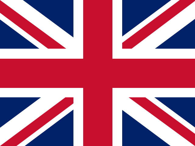
Blue with the UK flag in the upper-left quadrant and the Saint Helenian shield centered on the right half of the flag; the upper third of the shield depicts a white plover on a yellow field; under the bird is a rocky coastline and a three-masted sailing ship with sails furled and flying an English flag.

National animals and emblems
Saint Helena PloverWire Bird
Motto
“Loyal and Unshakeable”
National anthem

"God Save the King"
unknown

National day

Official birthday of King Charles III, celebrated in April or June as designated by the governor (1948)

Independence

none (overseas territory of the UK)

Flag description and meaning, colours, symbols, anthem details, national day and independence: CIA World Factbook (public domain). Coat of arms, motto and recording: Wikidata and Wikimedia Commons (credited above). Flag artwork: flag-icons (MIT), retrieved 1 November 2026.

There is more to explore.Discover the regions of Saint HelenaExplore regions
ON THE ATLAS · CHRONICLE IN PREPARATION

Discover Saint Helena

This is a sourced directory entry. A researched regional chronicle and verified location photography are in preparation.

UK-listed overseas territory

UK overseas listing: United Kingdom. Status & relationship source ↗

Association follows the cited UK listing; it does not resolve sovereignty disputes.

A CLOSER LOOK

Explore the regions

3 entries

Explore the first-order regions in this GeoNames snapshot. Local names and levels vary.

  • Photo: Drew Avery / Wikimedia Commons (resized) Image licenceCC BY 2.0Photograph by Drew Avery / Wikimedia Commons (resized). Display crop may differ from the original. · Flag: flag-icons
    Saint Helena · Western AfricaRegion
    • CapitalGeorgetown
    • CountrySaint Helena
    Explore this place
  • Illustration: The Landlore · AI-generated, imagined landscape (not this place).
    Saint Helena · Western AfricaRegion
    • CapitalJamestown
    • CountrySaint Helena
    Explore this place
  • Photo: The Official CTBTO Photostream / Wikimedia Commons Image licenceCC BY 2.0Photograph by The Official CTBTO Photostream / Wikimedia Commons. Display crop may differ from the original. · Flag: flag-icons
    Saint Helena · Western AfricaRegion
    • CapitalEdinburgh of the Seven Seas
    • CountrySaint Helena
    Explore this place
  • Illustration: The Landlore · An independent cultural & geographic atlas.
    OUR MISSIONTHE WORLD IN STORIES

    We are building an open, source-backed atlas of every country, region, ocean and culture — combining verified geographic data with long-form cultural storytelling.

    About The Landlore

Names and immediate parent assignments: GeoNames, CC BY 4.0, 28 October 2026. Unspecified code 00 excluded. This is not an exhaustive list of districts, counties or municipalities. Photographs are credited individually beneath each image; one pictured place does not represent every landscape in its region.

FROM THE JOURNAL

Stories from Saint Helena

Our editorial journey here is still ahead. No researched stories have been published for this place yet.

Explore published stories →
HELP US GET IT RIGHT

Suggest a correction

Spotted a factual issue, a wrong location or a missing image credit? Tell us what needs checking.

Send a correction

Saved privately for editorial review. Please do not include personal information. Reports do not change the article automatically.

CONVERSATION

Share what you know

Been there, grew up there, or know something we missed? Add a comment; corrections with a source are especially welcome.

Leave a comment

Your email address is never published. Comments are read before they appear. See our Privacy Policy.

Directory: UN M49 countries or areas, with 193 UN members, 2 observers and 53 other areas. Subdivisions: GeoNames, CC BY 4.0; filtered to this catalogue. Flags/symbols: flag-icons (MIT). Snapshot: 28 October 2026. Geographic groups are statistical. Associated-country links describe the cited relationship and do not settle sovereignty claims.

KEEP EXPLORING

Similar articles

Cultural journeys, craft traditions, and heritage chronicles from around the world.

All stories →
FOLLOW YOUR CURIOSITYA big world. A thousand ways to see it.

We’re here for the places, people and little details that make it extraordinary.

