
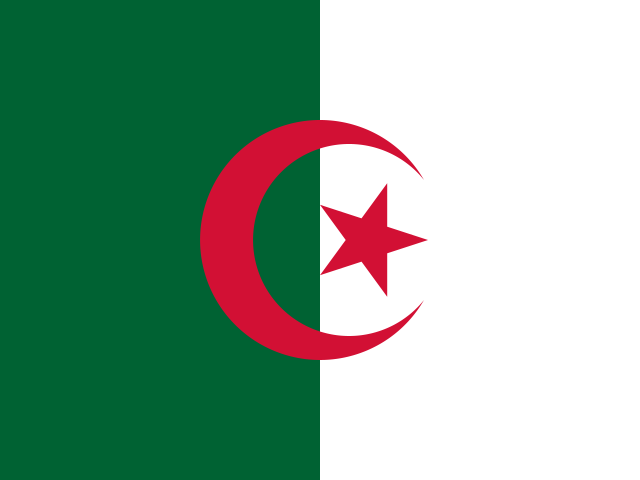


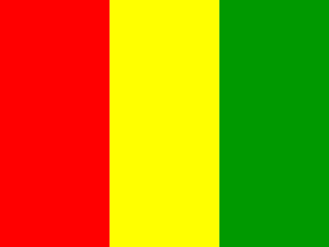


Encompassing one million two hundred and forty thousand one hundred and ninety-two square kilometers across the interior of West Africa, the Republic of Mali (République du Mali) is a landlocked nation defined by the dramatic ecological gradient of the Sahel. Bordered by Algeria to the north and northeast, Niger to the east, Burkina Faso and Côte d’Ivoire to the south, Guinea to the southwest, and Senegal and Mauritania to the west, Mali transitions from the hyper-arid gravel plains and drifting sand seas of the Sahara in the north through the acacia savannahs of the Sahel to the well-watered Sudanian savannah woodlands of the south.
Through this vast arid landscape flows the lifeblood of the nation: the Niger River (known in the Manding languages as the Joliba, meaning “Great River”). Entering southwestern Mali from the Fouta Djallon highlands of Guinea, the river flows northeast toward the desert before making a monumental, sweeping bend at Bourem and flowing southeast toward Niger and Nigeria. In central Mali, between Ségou and Timbuktu, the river spills across a flat geological basin to create the Inner Niger Delta (Macina)—a colossal inland freshwater wetland covering thirty thousand square kilometers during seasonal floods. For millennia, this aquatic highway and its annual silt deposits supported the rise of West Africa’s greatest medieval empires: Ghana, Mali, and Songhai.

The Earthen Citadel: The Great Mosque of Djenné
In the southern reaches of the Inner Niger Delta, situated on an island formed by the Bani River, lies Djenné, one of the oldest continuously inhabited urban centers in sub-Saharan Africa. Archaeological excavations at nearby Djenné-Djenno demonstrate that an indigenous, unstratified iron-working and trading metropolis flourished here as early as 250 BC, long before Arab-Islamic trade contact across the Sahara. Djenné developed as the twin commercial capital to Timbuktu: while Timbuktu received camel caravans carrying rock salt and European goods across the Sahara from North Africa, Djenné controlled the riverine traffic of gold dust, kola nuts, dried fish, and African rice (Oryza glaberrima) moving up from the southern tropical forests.
The architectural crown of this ancient trading city is the Great Mosque of Djenné, recognized as the supreme masterpiece of Sudano-Sahelian monumental earthen architecture. Originally constructed around 1280 by King Koi Konboro following his conversion to Islam, the present monumental structure was reconstructed between 1906 and 1907 by the master guild of Djenné masons (the barey ton) on the historic site. Erected upon a massive three-meter-high raised clay plinth to protect against seasonal river inundations, the mosque is constructed entirely from sun-dried clay mudbricks (ferey), sand, and organic binders bound with a mortar of river mud and rice husks.
Its monumental eastern facade features three towering minarets rising sixteen meters above the roofline, supported by eighteen engaged buttresses terminating in sculpted conical pinnacles crowned with ostrich eggs—symbols of fertility, purity, and spiritual renewal in Sahelian tradition. Protruding horizontally from the smooth, hand-sculpted earthen walls are hundreds of bundles of dense rhun palm timber (toron). These beams serve not merely as structural reinforcement to distribute compressive tension, but as permanent integrated scaffolding for the most spectacular communal ritual in West Africa: the annual festival of the Crépissage (plastering).
Every spring, before the onset of the torrential monsoon rains that would wash away the dry adobe plaster, the entire population of Djenné gathers at dawn. Divided by neighborhood guilds, boys mix fresh mud and rice husks in vast outdoor pits by trampling it with their feet, young men scramble up the palm toron beams like acrobats to smear fresh mud across the high towers, while elders, women, and girls carry buckets of water from the river to replenish the mixing troughs. Accompanied by beating drums and flute players, the entire mosque is replastered by hand in a single day, reaffirming community solidarity, architectural stewardship, and religious devotion.

The Cliffs of Bandiagara and Dogon Cosmology
East of Djenné, rising sheer above the arid Seno-Gondo plain, stands the geological marvel of the Bandiagara Escarpment. Stretching for one hundred and fifty kilometers from southwest to northeast and ascending up to five hundred meters in vertical sandstone walls, this rugged cliff barrier is the sanctuary of the Dogon people. Inscribed on the UNESCO World Heritage list in 1989 for its combined natural and cultural significance, the “Land of the Dogons” contains nearly three hundred traditional villages clinging precariously to the rock ledges, scree slopes, and plateau rims.
The Dogon migrated to these impregnable sandstone cliffs in the fifteenth century to escape forced Islamic conversion and cavalry raiding by expanding Sahelian empires. High on the vertical cliff faces, inaccessible without ropes, are the tiny mudbrick dwellings of the ancient Tellem people, a pygmy population who inhabited the rock cavities before the Dogon and whose granaries were repurposed as collective burial vaults where Dogon dead are hauled up cliff faces wrapped in handwoven checked funerary cloths (tawadji).
Dogon social architecture reflects an intimate alignment between human settlement and spiritual cosmology. Villages feature two distinct communal architectural structures. The Togu Na (“House of Words”) is an open-sided men’s assembly pavilion constructed with heavy carved wooden pillars supporting a colossal, two-meter-thick thatched roof of millet stalks. The roof is intentionally built scarcely one meter high, compelling men to sit down during village debates; should an argument grow heated, a man rising in anger bumps his head, a practical physical restraint that prevents physical violence and restores reasoned dialogue. Nearby stand the circular menstrual houses (punulu), where women gather during their cycles outside the village center, recognized as a sacred female space connected to the fertility of the earth.
At the center of Dogon religious life is the complex masked dance ceremony known as the Dama, a collective funeral rite celebrated to usher the souls of deceased elders peacefully into the realm of the ancestors. Master carvers fashion towering wooden masks, notably the Kanaga mask, whose double-barred cross represents the creator god Amma establishing equilibrium between heaven and earth, and the monumental Sirige mask, carved from a single tall tree trunk extending up to four meters in height, balanced with extraordinary athleticism by dancers who sweep its tip across the earth in broad, sweeping arcs.

Mansa Musa and the Golden Legend of Timbuktu
In the thirteenth century, following the unification of the Mandinka clans under the warrior-king Sundiata Keita at the Battle of Kirina in 1235, the Mali Empire emerged as the wealthiest political hegemony in the medieval world. Sundiata established the Kouroukan Fouga, an oral constitutional charter proclaiming universal human dignity, women’s rights, and professional guild responsibilities centuries before the Enlightenment.
The zenith of Malian wealth arrived with Mansa Musa, who ruled from 1312 to 1337. In 1324, Musa embarked on his monumental pilgrimage (hajj) to Mecca, leading an entourage of sixty thousand courtiers, soldiers, and heralds dressed in Persian silks, accompanied by eighty camels each carrying three hundred pounds of pure gold dust. As the caravan passed through Cairo, Musa distributed gold with such lavish generosity to mosques, charities, and merchants that he depressed the global market price of gold across the Mediterranean and Middle East for more than a decade. His unimaginable wealth placed Mali on European cartographic maps, most famously the Catalan Atlas of 1375 drawn by Abraham Cresques, which depicts Mansa Musa seated upon a golden throne holding a golden scepter and an immense golden orb.
Returning from Mecca, Mansa Musa brought with him the Andalusian polymath and architect Abu Ishaq al-Sahili, commissioning him to construct the great Djinguereber Mosque in Timbuktu in 1327. Situated at the northernmost apex of the Niger River bend where the river kisses the Sahara, Timbuktu flourished into the intellectual capital of the Islamic world. At its peak in the sixteenth century under the Songhai Empire, the Sankore Madrasah and its associated university housed over twenty-five thousand scholars and students.
The enduring treasure of Timbuktu is its private libraries, holding hundreds of thousands of handwritten medieval Arabic and Ajami manuscripts. Penned on imported Italian paper by master calligraphers with squid ink and highlighted with gold leaf and vegetable dyes, these texts encompass every discipline of medieval thought: Islamic jurisprudence, advanced mathematics, navigational astronomy, optical physics, optics, medicine, and treatises condemning slavery and administrative corruption. During the 2012 occupation of northern Mali by radical insurgents, courageous local librarians led by Abdel Kader Haidara organized a covert evacuation, smuggling over three hundred and fifty thousand historic manuscripts out of Timbuktu in metal trunks and donkey carts down the river to safety in Bamako.
The Griot Tradition and the Desert Blues
While written scholarship flourished in Timbuktu, the historical memory of southern and western Mali has been preserved for over eight centuries through the spoken word of the jeliw (commonly known as griots). Serving as hereditary oral historians, praise singers, genealogists, and diplomatic peacemakers for Mandé society, the jeli holds the sacred responsibility of carrying the collective memory of kings, lineages, and ancient battles.
The musical instruments of the jeli are works of artistic mastery. The kora is a twenty-one-string harp-lute constructed from a massive halved calabash gourd covered with cowhide and fitted with a hardwood neck, played with the thumbs and index fingers to produce complex, cascading polyphonic arpeggios that mimic the flowing waters of the Niger. The balafon is a wooden xylophone made from flame-cured rosewood bars suspended over tuned gourd resonators, while the ngoni is a small lute that musicologists recognize as the direct ancestor of the American banjo, transported across the Atlantic during the slave trade.
In the modern era, this deep musical pedigree made Mali the undisputed musical powerhouse of the African continent. In Niafunké, agriculturalist and guitarist Ali Farka Touré blended traditional Songhai acoustic rhythms with Mississippi Delta blues, demonstrating the deep cyclical roots connecting West African modal music with American blues and jazz. Concurrently, Tuareg musicians who grew up in refugee camps in Libya and Algeria picked up electric guitars to pioneer “desert blues” (assouf), creating the international phenomenon of Tinariwen, whose hypnotic, droning guitar riffs recount nomadic survival, political dispossession, and the boundless beauty of the Saharan night.
Parallel to musical expression is Mali’s celebrated textile mastery, symbolized worldwide by bògòlanfini (Bamana mud cloth). Originating in the Beledougou region, this art form begins with men weaving narrow strips of handspun raw cotton on portable foot looms, which women sew together into wide blankets and tunics. The cloth is soaked in a mordant solution brewed from the mashed leaves of the n’galama tree, which stains the fibers deep yellow. Women artists then use iron needles, bamboo reeds, and carved wooden spatulas to hand-paint intricate geometric motifs using fermented river mud gathered from riverbeds and aged in clay pots for months. The chemical reaction between the iron-rich mud and the plant tannic acid permanently dyes the fabric dark brown or jet black. Once rinsed in fresh river water to remove excess mud, the yellow background bleached with caustic soda turns brilliant white, leaving striking abstract patterns that convey clan proverbs, historical milestones, and protective spiritual amulets.
Daily dining across Mali celebrates the rich agricultural bounty of the Niger riverbanks. The quintessential national stew is tigadèguèna (peanut butter stew), made by slowly braising chicken, beef, or river catfish with smooth roasted groundnut paste, onions, garlic, and fresh tomatoes, served over mountain heaps of broken rice or millet couscous. In urban family compounds, the day concludes with the ritual of Malian green tea (chaban), brewed in tiny enameled pewter pots over glowing charcoal braziers and poured from dizzying heights into miniature glasses. Consumed in three successive rounds of three glasses each, the ceremony embodies a famous Sahelian philosophy: the first glass is bitter like life, the second sweet like love, and the third gentle like death.
Sovereignty, Agriculture, and Modern Security
Today, Mali’s economy remains deeply agrarian, employing over two-thirds of the population in smallholder farming, livestock pastoralism, and artisanal gold mining. In the southern river valleys of Sikasso, farmers produce massive surpluses of cotton—making Mali one of Africa’s leading cotton exporters—alongside white maize, millet, and sweet mangoes. In the north, nomadic Tuareg and Fulani (Peul) pastoralists move immense herds of zebu cattle and camels across seasonal Sahelian grazing corridors.
Yet the country faces formidable modern challenges. Since 2012, northern and central Mali have experienced severe political instability, insurgencies, and military coups, prompting a fundamental re-evaluation of national sovereignty, regional counter-terrorism alliances, and international military partnerships. Across the Sahel, advancing desertification, driven by climate change and prolonged droughts, places severe stress on communal grazing rights, periodically stoking tensions between sedentary agriculturalists and nomadic herders.
Yet throughout these trials, the foundational social ethos of jatigiya—the sacred Mandinka value of hospitality, mutual respect, and obligation toward guests and neighbors—remains the unshakeable bedrock of Malian society. From the earthen towers of Djenné and the scholarly vaults of Timbuktu to the sandstone cliffs of Bandiagara and the resonant strum of the kora on the banks of the Niger, Mali stands as an enduring monument to West African intellectual brilliance and human resilience.








Share what you know
Been there, grew up there, or know something we missed? Add a comment; corrections with a source are especially welcome.