



Bolivia’s constitution establishes Sucre as the historic constitutional capital and seat of the judiciary, while the executive presidency and national legislature govern from the high-altitude canyon of La Paz.[1][2][3][reference needed] That constitutional division opens onto an extraordinary physical and cultural realm: glaciated Andean cordilleras, wind-swept Altiplano basins, subtropical cloud-forest valleys, and expansive tropical lowlands and Amazonian rainforests whose communities negotiate distinct geographic realities.[1][3][5] Understanding Bolivia begins by following the transport arteries, river catchments, internal migration routes, and ancestral languages that bind these contrasting ecosystems into a unified Plurinational State.[1][2][4]
Highland cordilleras, the Altiplano and Amazonian lowlands
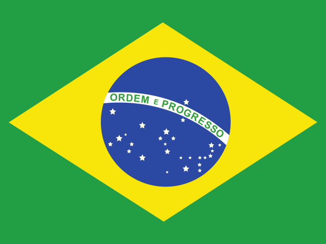
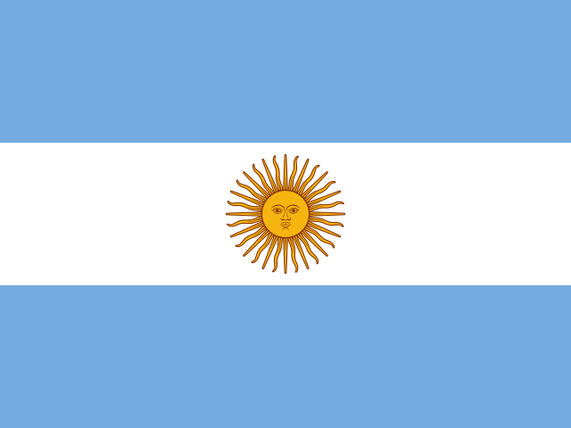
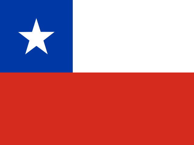
Landlocked in the heart of South America, Bolivia is bounded by Brazil to the north and east, Paraguay and Argentina to the south, and Chile and Peru to the west.[1][5] Its territory descends through dramatic vertical gradients, organized into three primary physical regions: the Andean Highlands (*Zona Andina*), the Sub-Andean Intermediate Valleys and Yungas, and the Eastern Tropical Lowlands (*Llanos Orientales*).[1][5]
The western third of the country is dominated by the Altiplano, a massive endorheic plateau suspended between the Western Cordillera (*Cordillera Occidental*) and the Eastern Cordillera (*Cordillera Real*) at elevations between 3,600 and 4,000 meters.[1][5] In the northern Altiplano, Lake Titicaca—the highest navigable lake in the world at 3,812 meters—moderates the thin mountain atmosphere, allowing Aymara and Quechua farmers to cultivate terraced slopes and fish along totora reed shores.[1][5]

Directly below the eastern rim of the Altiplano lies La Paz, situated within a dramatic eroded canyon carved by the Choqueyapu River, with the three-peaked glaciated massif of Mount Illimani rising to 6,438 meters on the southeastern horizon.[1][16] Directly above the canyon rim sits El Alto, situated at 4,150 meters as one of the highest and fastest-growing metropolitan centers on Earth, where modern Aymara commerce, transport networks, and festive traditions thrive.[20][22] The two cities are seamlessly united by Mi Teleférico, the world’s longest and highest urban cable car transit network, which glides above canyon cliffs to provide affordable, zero-emission mass transit between the highland plateau and the city bowl.[16][22]
Heading southward across the Altiplano, rainfall declines dramatically into hyper-arid volcanic plains, terminating in the vast white expanse of the Salar de Uyuni.[1][13] Covering more than 10,500 square kilometers, it is the largest salt flat on Earth, composed of thick polygonal crusts of sodium chloride and lithium-bearing brines left behind by the evaporation of prehistoric Pleistocene lakes.[1][18][19]

East of the Andes, the landscape drops steeply through the cloud forests of the Yungas into temperate valleys around Cochabamba and Sucre, before opening into the vast eastern lowlands of Santa Cruz, Beni, and Pando.[1][5] These humid plains comprise over sixty percent of national territory, drained by major tributaries of the Amazon and Río de la Plata basins, including the Mamoré, Beni, and Pilcomayo rivers.[1][5]
Ancient civilizations, Potosí silver and colonial transformations
Bolivia’s human geography traces millennia of monumental indigenous statecraft.[4][6] South of Lake Titicaca, the Tiwanaku civilization established a monumental spiritual and political metropolis that dominated the southern Andes between 500 and 1000 CE.[4][6] Inscribed by UNESCO as a World Heritage site, Tiwanaku features megalithic andesite architecture, the subterranean Kalasasaya temple, and the carved monolithic Gate of the Sun (*Puerta del Sol*).[6] Later, the Inca Empire integrated these high-altitude domains into Qullasuyu, constructing paved roadways along the Qhapaq Ñan to connect highland storehouses and administrative centers across modern borders.[4][7]

Spanish conquest reorganized Andean geography around mineral extraction.[4][8] In 1545, the discovery of colossal silver deposits inside the reddish volcanic cone of Cerro Rico (*Sumaj Orqo*) transformed the high-altitude settlement of Potosí into one of the largest and wealthiest cities in the world, with over 160,000 residents in the early seventeenth century.[4][8] Under the colonial *mita* draft system, tens of thousands of indigenous Quechua and Aymara men were conscripted into forced labor, mining subterranean silver veins and processing ore using toxic mercury amalgamation in hydraulic stamping mills.[4][8]
Potosí silver was minted into “pieces of eight” (*reales de a ocho*) at the Casa de la Moneda, functioning as the premier global trade currency across Europe and Asia.[4][8] The immense mine acted as an economic magnet, drawing coca leaves from the Yungas, mules from Argentina, textiles from Quito, and wheat from Cochabamba.[4][8] The city’s preserved baroque churches, ornate stone convents, and hydraulic aqueducts stand as enduring reminders of this colonial extraction complex.[4][8]
Independence, revolutionary reform and the Plurinational State
Following sixteen years of guerrilla warfare against Spanish royalist forces, Bolivia declared sovereign independence in Sucre on 6 August 1825, naming the new republic in honor of the Liberator Simón Bolívar.[4][9] The nineteenth and twentieth centuries were punctuated by territorial conflicts, notably the War of the Pacific (1879–1883) against Chile, which deprived Bolivia of its coastal Atacama province and access to the sea, and the Chaco War (1932–1935) against Paraguay over southeastern borderlands.[4][9]
In 1952, the Bolivian National Revolution (*Revolución Nacional*) transformed the country’s social structure.[4][9] Led by the Revolutionary Nationalist Movement (MNR) and armed indigenous and miner militias, the state enacted universal suffrage without literacy tests, nationalized the giant tin mines of the tin barons under COMIBOL, and executed radical agrarian reform dismantling feudal haciendas across the Altiplano and valleys.[4][9]
Decades of authoritarian military dictatorships and subsequent neoliberal privatizations prompted grassroots indigenous mobilizations in the early 2000s, including the “Water War” in Cochabamba and the “Gas War” in El Alto.[9][22] In 2005, Evo Morales was elected as the country’s first indigenous president, initiating a constituent assembly that culminated in the 2009 Constitution.[2][9] The charter renamed the country the Plurinational State of Bolivia (*Estado Plurinacional de Bolivia*), granting formal constitutional status to thirty-six indigenous nations, recognizing community justice systems, and enshrining the indigenous philosophical concept of *Vivir Bien* (*Suma Qamaña* in Aymara; *Allin Kawsay* in Quechua)—living in harmonious equilibrium with nature and community.[2][10]
Lithium reserves, water geochemistry and macroeconomic horizons
Bolivia’s natural resource governance centers on the Salar de Uyuni, which contains the world’s single largest concentration of lithium reserves, estimated at over twenty-three million metric tons.[17][18] As international demand surges for lithium-ion batteries to power electric vehicles and renewable energy storage grids, the Bolivian government enacted policies prioritizing state-led industrialization through the state mining enterprise Yacimientos de Litio Bolivianos (YLB).[17][18]
Studies from the Harvard Growth Lab emphasize the complex technological and economic considerations involved in commercializing Altiplano brine deposits, which possess high magnesium-to-lithium ratios and face seasonal rainfall dilution during summer months.[18] Geochemical research published in *Applied Geochemistry* underscores that local Aymara and Quechua pastoral communities in the vicinity of the salar depend on fragile, shallow freshwater aquifers that exist in delicate equilibrium with subterranean mineral brines, necessitating direct environmental monitoring and community water consultations.[19]
At the macro-level, the World Bank highlights that economic growth, supported by natural gas and agricultural commodity exports from Santa Cruz, has substantially reduced extreme poverty over recent decades, while the Country Partnership Framework prioritizes economic diversification, climate resilience, and equitable service delivery across rural and indigenous municipalities.[17][20]
Altiplano agricultural ecology and the Royal Quinoa heritage
Agriculture across the Altiplano represents a triumph of indigenous agronomy over extreme environmental constraints.[12][13] In the cold Southern Altiplano, where freezing night temperatures, intense solar UV radiation, and arid soils preclude most crops, indigenous farmers cultivate Royal Quinoa (*Quinua Real*).[12][13] Recognized by the Food and Agriculture Organization (FAO) as a globally significant agricultural heritage system, Royal Quinoa has been cultivated around the salt flats for thousands of years.[12][13] Farmers rotate quinoa plots with extensive herds of llamas and alpacas, using camelid manure to fertilize sandy soils and hand tools like the foot-plow (*chakitaklla*) to minimize wind erosion.[12][13]
To preserve harvests against winter frosts, highland communities practice ancient freeze-drying techniques.[12][13] Small native bitter potatoes (*papa amarga*) are spread across straw mats on freezing winter nights, stomped by barefoot farmers to express moisture, and washed in mountain streams to produce *chuño* and white *tunta*, durable freeze-dried tubers that can be stored safely in ceramic bins for years.[12][13]
Textile cosmologies, the Aymara pollera and urban identity
Textile weaving in Bolivia is an ancient visual language that encodes cultural cosmology, clan lineages, and spatial geography.[4][10] In Chuquisaca and northern Potosí, indigenous weavers produce world-renowned Jalq’a and Tarabuco textiles on traditional backstrap looms (*awa*).[4][10] Jalq’a weavings, executed in bold black and scarlet wools, depict the *Ukhu Pacha* (the chaotic subterranean underworld) populated by zoomorphic mythical creatures (*khurus*) with multiple heads and eyes, woven entirely from memory without preliminary sketches.[4][10]
In urban centers like La Paz, Cochabamba, and El Alto, Aymara and Quechua women proudly assert their identity through the attire of the *Cholita*.[16][22] The iconic ensemble features an accordion-pleated multilayered velvet skirt (*pollera*), an embroidered shawl pinned with ornate filigree jewelry, a hand-woven carrying cloth (*aguayo*) tied across the shoulders to carry children or goods, and a stiff Italian-style felt bowler hat (*bombín*) perched precisely on braided hair.[16][22] Far from folkloric relics, Cholitas operate multi-million-dollar import businesses, serve as university professors, anchor municipal politics, and compete in athletic lucha libre wrestling matches in El Alto, reclaiming indigenous female dignity in modern civic life.[16][22]
Jesuit mission heritage across eastern plains
In stark contrast to the Andean highlands, eastern Bolivia encompasses the expansive savannas and forests of Santa Cruz and the Beni basin.[1][5] In the Chiquitania region of Santa Cruz, the Jesuit Missions of Chiquitos—inscribed by UNESCO as World Heritage sites—preserve six historic mission settlements founded in the late seventeenth and eighteenth centuries, including San Javier, Concepción, and Santa Ana.[4][6] Unlike mission complexes elsewhere in South America that fell into ruin after the Jesuit expulsion in 1767, the Chiquitano indigenous communities maintained their wooden baroque churches, preserving soaring timber columns carved from single trunks of *cuchi* wood, polychrome murals, and vast archives of sacred baroque choral music performed annually in international music festivals.[4][6]
Today, the departmental capital of Santa Cruz de la Sierra anchors Bolivia’s modern agro-industrial powerhouse.[1][17] Sprawling across tropical plains, Santa Cruz leads nationwide production of soybeans, sunflower oil, sugarcane, beef cattle, and natural gas, attracting internal migrants from both the western highlands and international communities, illustrating the dynamic economic diversity of the plurinational state.[1][17][20]
Andean musical instruments and folk pageantry
Bolivia’s musical traditions embody the acoustic breath of the high Andes and the celebratory rhythms of regional communities.[11][16] The quintessential instrument of the highlands is the *charango*, a small ten-stringed lute traditionally fashioned from the carapace of an armadillo (*kirkincho*), though modern luthiers in Aiquile craft instruments exclusively from resonant native hardwoods like cedar and jacaranda.[11][16] Played with rapid strumming techniques (*rasgueo*), the charango accompanies haunting pentatonic melodies played on indigenous wind instruments: the *quena* (a notched end-blown cane flute dating to pre-Incan times) and the *zampoña* or *siku* (bamboo panpipes arranged in dual interlocking rows played in communal dialogue by paired musicians).[11][16]
In La Paz, this musical devotion culminates in the annual festival of the *Señor Jesús del Gran Poder*, where tens of thousands of costumed dancers flood the city’s steep thoroughfares.[11][16] Accompanied by thunderous brass bands, fraternity troupes perform the *Morenada*, whose heavy bell-shaped embroidered costumes and black masks commemorate the endurance of enslaved African laborers brought to colonial silver mines, alongside the athletic jumps of the *Caporales* and the energetic foot-stamping of the indigenous *Tinku*, celebrating ritual martial encounters from northern Potosí.[11][16]
Festive traditions, street gastronomy and the paceño palate
Bolivia’s cultural calendar is renowned for religious and folkloric syncretism, exemplified by the Carnival of Oruro, inscribed on UNESCO’s Representative List of Intangible Cultural Heritage.[11] Originating as an ancient Uru indigenous festival honoring mountain deities (*Achachilas*), the celebration evolved under colonial Catholicism into a grand public festival honoring the Virgin of the Mineshaft (*Virgen del Socavón*).[11] Over fifty thousand dancers and twenty thousand brass musicians parade through the streets performing the *Diablada*, an elaborate devil dance dramatizing the battle between Archangel Michael and Lucifer, alongside the *Morenada* and *Caporales*, wearing towering velvet and sequined costumes.[11]
Gastronomy in Bolivia celebrates diverse regional produce and street food artistry.[14][15] In La Paz, morning routines begin with *salteñas*, savory baked pastries filled with a sweet and spicy stew of braised beef or chicken, potatoes, peas, and rich gelatinous gravy spiced with yellow *ají amarillo* chili.[14][15] At mid-day, market stalls serve *sopa de maní*, a creamy, velvety soup prepared with ground raw peanuts, beef ribs, peas, and macaroni, topped with crispy shoestring potatoes and fresh herbs.[14][15] In the evening, street vendors along urban plazas grill *anticuchos*—skewered beef heart marinated in garlic, cumin, and vinegar, cooked over open coals and served with boiled potatoes and fiery peanut-chili sauce.[14][15]
Modern culinary movements, highlighted by international culinary reports, are elevating indigenous Andean and Amazonian ingredients into fine dining, celebrating wild palm fruits, native potatoes, and river fish while honoring traditional market cooks.[15][16] Through its glaciated Andean pinnacles, glistening Altiplano salt flats, ancient Tiwanaku stone gateways, and dynamic indigenous urban markets, Bolivia endures as an awe-inspiring heartland of South American civilization, where ancient indigenous knowledge actively guides constitutional democracy and sustainable development.[1][2][4][10][11]








Share what you know
Been there, grew up there, or know something we missed? Add a comment; corrections with a source are especially welcome.