

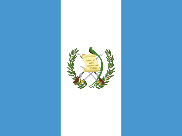


Straddling the mountainous heart of the Central American isthmus, Honduras spans one hundred and twelve thousand square kilometers of cloud-forested peaks, broad Caribbean river deltas, and deeply indented Pacific gulfs. Bordered by Guatemala to the west, El Salvador to the southwest, and Nicaragua across the southern pine savannas and Coco River to the southeast, the nation possesses over seven hundred kilometers of Caribbean coastline and a narrow, strategic window onto the Pacific through the island-studded Gulf of Fonseca. Over eighty percent of its topography is mountainous, forming an intricate continental watershed where northern rivers such as the Ulúa, Patuca, and Aguán drain toward the Atlantic while shorter, steeper torrents descend toward the Pacific Ocean.
Yet Honduras is defined as much by its cultural and ecological plurality as by its rugged terrain. In the western highlands, the stone monuments of Copán mark the southeastern boundary of the ancient Maya civilization. Along the north coast and the offshore Bay Islands, the Afro-indigenous Garifuna culture preserves ancestral drumming, dance, and maritime farming systems recognized as an Intangible Cultural Heritage of Humanity. In the southern and southwestern cordilleras, the Lenca people maintain ancestral ceramic crafts and communal peace ceremonies. In the remote eastern wilderness of the Mosquitia, the Río Plátano Biosphere Reserve protects the largest continuous tract of primary tropical rainforest in Central America.

The Athens of the Maya: Copán and the Hieroglyphic Stairway
In the fertile alluvial valley of the Copán River, near the western border with Guatemala, rise the monumental limestone and green volcanic tuff temples of Copán. Inhabited for more than two thousand years, Copán flourished during the Classic Maya period (426–822 CE) as the capital of a major regional kingdom founded by K’inich Yax K’uk’ Mo’. Unlike the towering, steep-sided pyramids of northern Petén sites like Tikal, Copán is celebrated for the unparalleled artistic refinement of its sculptural art, earning its reputation among archaeologists as the “Athens of the New World.”
The city’s master sculptors utilized local green andesite tuff, a fine-grained volcanic stone that carved like wood when freshly quarried but hardened upon exposure to air. This enabled artisans to produce freestanding, three-dimensional high-relief stelae—most famously commissioned by King Uaxaclajuun Ub’aah K’awiil (Eighteen Rabbit)—that depict royal rulers adorned in towering feathered headdresses, jade pectorals, and symbolic iconography of the underworld. In the Great Plaza, these monumental stone portraits stand surrounded by one of the largest and most intact ballcourts in Mesoamerica, where ritual ballgames symbolized the perpetual cosmological struggle between life, death, and celestial rebirth.
The supreme epigraphic monument of the ancient Americas is Copán’s Hieroglyphic Stairway, built on the western flank of Temple 26. Rising across sixty-three stone steps, the stairway contains more than two thousand individual hieroglyphic glyph blocks, constituting the longest contiguous written pre-Columbian text in the Americas. The inscription records the dynastic history of the Copán kingdom, detailing the accessions, military campaigns, religious rituals, and deaths of its sixteen monarchs. Deep within the core of the acropolis, archaeologists tunneling through successive construction layers discovered Rosalila Temple—an early sixth-century ceremonial structure preserved entirely intact beneath later masonry, its stucco reliefs of celestial macaws and solar deities still bearing brilliant traces of original scarlet, green, and yellow mineral paint.
Today, the archaeological park is also celebrated as a living sanctuary for the scarlet macaw (Ara macao), the national bird of Honduras. Known to the ancient Maya as Mo’, these magnificent parrots with brilliant red, yellow, and blue plumage were worshipped as earthly emissaries of the sun deity. In partnership with local bird conservation initiatives, dozens of scarlet macaws have been bred and reintroduced into the Copán Valley, flying freely between the towering ceiba trees and nesting in the hollow limestone walls of the ancient acropolis, their raucous calls echoing over the ruined plazas just as they did fifteen centuries ago.
The Living Reef: Roatán and the Bay Islands
Fifty kilometers off the northern Caribbean coast lies the department of the Bay Islands (Islas de la Bahía), an archipelago comprising the three main islands of Roatán, Utila, and Guanaja, alongside smaller cays such as Cayos Cochinos. Perched along the southern terminus of the Mesoamerican Barrier Reef—the largest coral reef system in the Western Hemisphere—the Bay Islands are encircled by sheer submarine walls, flourishing elkhorn and staghorn coral gardens, and clear azure waters that host over sixty species of stony corals and five hundred species of tropical marine fish.

The cultural history of the Bay Islands is distinctly separate from the mainland. Historically contested by Spanish conquistadors and English buccaneers—including infamous corsairs like Henry Morgan who used the island’s labyrinthine mangrove harbors as raiding bases—the islands were colonized extensively by British settlers and freed slaves from the Cayman Islands and Jamaica in the eighteenth and nineteenth centuries. Consequently, the indigenous islanders (the Caracol population) speak an English-based Caribbean creole alongside Spanish, maintaining close cultural ties to the wider Anglophone Caribbean.
Utila is globally renowned among marine biologists as one of the world’s primary gathering grounds for whale sharks (Rhincodon typus), the largest fish in the sea, which congregate year-round to feed in pelagic upwellings. In Cayos Cochinos, a strictly protected marine reserve governed by the Honduran Coral Reef Foundation, commercial fishing is prohibited, preserving an ecological baseline where endangered hawksbill sea turtles nest on white coral sand and queen conch graze undisturbed across shallow turtle grass beds.
The Garifuna Coast: Drums, Cassava, and Ocean Ancestry
Along the mainland Caribbean coast, from Tela and La Ceiba eastward into Trujillo, lie dozens of coastal villages inhabited by the Garifuna people. The history of the Garifuna is an epic of resilience: descendants of West African survivors of seventeenth-century slave shipwrecks who intermarried with indigenous Island Carib and Arawak populations on the island of Saint Vincent, the Garifuna resisted British colonial conquest until 1797, when they were forcibly exiled and deposited on the shores of Roatán. From the island, they quickly migrated to the mainland coast, establishing self-reliant fishing and farming communities that stretch across Honduras, Guatemala, Belize, and Nicaragua.
Garifuna culture is anchored in ancestral spiritual communication (the Dugu religion), led by spiritual healers known as buyeis who commune with the spirits of departed ancestors (Gubida). Music and dance form an indivisible expressive language: the driving rhythm of Punta, performed with two hollowed-out mahogany drums (the lead Primero and bass Segunda), accompanying lyrics that narrate communal struggles, folklore, and social commentary. Accompanying the drums, percussionists strike dried turtle shells (conchas de tortuga) with wooden mallets, producing sharp, resonant clicks that pierce through the heavy bass rhythms. During the winter holidays, men perform the Wanaragua (or Yancunú), a masked warrior dance in which dancers wear painted wire-mesh European face masks and headdresses adorned with bright macaw feathers, executing athletic footwork that originally satirized British colonial officers.
In traditional open-air kitchen huts (gayunares), Garifuna women transform bitter cassava tubers into ereba—large, flat, sun-dried cassava flatbreads baked over open clay hearths that can store for months without spoiling, providing a staple carbohydrate that has sustained the community for centuries.
Lakes, Cloud Forests, and Lenca Traditions
Ascending into the interior highlands, the climate cools rapidly as the landscape transitions into montane pine-oak ridges and humid cloud forests. In the central plateau lies Lake Yojoa, the only natural lake of major scale in Honduras. Formed thousands of years ago in a volcanic depression between two national parks—Montaña de Santa Bárbara and Cerro Azul Meámbar—Lake Yojoa covers seventy-nine square kilometers of tranquil water surrounded by citrus orchards, coffee fincas, and dense jungle slopes.

Lake Yojoa is a globally renowned ornithological sanctuary, harboring more than five hundred resident and migratory bird species—more than half of all avian species recorded in Honduras. Keel-billed toucans, resplendent quetzals, northern jacanas, and snail kites frequent the lake’s freshwater marshes. Around the lake’s perimeter, roadside eateries serve the beloved local culinary specialty: deep-fried freshwater fish (pescado frito al estilo Yojoa), seasoned with local spices and served with crispy green plantain chips (tajadas), pickled red onions, and homemade cabbage slaw.
Further west and south, the cordillera reaches its zenith at Montaña de Celaque, rising to 2,870 meters as the highest point in Honduras. Draped in moss-draped dwarf cloud forest, Celaque forms the ancestral homeland of the Lenca people, the largest indigenous nation in Honduras. The Lenca are celebrated for their hand-burnished pottery, produced by women artisans in towns like La Campa and Sanuariguare using ancestral open-pit firing methods with pine bark and natural clay slips, yielding black-and-white geometric vessels. The Lenca also preserve the Guancasco, an ancient syncretic peace covenant where neighboring towns carry patron saint statues across mountain passes in ceremonial processions to renew mutual treaties of friendship, commerce, and non-aggression.
Colonial Stone and the Heart of Coffee
In the valley between the central mountain chains lies Comayagua, the historic colonial capital of Honduras from 1537 to 1880. Comayagua preserves the most intact colonial urban grid in the country, centered on the Cathedral of the Immaculate Conception, completed in 1711. The cathedral’s bell tower houses one of the oldest working mechanical clocks in the Americas, fabricated by Moorish craftsmen around 1100 CE for the Alhambra Palace in Granada, Spain, and gifted to the city by King Philip II in the late sixteenth century. Its hand-forged iron gears, weights, and escapement mechanism continue to chime the hours over the cobblestone plaza today.
Across the high slopes surrounding Marcala, Santa Bárbara, and Copán, volcanic soils and misty altitudes create ideal conditions for high-grown Arabica coffee. Honduras has quietly grown into the largest coffee producer in Central America and the fifth-largest exporter in the world. Unlike large corporate mono-plantations found elsewhere, the Honduran coffee sector is dominated by more than one hundred thousand smallholder family farms organized into democratic cooperatives. Grown beneath native shade trees like inga and liquidambar, Honduran specialty coffees—notably the Marcala region, which earned the first protected Denomination of Origin in Central America—are prized by international roasters for delicate notes of peach, brown sugar, and dark chocolate.
Flavors of the Comal: The Baleada and Honduran Hearth
At the center of everyday Honduran cuisine stands the baleada, arguably Central America’s most beloved street food. Born on the banana plantations of the northern coast around La Ceiba in the mid-twentieth century, the baleada begins with a large, freshly pressed flour tortilla cooked on a flat metal griddle (comal) until puffed and lightly charred. While still piping hot, the tortilla is spread with a generous layer of refried red silk beans (frijoles rojos), folded over a crumble of salty, hard white cheese (queso duro), and dolloped with rich Honduran sour cream (mantequilla blanca).
Variations range from the simple baleada sencilla to the elaborate baleada con todo, stuffed with scrambled eggs, sliced avocado, grilled beef, pork sausage, or pickled onions. Beyond the baleada, the Honduran table celebrates sopa de caracol (conch soup), a famed coastal dish made with tender conch meat simmered in rich coconut milk, yuca, green plantains, and fresh coriander, popularized globally in the 1990s by the musical group Banda Blanca. In mountain villages, seasonal corn harvests are celebrated with tamalitos de elote, sweet fresh corn cakes steamed inside green corn husks and served with rich farm cream.
The Forest Frontier: Mosquitia and Conservation Challenges
In the far east of the country lies the Mosquitia, an expansive tropical wilderness covering over thirty thousand square kilometers of lowland rainforests, coastal lagoons, and pine savannas. Traversed only by river pirogues and small propeller aircraft, the region is home to the Río Plátano Biosphere Reserve, a UNESCO World Heritage site that protects unfragmented habitats for jaguars, Baird’s tapirs, giant anteaters, and the majestic harpy eagle. Indigenous Pech, Tawahka, and Miskito communities live along the winding waterways, practicing traditional rotational farming and managing communal forestry reserves.
The Mosquitia has also captured international archaeological attention. For generations, indigenous oral traditions spoke of a mysterious ancient civilization concealed in the impenetrable jungle valleys—known in folklore as the Ciudad Blanca (White City) or the City of the Monkey God. In recent years, airborne LiDAR laser scanning penetrated the dense jungle canopy, revealing extensive pre-Columbian urban complexes complete with ceremonial plazas, earth mounds, irrigation canals, and sculpted stone vessels carved with were-jaguar motifs. Archaeologists determined that these sites represent an advanced, non-Maya intermediate civilization that flourished between 1000 and 1400 CE, trading between Mesoamerica and lower Central American cultures.
Yet Honduras confronts pressing contemporary challenges. Illegal cattle ranching and illicit timber logging threaten the fragile borders of the Mosquitia, while international climate shocks subject agricultural valleys to alternating severe droughts and catastrophic tropical hurricanes like Mitch and Eta. In response, a resilient civil society led by indigenous environmental defenders, community forestry cooperatives, and conservation scientists continues to fight for watershed protection and sustainable development. From the ancient hieroglyphs of Copán to the coral gardens of Roatán and the cloud-capped summit of Celaque, Honduras draws unshakeable strength from its ancient heritage, its diverse peoples, and the majestic natural heritage of its mountain soil.








Share what you know
Been there, grew up there, or know something we missed? Add a comment; corrections with a source are especially welcome.