



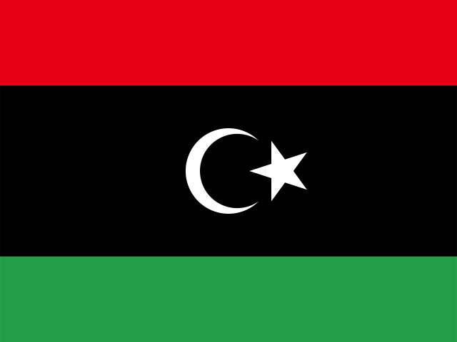

Spanning one million seven hundred and fifty-nine thousand five hundred and forty square kilometers across north-central Africa, the State of Libya (Dawlat Lībiyā) commands one thousand seven hundred and seventy kilometers of Mediterranean coastline—the longest maritime frontage of any African nation on that sea. Flanked by Egypt and Sudan to the east, Chad and Niger to the south, and Algeria and Tunisia to the west, Libya is overwhelmingly defined by the Sahara Desert, which blankets over ninety percent of its territory in wind-sculpted sand dunes (ergs), gravel plains (serirs), and barren rocky plateaus (hamadas).
Historically and geographically, Libya consists of three distinct historic zones: Tripolitania in the northwest, centered around the capital Tripoli and the fertile coastal Jafara plain; Cyrenaica (Barqa) in the northeast, crowned by the forested limestone highlands of the Jabal al-Akhdar (“Green Mountain”); and the vast southern desert province of the Fezzan, an arid basin punctuated by date palm oases and ancient trade routes crossing the Sahara. Despite the severe harshness of its climate, Libya was a cradle of Mediterranean civilization, home to Phoenician trading emporia, monumental Greek colonies, peerless Roman provincial capitals, and the Garamantes—an enigmatic Saharan empire that mastered subterranean hydraulic irrigation two millennia before modern civil engineering.

Tripolis and the Imperial Roman Emporia
The name Tripolitania derives from the Greek for “Three Cities”—Oea (modern Tripoli), Sabratha, and Leptis Magna—originally founded as coastal anchorages by Phoenician navigators from Tyre during the seventh and sixth centuries BC. Situated at the natural northern termini of trans-Saharan caravan trails, these coastal settlements facilitated trade in ivory, ostrich feathers, gold dust, and Saharan wild animals destined for Mediterranean amphitheaters, exchanging them for Aegean wine, olive oil, and bronze metalwork.
Under Roman administration following the Punic Wars and the incorporation of Numidia, these trading posts expanded into some of the wealthiest urban centers of the empire. Leptis Magna, situated one hundred and twenty kilometers east of Tripoli, reached the pinnacle of architectural grandeur when its native son, Lucius Septimius Severus, ascended the imperial throne as Rome’s first African-born emperor in 193 AD. Severus lavished royal patronage upon his hometown, commissioning a vast new forum, a basilica with carved pilasters depicting the labors of Hercules and Dionysus, an artificial port basin with lighthouses, and a triumphal tetrapylon arch whose marble reliefs celebrated imperial military campaigns.
Seventy kilometers west of Tripoli, the maritime emporium of Sabratha flourished through maritime trade across the Mediterranean. Its crowning monument is the monumental Roman theater, erected between 180 and 200 AD during the reign of Emperor Commodus. Designed to seat five thousand spectators against the azure backdrop of the Mediterranean, the theater preserves its three-story stage facade (scaenae frons), composed of ninety-six Corinthian columns carved from imported Greek and Italian cipollino and proconnesian marbles. Below the wooden stage floor, intricate bas-relief friezes depict dramatic muses, mythological judgment scenes, and allegorical figures of Roman peace and commercial prosperity.
In eastern Libya, the Greek pentapolis of Cyrenaica developed along the temperate slopes of the Jabal al-Akhdar. Founded in 631 BC by Dorian colonists from the volcanic island of Thera (Santorini) led by Battus I, Cyrene became an intellectual and medical center of the Hellenic world, famous for its school of philosophy founded by Aristippus, a student of Socrates. Cyrene derived immense wealth from the monopolistic cultivation and export of silphium, a wild giant fennel praised by ancient botanists as an indispensable culinary seasoning, contraceptive, and universal medicine. The plant was so central to the economy that Cyrenaean silver tetradrachm coins bore its stalk and seed pods until the species was harvested to extinction by the first century AD.

Ghadames: The Pearl of the Saharan Caravan Trails
Six hundred kilometers southwest of Tripoli, at the junction where the borders of Libya, Tunisia, and Algeria converge, lies the oasis of Ghadames (ancient Cydamus). Situated around the perennial artesian spring of Ain al-Faras (“Spring of the Mare”), Ghadames functioned for centuries as the indispensable hub of trans-Saharan trade. Here, merchant caravans comprising thousands of laden dromedaries rested after grueling journeys across the sand dunes, exchanging salt slabs, Sudanese gold, leather goods, and manuscripts before dispersing toward the Mediterranean ports or deep into West Africa.
The Old City of Ghadames, inscribed as a UNESCO World Heritage site in 1986, is a triumph of passive thermal architecture adapted to extreme desert temperatures that frequently exceed forty-five degrees Celsius. Built entirely from sun-dried clay mudbrick, palm trunks, and lime plaster, the settlement is constructed as a contiguous, multi-tiered urban honeycomb. At ground level, winding residential passageways are entirely vaulted over by upper stories, creating subterranean tunnels shielded from the scorching sun and scouring desert winds. These cooled corridors, lit only by occasional vertical skylights, served as the public sphere for men conducting business and gathering for daily prayers.
The domestic and social life of Ghadames operated on distinct vertical planes. The middle floors housed private family living quarters and grain storage, adorned with striking red-and-white geometric frescoes, mirrors, and brass utensils hung on lime-washed walls. The flat roofs of the houses formed a second, open-air city reserved exclusively for women. Unbroken by high dividing walls, these interconnected rooftop terraces allowed women to socialize, visit relatives, spin wool, and prepare dates and couscous freely without entering the public street level below. Water from Ain al-Faras was distributed through an ingenious system of stone channels and hydraulic water clocks (qadous), ensuring equitable, minute-by-minute irrigation to thousands of date palms in the adjacent palm groves.
Further east in the heart of the Fezzan, along the dry river valley of the Wadi al-Ajal, flourished the Garamantian civilization between 500 BC and 500 AD. Long dismissed by early Roman historians as nomadic desert raiders, extensive modern archaeological excavations around their ancient capital of Garama (modern Old Germa) revealed a sophisticated, urbanized state. The Garamantes sustained dense settlements of mudbrick townhouses and monumental temples in the hyper-arid Sahara by cutting hundreds of subterranean irrigation galleries, known as foggaras. Tapped into water-bearing limestone aquifers at the base of the escarpments, these gently inclined tunnels carried groundwater underground over miles to irrigate extensive fields of wheat, barley, grapes, and dates, sustaining a population of over fifty thousand people who controlled trade corridors connecting Lake Chad with Mediterranean ports.

Prehistoric Waters and the Tadrart Acacus Gallery
In the southwestern corner of the Fezzan, along the border with Algeria, the desert landscape fractures into the dramatic sandstone wilderness of the Tadrart Acacus mountains. Here, millions of years of wind erosion and prehistoric flash floods carved colossal natural arches, isolated rock towers, and deep labyrinthine canyons that rise out of orange and crimson sand dunes. The crowning geological monument is the Forzhaga Arch, a soaring sandstone gateway spanning tens of meters above the desert floor.
The caves and rock shelters of the Acacus preserve one of the world’s richest records of prehistoric rock art, spanning twelve thousand years of changing environmental history from 12,000 BC to 100 AD. Inscribed on the UNESCO World Heritage list in 1985, these thousands of paintings and petroglyphs document the radical climatic transformations of the Sahara. The earliest “Large Wild Fauna” period depicts animals that required lush savannahs, perennial rivers, and dense acacia woodlands: elephants, rhinoceroses, giraffes, hippopotamuses, and giant prehistoric cattle (Bubalus antiquus).
As the Green Sahara began to desiccate around 4000 BC, the artwork shifted into the “Pastoral” period, featuring polychrome paintings of domestic cattle herds, pastoral camps, women grinding seeds, and ritual dances. Later depictions show two-wheeled war chariots drawn by galloping horses, and finally the “Camel” period, chronicling the final onset of total aridity and the adoption of the dromedary by the ancestors of the Tuareg. These ancient dwellers left both visual art and deep cultural memories of a verdant Saharan home that gradually vanished beneath the encroaching sands.
The Great Man-Made River and Subterranean Fossil Aquifers
While surface rivers in modern Libya are non-existent—consisting entirely of ephemeral seasonal streams (wadis) that flow only after rare winter storms—the country rests upon immense reservoirs of fresh water buried deep within the earth. During the Pleistocene glaciations between thirty-eight thousand and fourteen thousand years ago, heavy rains soaked the Sahara, infiltrating porous subterranean sandstones to form the Nubian Sandstone Aquifer System, the largest known fossil water aquifer on Earth.
To exploit this ancient water and sustain coastal cities and agriculture, Libya embarked in 1984 on the construction of the Great Man-Made River (GMMR). Recognized by international civil engineers as one of the largest hydraulic engineering projects ever executed, the project comprises over four thousand kilometers of pre-stressed concrete cylinder pipes, each four meters in diameter and buried deep beneath the desert sands to prevent evaporation.
Drawing from hundreds of deep artesian wells in the Kufra, Sarir, and Murzuq basins, the pipeline network transports over six million cubic meters of pristine fossil water daily across hundreds of miles of hyper-arid desert to coastal distribution reservoirs at Benghazi, Sirte, and Tripoli. This water supplies drinking water to more than seventy percent of the national population and irrigates extensive agricultural projects growing grain, citrus, and vegetables along the coastal belt. However, because these fossil aquifers receive negligible contemporary recharge, their long-term management remains one of the country’s most vital environmental challenges.
Resistance, Oil, and Modern Sovereignty
Libya’s twentieth-century history was forged through brutal struggles for national self-determination. Following the collapse of Ottoman rule during the Italo-Turkish War of 1911, Italy attempted to colonize Libya as its “Fourth Shore,” seeking to settle hundreds of thousands of Italian farmers across the fertile plains of Tripolitania and Cyrenaica. For two decades, Italian military forces encountered ferocious guerrilla resistance led by the Sanusiya Islamic order in Cyrenaica under the leadership of Omar al-Mukhtar, known revered as the “Lion of the Desert.”
Operating on horseback across the rugged gorges of the Jabal al-Akhdar, Mukhtar’s fighters tied down superior Italian military forces using fluid hit-and-run cavalry tactics. In response, Italian fascist general Rodolfo Graziani conducted a brutal pacification campaign between 1929 and 1931, constructing an electrified barbed-wire fence along the Egyptian border to cut off supply lines and herding over one hundred thousand Cyrenaican pastoralists into desolate desert concentration camps, where tens of thousands perished from starvation and disease. Mukhtar was captured and executed by hanging in 1931, yet his principled defiance cemented him as the undisputed father of Libyan national resistance.
Following World War II, during which Libyan deserts hosted pivotal armored battles between the British Eighth Army and Erwin Rommel’s Afrika Korps, the United Nations oversaw the creation of the United Kingdom of Libya on December 24, 1951, under King Idris I al-Sanusi. Initially considered one of the poorest nations in the world, relying on scrap metal salvaging from wartime battlefields, Libya’s fortunes transformed dramatically in 1959 with the discovery of massive reserves of sweet, light, low-sulfur crude oil in the Sirte Basin by Esso.
In 1969, a twenty-seven-year-old army captain named Muammar al-Qaddafi overthrew the monarchy in a bloodless coup, establishing the “Jamahiriya” (“State of the Masses”). For forty-two years, Qaddafi governed through oil revenues, populist social redistribution, and idiosyncratic political philosophies outlined in his Green Book, while pursuing erratic international interventions. In February 2011, inspired by the Arab Spring revolutions in neighboring Tunisia and Egypt, popular uprisings erupted in Benghazi, escalating into an armed civil conflict backed by NATO aerial strikes that resulted in Qaddafi’s downfall in October 2011.
In the subsequent decade, Libya navigated severe political fragmentation, competing governing administrations in Tripoli and the eastern city of Tobruk, and militia conflicts over oil terminal control. Yet the resilient social fabric of the country—anchored in deep familial lineages, respected municipal councils, and shared devotion to Islamic cultural heritage—has underpinned persistent efforts toward national reunification, constitutional stabilization, and the rehabilitation of its vital energy infrastructure.
Everyday cultural life in Libya centers on family hospitality, religious festivals, and communal food traditions that blend Berber, Arab, and Mediterranean influences. The undisputed centerpiece of traditional dining is bazeen, a dense, unleavened dome made by vigorously boiling and stirring whole-grain barley flour with water using a heavy wooden paddle called a magraf. Placed in the center of a large communal platter, the smooth dough dome is encircled by a rich, slow-simmered tomato and onion stew laden with tender mutton, dried fenugreek leaves, hard-boiled eggs, and spicy potatoes. During Eid celebrations and family milestones, diners gather seated on traditional floor carpets, breaking off morsels of the hot barley with their right hands. Meals conclude with Libyan green tea (shahi maghreb), boiled three times in enameled steel kettles over glowing charcoal embers and poured from high above into small glasses to create a thick, velvety foam crown.
Today, Libya presents a compelling portrait of northern Africa, where ancient Mediterranean ruins meet the boundless silence of the Sahara, and modern pipelines traverse paths charted by Roman legions and prehistoric pastoralists. As its citizens work to reconstruct their civic institutions, the memory of Omar al-Mukhtar’s resilience and the centuries-old endurance of Ghadames continue to inspire the renewal of this historic nation.








Share what you know
Been there, grew up there, or know something we missed? Add a comment; corrections with a source are especially welcome.