





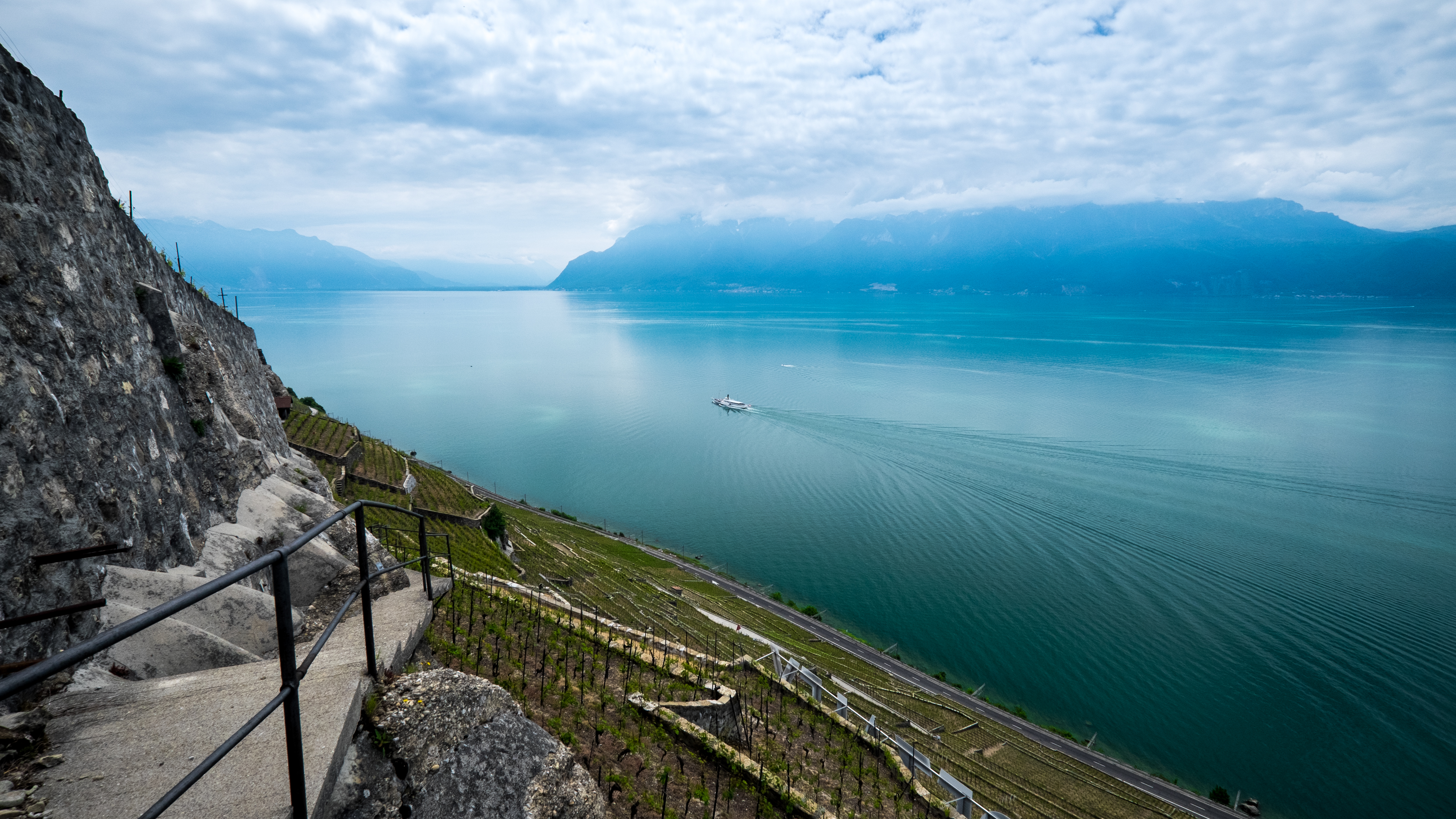
At Lavaux, vineyard terraces step down toward Lake Geneva, their stone walls shaped by generations of work. The present terraces trace back to the eleventh century, when Benedictine and Cistercian monasteries controlled the area; they still show how livelihood and landscape were made together.[7] Across the country, the scenery changes quickly: a French-speaking city, a German-speaking plateau town, an Italian-speaking valley, a Romansh-speaking village. Switzerland is often introduced through its mountains, but its deeper question is how people with different landscapes and languages have built shared institutions without becoming culturally identical. The answer is not a single Swiss way of life. It is a country where belonging is negotiated locally, canton by canton, and sometimes at the ballot box.[1][2][4]
A country of thresholds
The Alps occupy much of Switzerland’s map and imagination, but most people live on the Central Plateau, the lower band of settled land running between the Jura and the northern Alps. The Jura forms a wooded arc along the northwest. Between these regions, cities and towns sit beside lakes, rivers and transport corridors; beyond them, steep valleys climb toward high passes and peaks. The country shares borders with France, Germany, Italy, Austria and Liechtenstein, yet its geography also connects watersheds that flow toward the North Sea, Mediterranean and Black Sea.[1][13]
This variation makes short distances feel like changes of world. The western shore of Lake Geneva belongs to French-speaking Switzerland, while the city of Geneva is shaped by international institutions as well as its local history. The plateau around Zurich is the country’s largest urban and economic centre. Bern, the federal city, keeps the national government close to a smaller historic centre. In the south, Ticino crosses the Alpine watershed into Italian-speaking valleys and lakeside towns. In the east, Graubünden contains German, Italian and Romansh-speaking communities among its mountain valleys. The mountains divide, but passes, railways and roads also connect.[1][4]
Switzerland is often called a water tower because rivers rise in its mountains and carry water across borders. The Rhine begins in Graubünden and travels north toward the North Sea; the Rhône flows west through Valais and France toward the Mediterranean; the Inn runs east toward the Danube. In the Bernese Alps, the Jungfrau-Aletsch region holds the Great Aletsch Glacier, the largest glacier in the Alps, whose meltwater feeds mountain valleys and downstream rivers.[13] Lakes have supported settlement, power generation and movement. Water supply depends on weather and glaciation, while hydropower also changes river flows; climate change may limit water availability regionally during dry periods. Water management is therefore a practical concern for cantons as well as a landscape issue.[1][13][17]
Culture follows these local geographies too. Museums and galleries are a visible part of Swiss cultural life, alongside theatre, dance and amateur performance beyond the biggest stages. Choral societies, brass bands, carnival traditions such as Basel’s Fasnacht, and regional festivals bring residents together across towns and valleys. A canton’s cultural policy, language and institutions can shape which artists receive support and which stories are told in public. That makes culture another expression of federalism: a shared national scene assembled from local audiences, traditions and public choices, rather than a single capital dictating what counts as Swiss.[6]








Share what you know
Been there, grew up there, or know something we missed? Add a comment; corrections with a source are especially welcome.