
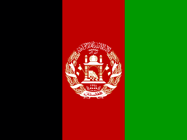


Anchoring the colossal geological knot where the Tian Shan, Karakoram, Kunlun, and Hindu Kush mountain ranges converge, the Republic of Tajikistan is the highest, most rugged sovereign nation in Central Asia. Landlocked across 143,100 square kilometers, this mountainous redoubt borders Uzbekistan to the west and northwest, Kyrgyzstan to the north, China to the east, and Afghanistan across the deep, churning waters of the Panj and Amu Darya rivers to the south. Mountains define the fundamental reality of Tajik existence: more than ninety-three percent of the national territory is covered by towering alpine peaks, with over half the country elevated higher than three thousand meters above sea level. In the capital of Dushanbe—cradled in the green Hissar Valley—modern boulevards, neoclassical theaters, and the world’s second-tallest flagpole gaze eastward toward the ice-crowned summits of the Pamirs, known across Central Asia as the Bam-i Dunya (“Roof of the World”).
Tajikistan occupies a distinct cultural and linguistic position within Central Asia. While its regional neighbors speak Turkic languages, the Tajik people speak a western Iranian language closely related to Persian (Farsi) and Dari, tracing their linguistic and civilizational identity to ancient Eastern Iranian populations—the Sogdians, Bactrians, and Khwarazmians—and the medieval glory of the Samanid Empire. Sunni Islam of the Hanafi school guides the spiritual life of the majority; however, the eastern mountain provinces of Gorno-Badakhshan are home to Pamiri ethnic communities who adhere to the Nizari Ismaili branch of Shia Islam under the spiritual leadership of the Aga Khan, speaking distinct East Iranian Pamiri idioms that predate modern Persian. This complex linguistic heritage unites ancient agricultural valleys with isolated highland canyons where ancestral hospitality, oral storytelling, and communal cooperation have formed an enduring shield against severe mountain winters.
A living embodiment of Central Asia’s deep antiquity survives in the high, isolated Yaghnob Valley of western Tajikistan, cut off from modern road networks for much of the year. Here reside the Yaghnobi people, the direct descendants of the ancient Sogdians who fled into the alpine canyons during the eighth-century Arab conquests. The Yaghnobi speak an Eastern Iranian language directly descended from ancient Sogdian, serving as the sole surviving dialect of the speech once used by Silk Road merchants from Byzantium to China. In their stone-built hamlets terraced into vertical shale cliffs, the Yaghnobi have preserved ancient solar calendars, pre-Islamic agrarian rituals, and collective water-sharing customs that offer linguists and anthropologists an unbroken living link to antiquity.
Glacial Giants and the Alpine Hydrology of the Pamir Knot
The eastern half of Tajikistan is dominated by the Pamir Mountains, a vast high-altitude plateau and glacial wilderness centered on the Gorno-Badakhshan Autonomous Region. Inscribed on the UNESCO World Heritage list in 2013, Tajik National Park encompasses 2.6 million hectares—nearly eighteen percent of the entire country—protecting one of the most rugged, tectonically active alpine landscapes on Earth. Here, jagged crystalline ridges climb above seven thousand meters, crowned by Ismoil Somoni Peak (7,495 meters, formerly Peak Communism), Ibn Sina Peak (7,134 meters, formerly Lenin Peak), and Peak Korzhenevskaya (7,105 meters).

Within this frozen wilderness lies the Fedchenko Glacier, the longest valley glacier on the planet outside the polar regions. Stretching seventy-seven kilometers down the eastern slope of the Academy of Sciences Range and plunging to ice depths exceeding one thousand meters, the Fedchenko Glacier acts as a colossal frozen water tower. Tajikistan contains over eight thousand cataloged glaciers, which together store more than five hundred cubic kilometers of freshwater. These high glaciers feed the headwaters of the Vakhsh and Panj rivers, which unite to form the Amu Darya (the classical Oxus), providing more than half of the total surface runoff that irrigates the arid agricultural lowlands of the entire Aral Sea basin in neighboring Uzbekistan, Turkmenistan, and Kazakhstan.
The tectonic violence of the Pamir Knot was dramatically illustrated in February 1911, when a catastrophic magnitude 7.4 earthquake triggered a massive landslide in the central Pamirs. Over two billion cubic meters of rock collapsed into the Murghab River canyon, burying the village of Usoi and creating the Usoi Dam—the tallest natural or man-made dam on Earth, standing 567 meters high. Behind this natural rock barrier accumulated Lake Sarez, a deep body of cobalt-blue water stretching seventy-five kilometers through vertical gorges. Containing seventeen cubic kilometers of water, Lake Sarez remains an exceptional natural laboratory for geomorphologists and a continuous reminder of the seismic forces actively shaping the mountains.
The Sogdian Legacy: Sarazm, Penjikent, and the Zarafshan Valley
Centuries before the emergence of modern borders, the river valleys of western Tajikistan formed the heart of Sogdiana, an ancient Eastern Iranian merchant civilization that controlled the overland Silk Road trade between the Mediterranean, China, and India from the sixth century BCE to the eighth century CE. In the fertile Zarafshan Valley, near the contemporary town of Panjakent, lies the proto-urban archaeological settlement of Sarazm, inscribed as a UNESCO World Heritage site in 2010. Flourishing between the fourth and second millennia BCE, Sarazm is the oldest agricultural and metallurgical settlement in Central Asia, boasting well-planned mudbrick residential complexes, grain storage granaries, and specialized copper, tin, and lead smelting furnaces that exported high-purity bronze tools and turquoise across Eurasia.
Nearby, the ruined city of Ancient Penjikent—often described by classical archaeologists as the “Pompeii of Central Asia”—provides an unprecedented window into pre-Islamic Sogdian urban life. Excavations have uncovered two-story mudbrick merchant mansions, elaborate reception halls, and Zoroastrian fire sanctuaries adorned with magnificent polychrome tempera wall murals. These paintings, executed with mineral pigments of lapis lazuli, cinnabar, and gold leaf, depict dynamic battle scenes, banqueting nobles in patterned silk tunics, mythical heroes from the Rustam epic cycle, and multi-armed deities, illustrating the cosmopolitan artistic synthesis achieved by Sogdian merchants whose trading colonies spanned from Samarkand to the Chinese capital of Chang’an.
When Arab Muslim armies advanced across the Zarafshan in the early eighth century, the Sogdian nobility retreated into the mountain fortresses of the upper Zarafshan. High above the river atop Mount Mug, archaeologists discovered the personal administrative archives of Dewashtich, the last independent ruler of Penjikent. Preserved on strips of willow wood and parchment, these bilingual Sogdian and Arabic legal contracts, diplomatic letters, and economic registers reveal a sophisticated civil service and document the poignant final resistance of pre-Islamic Sogdian civilization before its assimilation into the emerging Islamic Perso-Arab cultural sphere.
The Pamir Highway and the distinctive Heritage of Badakhshan
Traversing the high wilderness of eastern Tajikistan is the M41 highway, celebrated worldwide as the Pamir Highway. Engineered in the 1930s by Soviet military pioneers across the line of ancient Silk Road bridle paths, the Pamir Highway is the second-highest international paved highway on Earth, climbing over the barren Ak-Baital Pass at 4,655 meters above sea level. Starting from the regional administrative capital of Khorog, the road traverses expansive lunar plateaus where temperatures plunge below minus forty degrees Celsius in winter, passing remote settlements like Murghab, where semi-nomadic Kyrgyz pastoralists graze resilient herds of yaks, sheep, and horses across wide alpine meadows.

West of the central ranges, the Fann Mountains form an alpine wonderland of sheer granite spires and glacial lakes. Centered on Lake Iskanderkul, a triangular body of cold alpine water situated at an altitude of 2,195 meters, the region is steeped in legend; according to local folklore, Alexander the Great (known across the East as Iskander Zulkarnain) camped along its shores during his fourth-century BCE Central Asian campaign, his beloved steed Bucephalus allegedly plunging into the lake’s depths. South of Panjakent, the Shing River valley cradles the Haft Kul (the Seven Lakes), a stepped sequence of seven glacial tarns cascading down a narrow gorge. Each lake displays a distinct hue ranging from pale turquoise and deep cerulean to emerald green and dark violet, determined by varying water depths, suspended mineral silt, and shifting sunlight angle against the limestone canyon walls.
In addition to trade routes, the mountains of Badakhshan were famed across antiquity for their mineral treasures. Along the steep cliffs of the Kuh-i Lal mountain above the Panj River lay the legendary royal mines of “Balas rubies”—which were in fact exceptional red spinels, celebrated in the medieval travelogues of Marco Polo, who visited Badakhshan in the late thirteenth century. These vivid crimson gems adorned the imperial crowns of Russian tsars, Persian shahs, and the English monarchy (including the “Black Prince’s Ruby” in the British Imperial State Crown). Further into the eastern massifs, ancient deposits yielded deep-blue lapis lazuli and silver, financing local mountain kingdoms and drawing merchant caravans from distant civilizations.

The cultural life of the Wakhan and Western Pamir valleys is centered upon the traditional Pamiri house (chid), an architectural model laden with sacred cosmological symbolism. Constructed from unbaked river clay, stone, and heavy poplar beams, the interior of a chid features five load-bearing pillars, each named after venerated figures of Shia spiritual tradition: the Prophet Muhammad, Ali, Fatima, Hasan, and Husayn. Overhead, the timber roof culminates in the chorkhona (four tiers of square skylights), representing the four classical elements of earth, water, fire, and air. This sacred architectural sanctuary serves as the setting for communal music, poetry recitations, and the playing of traditional instruments such as the long-necked lute (pamiri rubob) and the frame drum (daf).
The Samanid Rebirth, Literary Humanism, and Independence
The cornerstone of modern Tajik national identity is the Samanid Empire (819–999 CE), an indigenous Persian dynasty founded by Ismail Samani that achieved independence from the Abbasid Caliphate in Baghdad. Choosing Bukhara and Samarkand as their capitals, the Samanid rulers oversaw a magnificent cultural and intellectual renaissance that revived the Persian language using the Arabic script. The Samanid court patronized luminaries who shaped global philosophy and literature: Abu Abdullah Rudaki, celebrated as the “Adam of Poets” and the father of classical Persian poetry, who was born near Panjakent; the pioneering physician and philosopher Abu Ali ibn Sina (Avicenna), whose Canon of Medicine guided medical education in Europe and the Islamic world for centuries; and Abu al-Qasim Ferdowsi, who began composing his monumental national epic, the Shahnameh (“Book of Kings”), under Samanid patronage.
Following the Mongol invasions of Genghis Khan and centuries of rule under the Khanate of Bukhara, the northern and central Tajik lands were incorporated into the Russian Empire in the late nineteenth century during the “Great Game” competition with Great Britain. In 1929, the Soviet Union established the Tajik Soviet Socialist Republic as a distinct constituent republic, developing industrial cotton farming in the southern Vakhsh valley, constructing schools, and introducing universal literacy in the Cyrillic alphabet.
Tajikistan declared its sovereignty on September 9, 1991, amidst the dissolution of the Soviet Union. The sudden transition to statehood was immediately complicated by a devastating civil war (1992–1997) fought between regional, political, and ideological factions. The conflict claimed over sixty thousand lives and displaced more than a million citizens before intensive United Nations- and regional-mediated negotiations culminated in the historic June 1997 General Agreement on the Establishment of Peace and National Accord. This landmark peace accord, which integrated opposition leaders into government ministries and state security bodies, remains a rare and successful model of civil war resolution in post-Soviet Eurasia, establishing lasting domestic stability.
Hydropower Ambitions and the Green Clean Energy Frontier
The economic geography of contemporary Tajikistan is anchored by its remarkable water and energy wealth. Possessing some of the steepest river gradients and most abundant freshwater runoff on the Eurasian continent, Tajikistan ranks eighth in the world for total hydropower potential, though only a fraction is currently harnessed. In the Vakhsh River cascade, the country is constructing the monumental Rogun Hydropower Project. Rising to a projected height of 335 meters upon completion, the Rogun Dam will become the tallest dam on planet Earth, designed to generate 3,600 megawatts of clean electricity—enough to achieve national energy self-sufficiency and export billions of kilowatt-hours to energy-deficit markets in Afghanistan and Pakistan via the CASA-1000 regional transmission grid.
Downstream on the Vakhsh sits the Nurek Dam, which at three hundred meters held the previous world record for embankment dam height, providing clean power to the Tajik Aluminum Company (TALCO) in Tursunzoda, one of the largest aluminum smelting facilities in the Commonwealth of Independent States. Meanwhile, in the fertile lowlands of the Sughd Province in the north and the Khatlon Province in the south, agriculture remains an essential livelihood driver; irrigated farms produce premium organic cotton, sweet apricots, pomegranates, and seedless table grapes exported across Central Asia and Russia.
Concurrently, Tajikistan confronts the critical ecological challenge of global climate change. Rising atmospheric temperatures have caused an estimated one thousand smaller glaciers across the Pamirs to recede or vanish entirely over the past half-century, threatening regional water security during late-summer irrigation cycles. In response, Tajikistan has emerged as a global leader in international climate diplomacy, championing the United Nations General Assembly resolution that declared 2025 as the International Year of Glaciers’ Preservation. Balanced between its colossal mountain citadels and its ancient poetic heritage, Tajikistan stands as an enduring sentinel of Persian civilizational resilience, looking toward a future powered by the clean meltwaters of its alpine peaks.






Share what you know
Been there, grew up there, or know something we missed? Add a comment; corrections with a source are especially welcome.